Haletown in Marion County, Tennessee — The American South (East South Central)
Running Water Town
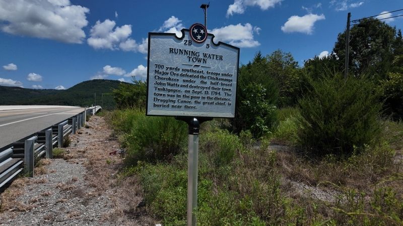
Photographed by Edward Troxel
1. Running Water Town Marker
Erected by Tennessee Historical Commission. (Marker Number 2B 5.)
Topics. This historical marker is listed in these topic lists: Indigenous Peoples and Communities • Settlements & Settlers. A significant historical date for this entry is September 13, 1794.
Location. 35° 1.744′ N, 85° 32.935′ W. Marker is in Haletown, Tennessee, in Marion County. It is on U.S. 64 half a mile west of State Highway 134, on the left when traveling west. Touch for map. Marker is at or near this postal address: 420 US-64, Jasper TN 37347, United States of America. Touch for directions.

Regionally, this marker is in the American South, specifically in the Upper South, in Appalachia, and specifically in Southern Appalachia. Globally, it is in North America, the Western Hemisphere, the Western World, and the Anglosphere. Historically, it finds itself in what was once the territory
this page online
Other nearby markers. At least 8 other markers are within 6 miles of this marker, measured as the crow flies: Civil War in Tennessee (approx. half a mile away); Federal-Georgia Road (approx. 1.1 miles away); Location and Capacity (approx. 1.3 miles away); Hales Bar Dam (approx. 1.4 miles away); Running Water Creek Bridge (approx. 2.8 miles away); Ebenezer Cumberland Presbyterian Church (approx. 3.2 miles away); Love's Ferry (approx. 3.7 miles away); Betsy Pack (approx. 5.3 miles away).
Other markers no longer nearby. Nickajack Cave (was approx. 0.6 miles away but has been confirmed missing); The TVA System of Multipurpose Dams (was approx. 4.6 miles away but has been confirmed missing).
Also see . . . Dragging Canoe. Wikipedia
Dragging Canoe (c. 1738 – February 29, 1792) was a Cherokee red (or war) chief who led a band of Cherokee warriors who resisted colonists and United States settlers in the Upper South. During the American Revolution and afterward, Dragging Canoe's forces were sometimes joined by Upper Muskogee, Chickasaw, Shawnee, and Indians from other tribes, along with British Loyalists, and agents of France and Spain. The Cherokee American Wars lasted more than a decade after the end of the American Revolutionary War.(Submitted on August 22, 2025, by James Hulse of Medina, Texas.)
Credits. This page was last revised on August 22, 2025. It was originally submitted on August 21, 2025, by Edward Troxel of Creal Springs, Illinois. This page has been viewed 325 times since then and 140 times this year. Photo 1. submitted on August 21, 2025, by Edward Troxel of Creal Springs, Illinois. • James Hulse was the editor who published this page.
