Niagara Falls in Niagara Region, Ontario — Central Canada (North America)
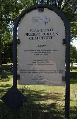
Stamford Presbyterian Cemetery History
Photographed by Kevin Westell, August 18, 2025
1. Stamford Presbyterian Cemetery - Marker
The diamond plaque in the lower left denotes a burial site of United Empire Loyalists.
First known burial Janet Mulwain, 1784
mother of Thomas McMicking
Township of Stamford acquired ownership in 1943
Stamford and Niagara Falls amalgamated in 1963
Property of City of Niagara Falls
Parks, Recreation & Culture
Cemeteries Section
905-354-4721
Erected by City of Niagara Falls.
Topics. This historical marker is listed in these topic lists: Cemeteries & Burial Sites • Religion & Religious Structures. A significant historical year for this entry is 1784.
Location. 43° 7.686′ N, 79° 6.061′ W. Marker is in Niagara Falls, Ontario, in Niagara Region. It is on McMicking Street, on the right when traveling east. Touch for map. Marker is at or near this postal address: 6275 McMicking Street, Niagara Falls ON L2J 1W7, Canada. Touch for directions.

Regionally, this marker is on Ontario’s Golden Horseshoe and in Niagara Canada. It is also in Central Canada. Globally, it is in North America, on the Great Lakes, in the Western Hemisphere, in the Western World, and in the Anglosphere. Historically, it finds itself in what was once a British colony, the Viceroyalty of New France, the Haudenosaunee (Iroquois) Confederacy, and Rupert’s Land.
Other nearby markers. At least 8 other markers are within walking distance of this marker: 1784 In Memorium 1984 (about 120 meters away, measured in a direct line); Russell Cottage circa 1830 (about 180 meters away); Oswald Regency Cottage circa 1835 (approx. 0.2 kilometers away); Haulage Road Recreational Trail (approx. 0.3 kilometers away); Niagara Portage Road (approx. 0.3 kilometers away); Alexander Robinson Cody House circa 1821 (approx. 0.3 kilometers away); 3357 St Patrick 1805 (approx. 0.4 kilometers away); Mitchell Cottage 1805 (approx.
this page online
Photographed by Kevin Westell, August 18, 2025
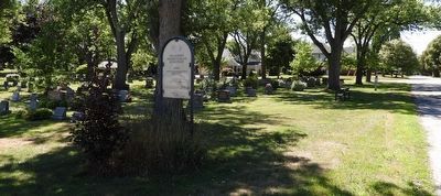
2. Stamford Presbyterian Cemetery
Photo faces west (along McMicking St.) and south-west. Marker is at the north-east corner of the cemetery.
Photographed by Kevin Westell, August 18, 2025
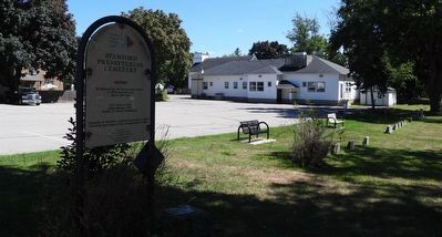
3. Stamford Presbyterian Cemetery
Photo faces south-east. Stamford Presbyterian Church is adjacent to the cemetery.
Credits. This page was last revised on August 23, 2025. It was originally submitted on August 21, 2025, by Kevin Westell of St. Catharines, Ontario. This page has been viewed 75 times since then and 12 times this year. Photos: 1, 2, 3. submitted on August 21, 2025, by Kevin Westell of St. Catharines, Ontario. • Andrew Ruppenstein was the editor who published this page.
