South Pittsburg in Marion County, Tennessee — The American South (East South Central)
Fort McCook
Chickamauga Campaign Heritage Trail
Photographed by Lee Hattabaugh, January 2, 2011
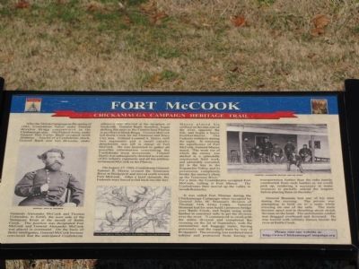
1. Fort McCook Marker
Inscription.
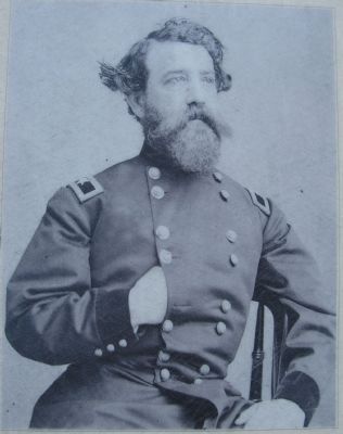
Fort McCook. Chickamauga Campaign Heritage Trail. After the Shiloh Campaign in the spring of 1862, Confederate forces under General Braxton Bragg concentrated in the Chattanooga area. The Federal Army, under General Don Carlos Buell occupied north Alabama. Fearful of a Confederate attack, General Buell sent two divisions, under Generals Alexander McCook and Thomas Crittenden, to fortify the west side of the Tennessee River at the mouth of Battle Creek. The position was designated Fort McCook and General Alexander McCook was placed in command. On the basis of faulty intelligence, General McCook became convinced that the anticipated Confederate offensive was directed at the recapture of Nashville. General Buell, therefore, began shifting his units to the Cumberland Plateau in an effort to block Bragg. General McCook left Battle Creek for the Altamont and Tracy City area. Colonel Leonard A. Harris, with two regiments and a small cavalry detachment, was left in charge of Fort McCook. He was instructed to gather all possible information concerning the Confederate troop movements. Colonel Harris was subsequently directed to send one of his infantry regiments and all his artillery to General McCook on the Plateau., On August 27, 1862, Confederate General Samuel B. Maxey crossed the Tennessee at Bridgeport and moved north toward Fort McCook. After a brief skirmish, the Federals were forced to fall back into the fort. Maxey placed his artillery on the east side of the river, opposite the fort, and began a heavy bombardment. The Federals withdrew during the night. In assessing the significance of Fort McCook, General Maxey stated, "The work out of which the enemy was shelled is a spendidly constructed field work, and admirably executed; [it] is the key to the Sequatchie Valley, and its possession completely breaks the enemy's chain up the Tennessee River." For a time, the Confederates occupied Fort McCook, calling it Fort Maxey. The Confederates then moved up the valley to invade Kentucky., It was called Fort Thomas during the Chickamauga Campaign when occupied by General John M. Brannan's division of Thomas' 14th Army Corps. General Brannan had his men build a pontoon bridge over Battle Creek, and began using scrap lumber to construct rafts to get the division over the river. "I commenced to cross with the entire division and completed the crossing on the 2d of September, with the ammunition and baggage trains, having previously sent the supply train by way of Bridgeport. The crossing was rendered most tedious and protracted from having no transportation further than the rafts hastily constructed from such lumber as we could pick up, rendering it necessary in many instances to partially unload the wagons before placing them on the rafts.", General Brannan lost one of his men during the crossing. The private was attempting to hold on to a mule while crossing on one of the rafts. The mule became upset and in thrashing about struck the man on the head. The unfortunate soldier was dragged overboard and drowned. He was buried with military honors beside the river at Battle Creek.
After the Shiloh Campaign in the spring of 1862, Confederate forces under General Braxton Bragg concentrated in the Chattanooga area. The Federal Army, under General Don Carlos Buell occupied north Alabama. Fearful of a Confederate attack, General Buell sent two divisions, under Generals Alexander McCook and Thomas Crittenden, to fortify the west side of the Tennessee River at the mouth of Battle Creek. The position was designated Fort McCook and General Alexander McCook was placed in command. On the basis of faulty intelligence, General McCook became convinced that the anticipated Confederate offensive was directed at the recapture of Nashville. General Buell, therefore, began shifting his units to the Cumberland Plateau in an effort to block Bragg. General McCook left Battle Creek for the Altamont and Tracy City area. Colonel Leonard A. Harris, with two regiments and a small cavalry detachment, was left in charge of Fort McCook. He was instructed to gather all possible information concerning the Confederate troop movements. Colonel Harris was subsequently directed to send one of his infantry regiments and all his artillery
Click or scan to see this page online
to General McCook on the Plateau.
On August 27, 1862, Confederate General Samuel B. Maxey crossed the Tennessee at Bridgeport and moved north toward Fort McCook. After a brief skirmish, the Federals were forced to fall back into the fort. Maxey placed his artillery on the east side of the river, opposite the fort, and began a heavy bombardment. The Federals withdrew during the night. In assessing the significance of Fort McCook, General Maxey stated, "The work out of which the enemy was shelled is a spendidly constructed field work, and admirably executed; [it] is the key to the Sequatchie Valley, and its possession completely breaks the enemy's chain up the Tennessee River." For a time, the Confederates occupied Fort McCook, calling it Fort Maxey. The Confederates then moved up the valley to invade Kentucky.
It was called Fort Thomas during the Chickamauga Campaign when occupied by General John M. Brannan's division of Thomas' 14th Army Corps. General Brannan had his men build a pontoon bridge over Battle Creek, and began using scrap lumber to construct rafts to get the division over the river. "I commenced to cross with the entire division
Photographed by Lee Hattabaugh, January 2, 2011
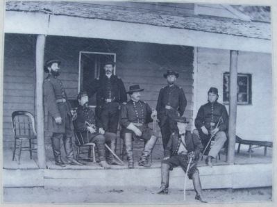
2. General Alexander McCook and his staff
and completed the crossing on the 2d of September, with the ammunition and baggage trains, having previously sent the supply train by way of Bridgeport. The crossing was rendered most tedious and protracted from having no transportation further than the rafts hastily constructed from such lumber as we could pick up, rendering it necessary in many instances to partially unload the wagons before placing them on the rafts."
General Brannan lost one of his men during the crossing. The private was attempting to hold on to a mule while crossing on one of the rafts. The mule became upset and in thrashing about struck the man on the head. The unfortunate soldier was dragged overboard and drowned. He was buried with military honors beside the river at Battle Creek.
Erected 2008 by Chickamauga Campaign Heritage Trail.
Topics and series. This historical marker is listed in this topic list: War, US Civil. In addition, it is included in the Chickamauga Campaign Heritage Trail series list. A significant historical date for this entry is November 1, 1862.
Location. 35° 1.049′ N, 85° 41.706′ W. Marker has been reported damaged. Marker is in South Pittsburg,
Photographed by Lee Hattabaugh, January 2, 2011
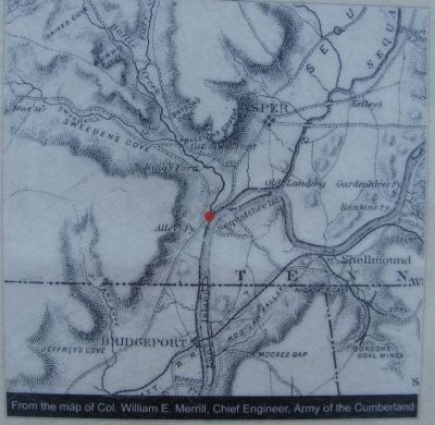
3. Fort McCook location map
From the map of Col. William E. Merrill, Chief Engineer, Army of the Cumberland

Tennessee, in Marion County. It is on Jaycee Drive/Rivers Landing Road (Route 56) 0.2 miles south of Cedar Avenue (U.S. 72), on the left when traveling south. Located in South Pittsburg's River Park, which is located near the former site of Fort McCook, just north of the TN-156 Tennessee River bridge. Touch for map. Marker is at or near this postal address: 838 W Main St, South Pittsburg TN 37380, United States of America. Touch for directions.
Regionally, this marker is in the American South, specifically in the Upper South, in Appalachia, and specifically in Southern Appalachia. Globally, it is in North America, the Western Hemisphere, the Western World, and the Anglosphere. Historically, it finds itself in what was once the territory of the Mississippian Culture, one of the Confederate States of America, and the Antebellum South.
Also see . . . Fort McCook. (Submitted on January 12, 2011, by Lee Hattabaugh of Capshaw, Alabama.)
Photographed by Lee Hattabaugh, January 2, 2011
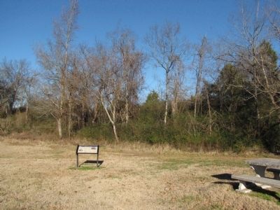
5. Fort McCook Marker
Credits. This page was last revised on August 23, 2025. It was originally submitted on January 12, 2011, by Lee Hattabaugh of Capshaw, Alabama. This page has been viewed 3,038 times since then and 76 times this year. Last updated on August 21, 2025, by Edward Troxel of Creal Springs, Illinois. Photos:1, 2, 3, 4, 5. submitted on January 12, 2011, by Lee Hattabaugh of Capshaw, Alabama. • Bernard Fisher was the editor who published this page.