
Locust Grove in Orange County, Virginia — The American South (Mid-Atlantic)
Face Off
Mine Run Campaign
Photographed by Craig Swain, January 5, 2008
1. Face Off Marker
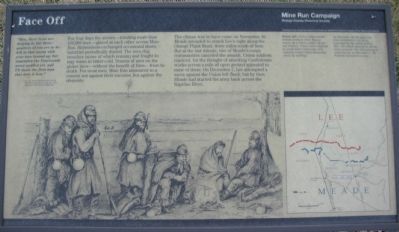
"Men, there is no use denying it, but three-quarters of you are to be left in that marsh with your toes turned up; but remember the Fourteenth never quailed yet, and I'll shoot the first man who does it now."
Lt. Col. Samuel Moore to the men of the 10th Connecticut on the eve of the planned attack at Mine Run.
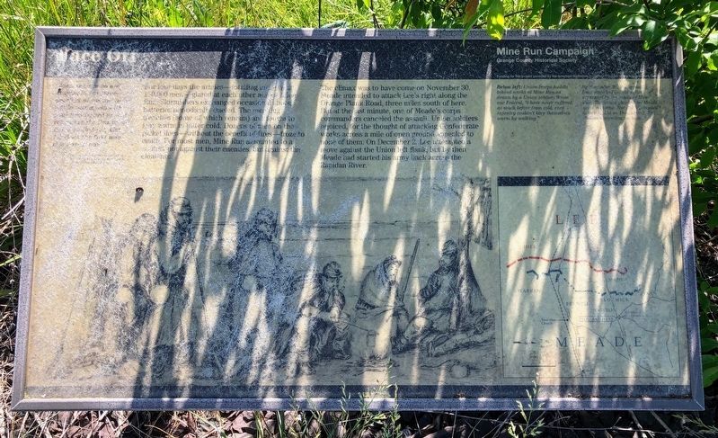
For four days the armies - totaling more than 150,000 men - glared at each other across Mine Run. Skirmishers exchanged occasional shots; batteries periodically dueled. The men dug trenches (some of which remain) and fought to stay warm in bitter cold. Dozens of men on the picket lines - without the benefit of fires - froze to death. For most men, Mine Run amounted to a contest not against their enemies, but against the elements.
The climax was to have come on November 30, Meade intended to attack Lee's right along the Orange Plank Road, three miles south of here. But at the last minute, one of Meade's corps commanders canceled the assault. Union soldiers rejoiced, for the thoughts of attacking Confederate works across a mile of open ground appealed to none of them. On December 2, Lee attempted a move against the
this page online
Erected by Orange County Historical Society; American Battlefield Protection Program.
Topics. This historical marker is listed in this topic list: War, US Civil. A significant historical month for this entry is November 1849.
Location. Marker has been permanently removed. It was located near 38° 18.275′ N, 77° 48.654′ W. Marker was in Locust Grove, Virginia, in Orange County. It was at the intersection of Constitution Highway (State Highway 20) and Gold Dale Road (County Route 611), on the right when traveling east on Constitution Highway. Located in a pull off to the southwest corner of the intersection. Touch for map. Marker was in this post office area: Locust Grove VA 22508, United States of America.
We have been informed that this marker is no longer there and will not be replaced. This page is an archival view of what was.
Regionally, this marker was in Northern Virginia and in the Piedmont. It was also in the American South and specifically in the Upper South. Globally, it was in North America, the Western Hemisphere, the Western World,

Photographed by Shane Oliver, May 30, 2020
2. Face Off Marker
Marker is significantly weathered and barely readable.
Other nearby markers. At least 8 other markers are within 3 miles of this location, measured as the crow flies: Robinson's Tavern (about 700 feet away, measured in a direct line); a different marker also named Mine Run Campaign (about 700 feet away); a different marker also named The Mine Run Campaign (approx. 2.1 miles away); a different marker also named The Mine Run Campaign (approx. 2.1 miles away); a different marker also named The Mine Run Campaign (approx. 2.1 miles away); The Battle of Payne’s Farm (approx. 2.1 miles away); a different marker also named The Battle of Payne’s Farm (approx. 2.1 miles away); a different marker also named The Battle of Payne’s Farm (approx. 2.2 miles away). Touch for a list and map of all markers in Locust Grove.
Other markers no longer nearby. Mine Run Campaign (was here, next to this marker but has been permanently removed); a different marker also named Mine Run Campaign
Photographed by Craig Swain, February 16, 2008
3. Battle Map of Mine Run
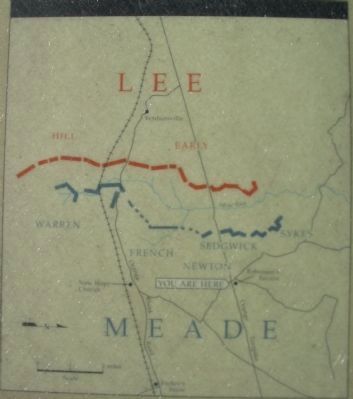
Note the north seeking arrow pointed to the right.
More about this marker. On the lower left, "Union soldiers huddle behind works at Mine Run, as drawn by a Union soldier. Wrote one Federal, 'I have never suffered as much before from cold, even infantry couldn't keep themselves warm by walking.'"
On the right is a map of the battle area. "By November 30, the opposing lines stretched for ten miles separated by the valley of Mine Run. The attack planned by Meade never occurred. Nor did a prepared attack by Lee on December 2. The Federals retreated back north."
Regarding Face Off. This marker is one in a series that detail the Mine Run Campaign. See the Mine Run Virtual Tour by Markers link below for a full list.
Also see . . .
1. A Photo Tour of the Campaign Area. (Submitted on January 13, 2008, by Craig Swain of Leesburg, Virginia.)
2. Mine Run Virtual Tour by Markers. Series of markers that detail the Mine Run Campaign. (Submitted on January 13, 2008, by Craig Swain of Leesburg, Virginia.)
Photographed by Craig Swain
4. Orange County Historical Society's Mine Run Markers
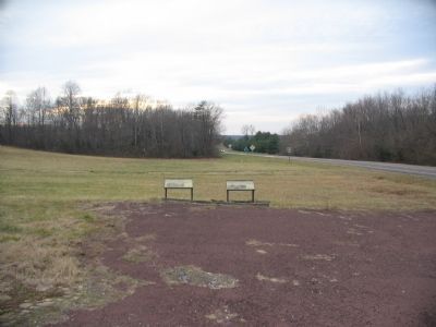
Located at the intersection near Robinson's Tavern.

Photographed by Craig Swain, January 5, 2008
5. New Hope Church
To the south along CR 621, the historical trace of the Orange Plank Road, stands New Hope Church (see the detail of the map in photo 2), the center for a sharp action on November 27. Fighting here started as Federal cavalry under General David M. Gregg first sparred with Confederate cavalry under General J.E.B. Stuart. The church is a modern structure built on the site of the original which stood during the war.
Photographed by Craig Swain, January 5, 2008
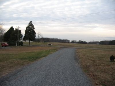
6. Infantry Fighting at New Hope Church
After the initial cavalry fighting, both sides reinforced the horse soldiers with infantry. Maj. Gen. Henry Heth's Confederate division arrived to occupy the high ground to the west of the church (in the distance beyond the field here). Federal General John Sykes' V Corps arrived on the field to press Heth from this line.
Credits. This page was last revised on August 23, 2025. It was originally submitted on January 13, 2008, by Craig Swain of Leesburg, Virginia. This page has been viewed 2,101 times since then and 22 times this year. Last updated on August 21, 2025, by Evan Dwyer of Richmond, Virginia. Photos: 1. submitted on January 13, 2008, by Craig Swain of Leesburg, Virginia. 2. submitted on May 18, 2021, by Shane Oliver of Richmond, Virginia. 3, 4, 5, 6. submitted on January 13, 2008, by Craig Swain of Leesburg, Virginia. • Bernard Fisher was the editor who published this page.
