Locust Grove in Orange County, Virginia — The American South (Mid-Atlantic)
Mine Run Campaign
Photographed by Craig Swain, January 5, 2008
1. Mine Run Campaign Marker
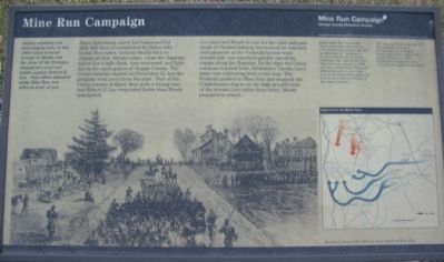
Since Gettysburg, much had happened but little had been accomplished by either side. In late November, General Meade tried to change all that. Meade's plan: cross the Rapidan below Lee's right flank, turn westward, and fight Lee in the open spaces of Orange County. The Union columns started on November 26, but the program went awry from the start. Part of the Union column delayed, then took a wrong turn. And Robert E. Lee responded faster than Meade anticipated.
Lee expected Meade to run for the vital railroads south of Fredericksburg, but instead he watched with pleasure as the Federals turned west, toward him. Lee marched quickly out of his camps along the Rapidan. By the time the Union columns reached here, Robinson's Tavern, Lee's army was contesting their every step. The Federals pushed to Mine Run and stopped; the Confederates dug in on the high ground west of the stream (two miles from here). Meade
this page online
Erected by Orange County Historical Society
American Battlefield Protection Program.
Topics and series. This historical marker is listed in this topic list: War, US Civil. In addition, it is included in the Battlefield Trails - Civil War series list. A significant historical year for this entry is 1863.
Location. Marker has been permanently removed. It was located near 38° 18.275′ N, 77° 48.654′ W. Marker was in Locust Grove, Virginia, in Orange County. It was at the intersection of Constitution Highway (State Highway 20) and Gold Dale Road (County Route 611), on the right when traveling east on Constitution Highway. Located in a pull off to the southwest corner of the intersection. Touch for map. Marker was in this post office area: Locust Grove VA 22508, United States of America.
We have been informed that this marker is no longer there and will not be replaced. This page is an archival view of what was.
Regionally, this marker was in Northern Virginia and in the Piedmont. It was also in the American South and specifically in the Upper South. Globally, it was in North America, the Western Hemisphere,

Photographed by Shane Oliver, May 30, 2020
2. Mine Run Campaign Marker
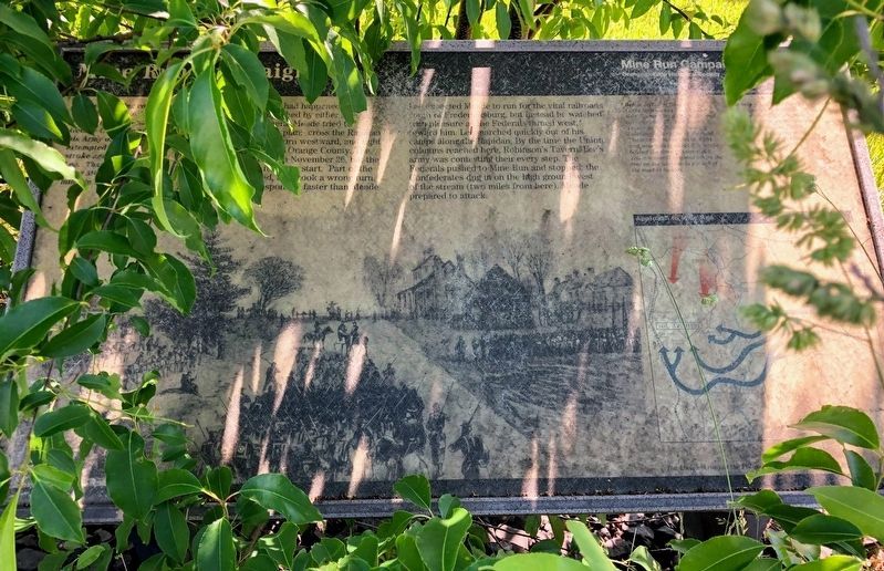
Marker is significantly weathered and is mostly unreadable.
Other nearby markers. At least 8 other markers are within 3 miles of this location, measured as the crow flies: Robinson's Tavern (about 700 feet away, measured in a direct line); a different marker also named Mine Run Campaign (about 700 feet away); a different marker also named The Mine Run Campaign (approx. 2.1 miles away); a different marker also named The Mine Run Campaign (approx. 2.1 miles away); a different marker also named The Mine Run Campaign (approx. 2.1 miles away); The Battle of Payne’s Farm (approx. 2.1 miles away); a different marker also named The Battle of Payne’s Farm (approx. 2.1 miles away); a different marker also named The Battle of Payne’s Farm (approx. 2.2 miles away). Touch for a list and map of all markers in Locust Grove.
Other markers no longer nearby. Face Off (was here, next to this marker but has been permanently removed); a different marker also named
Photographed by Craig Swain, February 16, 2008
3. Mine Run Campaign Marker
More about this marker. On the left is a drawing of "The Union Fifth Corps approaches this intersection (Locust Grove) from the east on November 27. Robinson's Tavern is the double chimney building to the right off the road. The tavern was moved in 1994 and now stands about 200 yards behind the store to your right. You are standing about where the trees on the horizon to the left of of the road is located."
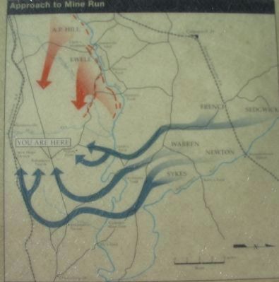
A map on the lower right details the campaign. "The only significant fighting of the campaign took place on November 27 at Payne's Farm, about three miles north of this intersection. This Confederate delaying action seriously disrupted Union plans."
Regarding Mine Run Campaign. This marker is one in a series that detail the Mine Run Campaign. See the Mine Run Virtual Tour by Markers link below for a full list.
Related markers. Click here for a list of markers that are related to this marker. Mine Run
Photographed by Craig Swain, January 5, 2008
4. Orange County Historical Society's Mine Run Markers
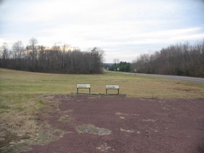
Located at the intersection near Robinson's Tavern.
Also see . . . A Photo Tour of the Campaign Area. (Submitted on January 13, 2008, by Craig Swain of Leesburg, Virginia.)
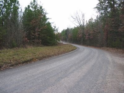
Photographed by Craig Swain, January 5, 2008
5. Indiantown Road
The Federal III Corps, lead by Major General William French, passed from Jacob's Ford (from the road path leading off the photo to the right) through this point along what is today CR 603. Use the National Park Service tour guide for driving instructions (see link).
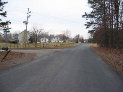
Photographed by Craig Swain, January 5, 2008
6. French and Prince are Lost
At this point, where the Indiantown and Russel Roads intersect, Generals French and Prince (one of French's division commanders) debated which road led to Robinson's Tavern. While this vacillation took place, General Meade's plans were rapidly unraveled by delay. Across the intersection stood the Widow Morris Farm house, which French would use as a headquarters.
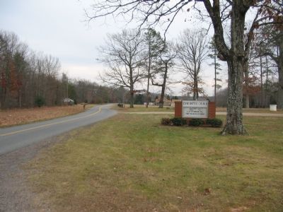
Photographed by Craig Swain, January 5, 2008
7. Payne's Farm
Looking from the parking lot for the New Zoar Church, the Confederates under General Edward Johnson formed along the road here and advanced into the woods to the left of the road into the open fields around Payne's Farm. The ground is currently under private ownership, but remains generally undisturbed.
Credits. This page was last revised on August 23, 2025. It was originally submitted on January 13, 2008, by Craig Swain of Leesburg, Virginia. This page has been viewed 3,157 times since then and 33 times this year. Last updated on August 21, 2025, by Evan Dwyer of Richmond, Virginia. Photos: 1. submitted on January 13, 2008, by Craig Swain of Leesburg, Virginia. 2. submitted on May 18, 2021, by Shane Oliver of Richmond, Virginia. 3. submitted on February 17, 2008, by Craig Swain of Leesburg, Virginia. 4, 5, 6, 7. submitted on January 13, 2008, by Craig Swain of Leesburg, Virginia. • Bernard Fisher was the editor who published this page.
