
Fort Smith in Sebastian County, Arkansas — The American South (West South Central)
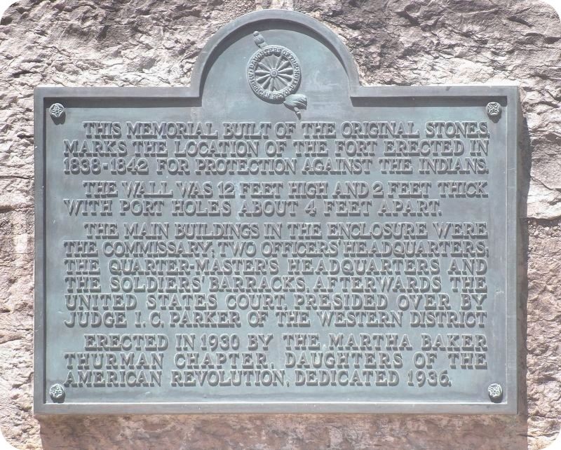
Second Fort Smith Memorial
Photographed by Duane and Tracy Marsteller, June 22, 2025
1. Second Fort Smith Memorial
This memorial built of the original stones marks the location of the fort erected in 1838-1842 for protection against the Indians.
The wall was 12 feet high and 2 feet thick with port holes about 4 feet apart.
The main buildings in the enclosure were the commissary, two officers' headquarters, the quarter-master's headquarters and the soldiers' barracks. Afterwards the United States Court, presided over by Judge I.C. Parker of the Western District.
Erected 1930 by Martha Baker Thurman Chapter, Daughters of the American Revolution.
Topics and series. This historical marker and memorial is listed in these topic lists: Forts and Castles • Law Enforcement. In addition, it is included in the Daughters of the American Revolution (DAR), and the National Historic Landmarks series lists. A significant historical year for this entry is 1838.
Location. 35° 23.293′ N, 94° 25.742′ W. Marker is in Fort Smith, Arkansas, in Sebastian County. It is at the intersection of Rogers Avenue and South 3rd Street, on the left when traveling north on Rogers Avenue. Touch for map. Marker is at or near this postal address:
this page online

Regionally, this marker and memorial is in the Arkansas River Valley, in the Cherokee Heritage Region, and in Osage Territory. It is also in the American South and specifically in the Upper South. Globally, it is in North America, the Western Hemisphere, the Western World, and the Anglosphere. Historically, it finds itself in what was once the territory of the Mississippian Culture, the Louisiana Purchase, one of the Confederate States of America, and the Antebellum South.
Other nearby markers. At least 8 other markers are within walking distance of this marker: Welcome to Fort Smith (here, next to this marker); Barracks, Courthouse, Jail (within shouting distance of this marker); Confederate Occupation of Fort Smith / Union Occupation of Fort Smith (within shouting distance of this marker); Clues from the Past (within shouting distance of this marker); The Commissary Storehouse (within shouting distance of this marker); Meeting of Nations (within shouting distance of this marker); The Flagstaff (within shouting distance of this marker);
Photographed by Duane and Tracy Marsteller, June 22, 2025
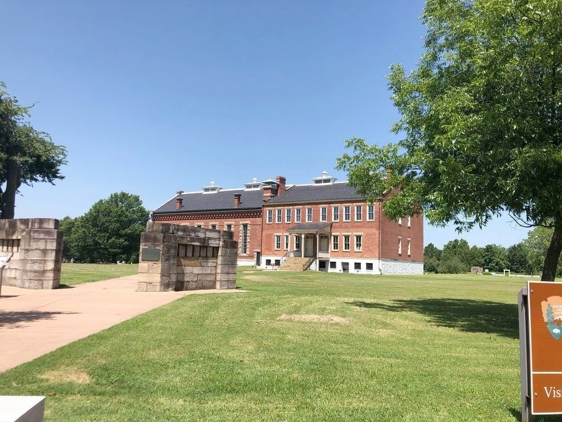
2. Second Fort Smith Memorial Marker
Also see . . . Building the Second Fort Smith. Belle Point was the busiest place on the America's southwestern frontier during the late 1830s. A new military post was under construction and a bustling town named Fort Smith was emerging on its eastern edge. Without the hard work of 55 men from Bangor Maine, the second Fort Smith might never have existed. (National Park Service) (Submitted on August 23, 2025, by Duane and Tracy Marsteller of Murfreesboro, Tennessee.)
via National Park Service (Public Domain)
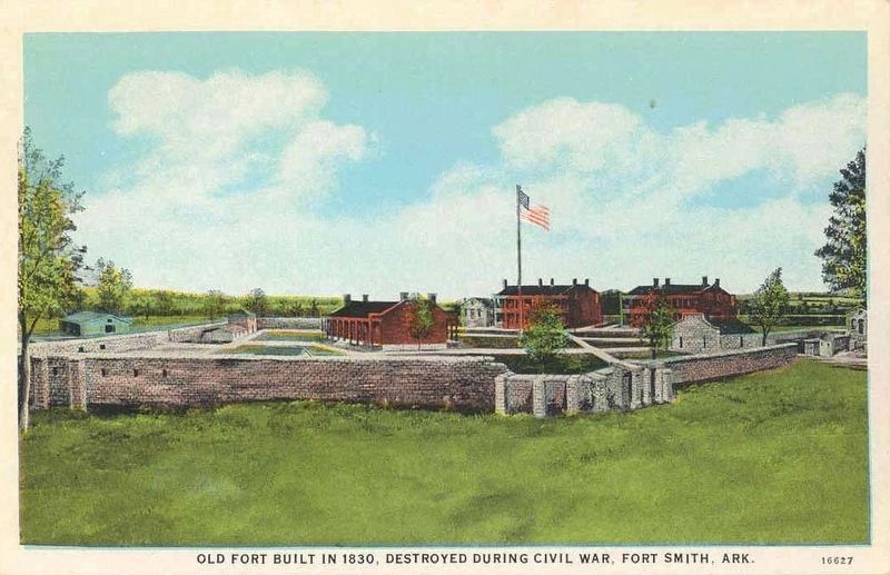
3. Postcard of Second Fort Smith
Contrary to the postcard caption, the second Fort Smith was constructed in 1838 and survived the Civil War. It was garrisoned until 1871.
via National Park Service (Public Domain), circa 1865
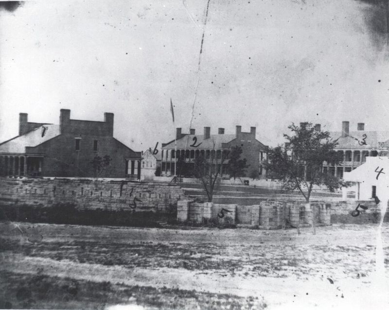
4. View of Second Fort Smith from Bastion #5
Shown are the Enlisted Men's Barracks, Officer's Quarters, Guardhouse, the fort wall and the Quartermaster Building.
Credits. This page was last revised on August 25, 2025. It was originally submitted on August 23, 2025, by Duane and Tracy Marsteller of Murfreesboro, Tennessee. This page has been viewed 94 times since then and 18 times this year. Photos: 1, 2, 3, 4. submitted on August 23, 2025, by Duane and Tracy Marsteller of Murfreesboro, Tennessee.
