Sunfish Township in Arkoe in Pike County, Ohio — The American Midwest (Great Lakes)
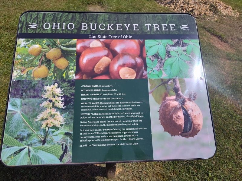
Ohio Buckeye Tree
The State Tree of Ohio
Photographed by Craig Doda, August 2, 2025
1. Ohio Buckeye Tree Marker
Common Name: Ohio buckeye
Botanical Name: Aesculus glabra
Height/Width: 20 to 40 feet/20 to 40 feet
Habitats: Mesic woods and bottomlands
Wildlife Value: Hummingbirds are attracted to the flowers, and some wildlife species eat the seeds. The raw seeds are poisonous to humans and most domestic livestock.
History/Lore: Historically, its light, soft wood was used for pulpwood, woodenware, and the production of artificial limbs.
Native Americans called the nut hetuck, meaning "buck eye" because markings on the nut resemble the eye of a deer.
Ohioans were called "Buckeyes" during the presidential election of 1840 when William Henry Harrison's supporters wore buckeye necklaces and carved campaign souvenirs out of buckeye wood to illustrate support for their fellow Ohioan.
In 1953 the Ohio buckeye became the state tree of Ohio.
Topics. This historical marker is listed in these topic lists: Government & Politics • Horticulture & Forestry • Indigenous Peoples and Communities. A significant historical year for this entry is 1840.
Location. 39° 2.505′ N, 83° 13.684′ W. Marker is in Arkoe, Ohio, in Pike County.
this page online

Regionally, this marker is in the Scioto Valley and in Southern Ohio Hill Country. It is also in the American Midwest, in Appalachia, and specifically in Northern Appalachia. Globally, it is in North America, the Western Hemisphere, the Western World, and the Anglosphere. Historically, it finds itself in what was once the Haudenosaunee (Iroquois) Confederacy, the territory of the Mississippian Culture, and the Northwest Territory.
Other nearby markers. At least 8 other markers are within 9 miles of this marker, measured as the crow flies: Stoney Ridge (approx. 6.6 miles away); Grave of Unknown Union Soldier (approx. 8.1 miles away); An Unknown Union Soldier (approx. 8.1 miles away); An Unknown Soldier - Ohio And The Civil War (approx. 8.1 miles away); You Are On The Buckeye Trail (approx. 8.2 miles away); Locust Grove (approx. 8.9 miles away); Governor Charles Willing Byrd
Photographed by Craig Doda, August 2, 2025
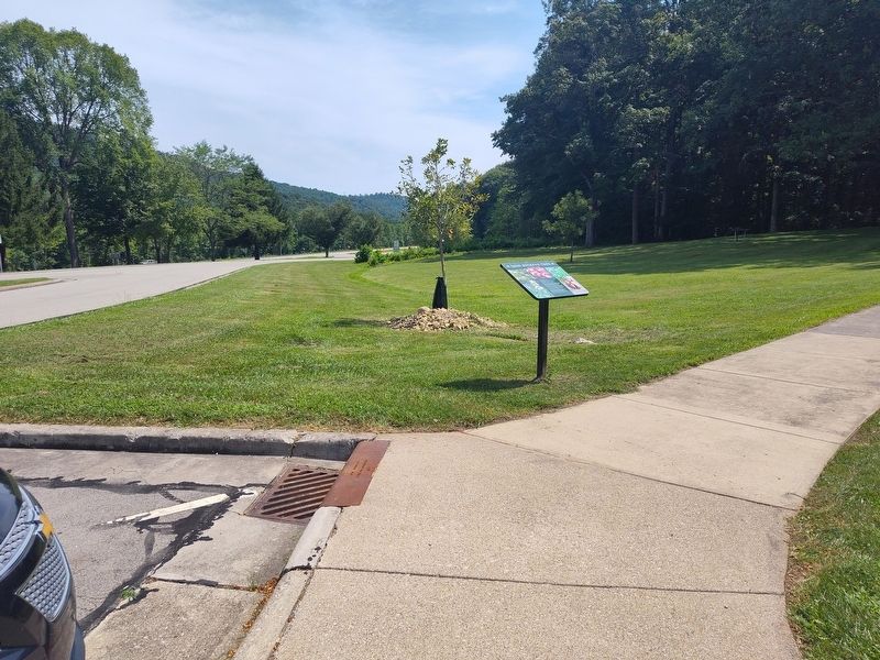
2. Ohio Buckeye Tree Marker
Credits. This page was last revised on August 28, 2025. It was originally submitted on August 23, 2025, by Craig Doda of Napoleon, Ohio. This page has been viewed 106 times since then and 44 times this year. Photos: 1, 2. submitted on August 23, 2025, by Craig Doda of Napoleon, Ohio. • Devry Becker Jones was the editor who published this page.
