Harbour Town on Hilton Head Island in Beaufort County, South Carolina — The American South (South Atlantic)
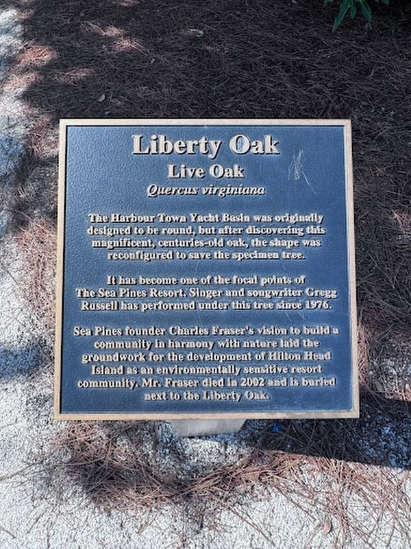
Liberty Oak
Live Oak (Quercus virginiana)
Photographed by Thomas Moore, July 12, 2025
1. Liberty Oak Marker
It has become one of the focal points of The Sea Pines Resort. Singer and songwriter Gregg Russell has performed under this tree since 1976.
Sea Pines founded Charles Fraser's vision to build a community in harmony with nature laid the groundwork for the development of Hilton Head Island as an environmentally sensitive resort community. Mr. Fraser died in 2002 and is buried next to the Liberty Oak.
Topics and series. This historical marker is listed in this topic list: Environment. In addition, it is included in the Historic Trees series list.
Location. 32° 8.303′ N, 80° 48.683′ W. Marker is on Hilton Head Island, South Carolina, in Beaufort County. It is in Harbour Town. It can be reached from Lighthouse Road. Touch for map. Marker is at or near this postal address: 147 Lighthouse Road, Hilton Head Island SC 29928, United States of America. Touch for directions.

Regionally, this marker
this page online
Other nearby markers. At least 8 other markers are within 7 miles of this marker, measured as the crow flies: Charles E. Fraser (a few steps from this marker); "Mystique" (within shouting distance of this marker); a different marker also named Charles E. Fraser (approx. 3.2 miles away); Hilton Head Island (approx. 3.2 miles away); Intracoastal Waterway (approx. 3½ miles away); The Martinangeles (approx. 5½ miles away); World’s Largest Figurative Sundial (approx. 5.7 miles away); Palmetto Bluff (approx. 6.3 miles away). Touch for a list and map of all markers in Hilton Head Island.
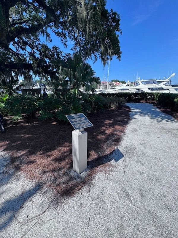
Photographed by Thomas Moore, August 23, 2025
2. Liberty Oak Marker
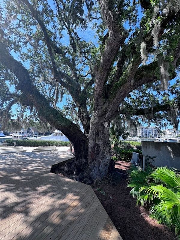
Photographed by Thomas Moore, August 23, 2025
3. Liberty Oak
Credits. This page was last revised on August 24, 2025. It was originally submitted on August 24, 2025, by Thomas Moore of Charleston, South Carolina. This page has been viewed 1,044 times since then and 304 times this year. Photos: 1, 2, 3. submitted on August 24, 2025, by Thomas Moore of Charleston, South Carolina. • Andrew Ruppenstein was the editor who published this page.
