Chambersburg in Franklin County, Pennsylvania — The American Northeast (Mid-Atlantic)
Fill 'Er Up
Lincoln Highway Heritage Corridor
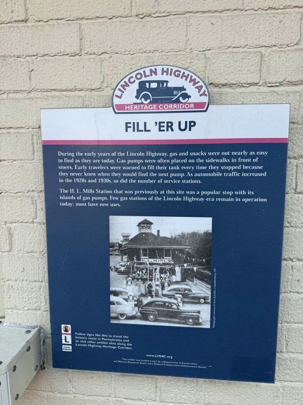
During the early years of the Lincoln Highway, gas and snacks were not nearly as easy to find as they are today. Gas pumps were often placed on the sidewalks in front of stores. Early travelers were warned to fill their tank every time they stopped because they never knew when they would find the next pump. As automobile traffic increased in the 1920s and 1930s, so did the number of service stations.
The H. L. Mills Station that was previously at this site was a popular stop with its islands of gas pumps. Few gas stations of the Lincoln Highway-era remain in operation today: most have new ones.
Erected by Lincoln Highway Heritage Corridor.
Topics and series. This historical marker is listed in these topic lists: Industry & Commerce • Roads & Vehicles. In addition, it is included in the Lincoln Highway series list.
Location. 39° 56.286′ N, 77° 39.813′ W. Marker is in Chambersburg, Pennsylvania, in Franklin County. It is on Lincoln Way West (U.S. 30) west of Chambersburg Rail-Trail, on the right when traveling west. Touch for map. Marker is at or near this
this page online

Regionally, this marker is in South-Central Pennsylvania. It is also in the American Northeast, in the Mid-Atlantic, in Appalachia, and specifically in Northern Appalachia. Globally, it is in North America, the Western Hemisphere, the Western World, and the Anglosphere. Historically, it finds itself in what was once the Haudenosaunee (Iroquois) Confederacy and also one of the original Thirteen Colonies.
Other nearby markers. At least 8 other markers are within walking distance of this marker: Franklin County Liberty Tree (about 300 feet away, measured in a direct line); Friends of the Chambersburg Water Wheel (about 400 feet away); World War II Killed in Action Memorial (about 400 feet away); Korean War Veterans Memorial (about 400 feet away); Fort Chambers (about 400 feet away); Vietnam Veterans Memorial (about 500 feet away); Founding Family Memorial Statue (about 500 feet away); Thompson's Rifle Battalion: Capt. James Chambers' Company (about 500 feet away). Touch for a list and map of all markers in Chambersburg.

Photographed by Devry Becker Jones (CC0), August 23, 2025
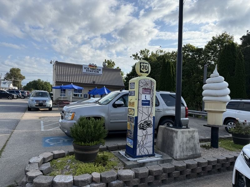
2. Fill 'Er Up Marker on today's Ice Cream Station
Credits. This page was last revised on August 24, 2025. It was originally submitted on August 24, 2025, by Devry Becker Jones of Washington, District of Columbia. This page has been viewed 114 times since then and 33 times this year. Photos: 1, 2, 3. submitted on August 24, 2025, by Devry Becker Jones of Washington, District of Columbia.
