Southeast Colorado Springs in El Paso County, Colorado — The American Mountains (Southwest)
The First Summit House
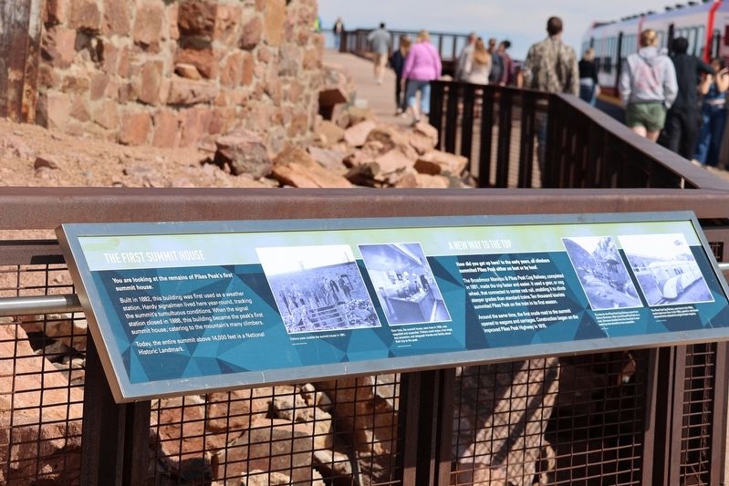
Photographed by Sandra Hughes Tidwell, August 9, 2025
1. The First Summit House Marker
The First Summit House
You are looking at the remains of Pikes Peak's first summit house.
Built in 1882, this building was first used as a weather station. Hardy signalmen lived here year-round, tracking the summit's tumultuous conditions. When the signal station closed in 1888, this building became the peak's first summit house, catering to the mountain's many climbers.
Today, the entire summit above 14,000 feet is a National Historic Landmark.
A New Way to the Top
How did you get here? In the early years, all climbers summited Pikes Peak either on foot or by hoof.
The Broadmoor Manitou & Pikes Peak Cog Railway, completed in 1891, made the trip faster and easier. It used a gear, or cog wheel, that connected to the center rack rail, enabling it to climb steeper grades than standard trains. Ten thousand tourists summited Pikes Peak on the train in its first season.
Around the same time, the first crude road to the summit opened to wagons and carriages. Construction began on the improved Pikes Peak Highway in 1915.
Topics. This historical marker is listed in these topic lists: Notable Places •
this page online
Location. 38° 50.394′ N, 105° 2.544′ W. Marker is in Colorado Springs, Colorado, in El Paso County. It is in Southeast Colorado Springs. It is on Pikes Peak Highway. Marker is located next to the Pikes Peak Visitor Center atop Pikes Peak. Touch for map. Marker is at or near this postal address: Pikes Peak Highway, Colorado Springs CO 80910, United States of America. Touch for directions.

Regionally, this marker is in the Front Range and in Pikes Peak Region. It is also in the American Mountain West. Globally, it is in North America, the Rocky Mountains, the Western Hemisphere, the Western World, and the Anglosphere. Historically, it finds itself in what was once the Comanchería.
Other nearby markers. At least 8 other markers are within 3 miles of this marker, measured as the crow flies: Commemorating the 100th Anniversary of the Inspiration of America the Beautiful (about 300 feet away, measured in a direct line); The Continental Divide (about 300 feet away); Zebulon Montgomery Pike (about 300 feet away); Pike's Peak (about 300
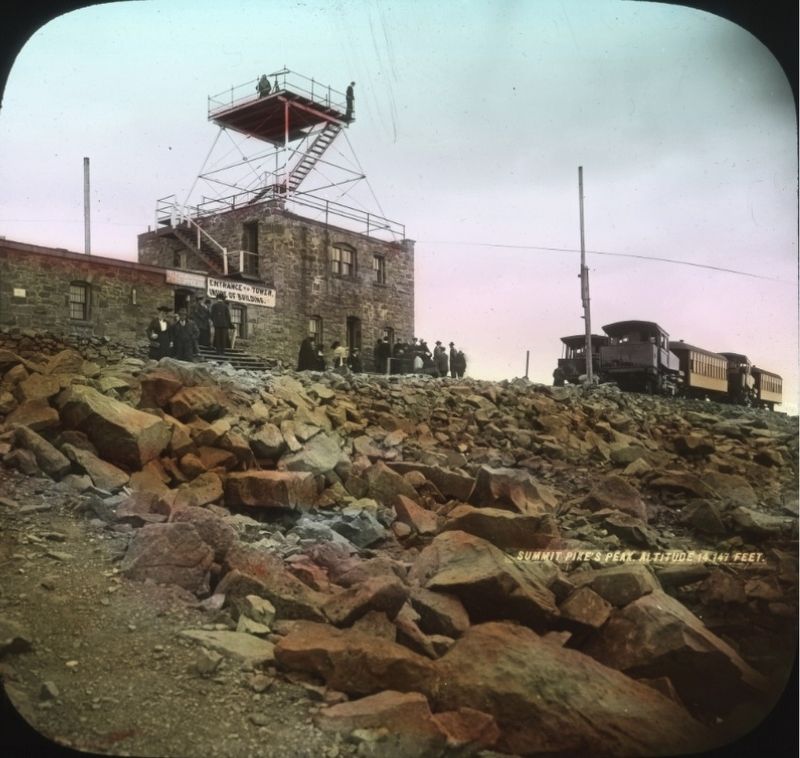
William E. Hook (courtesy Pikes Peak Library District), circa 1900
2. Summit, Pikes Peak
‘Hand-tinted view of Pikes Peak Summit House. Tourists and cog train visible. Sign on building reads "Entrance to Tower inside of building" and "The Highest Telegraph Office in the World."’
Credits. This page was last revised on August 24, 2025. It was originally submitted on August 24, 2025, by Sandra Hughes Tidwell of Killen, Alabama, USA. This page has been viewed 151 times since then and 54 times this year. Photos: 1. submitted on August 24, 2025, by Sandra Hughes Tidwell of Killen, Alabama, USA. 2. submitted on August 24, 2025. • Andrew Ruppenstein was the editor who published this page.
