Near Livingston in Park County, Montana — The American West (Mountains)
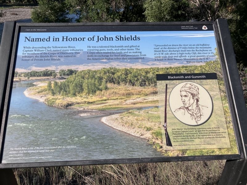
Named in Honor of John Shields
Clark on the Yellowstone
Photographed by Barry Swackhamer, July 28, 2025
1. Named in Honor of John Shields Marker
While descending the Yellowstone River, Captain William Clark named many tributaries for members of the Corp of Discovery. This tributary, the Shields River, was named in honor of Private John Shields.
He was a talented blacksmith and gifted at repairing guns, tools, and other items. The Corps often traded his knife and ax making skills in exchange for food and provisions from the American Indian tribes they encountered.
The Shieds River is one of the few rivers named after the expedition members that has retained its name over time.
(insert)
Blacksmith and Gunsmith
John Shields' blacksmithing experience came in handy to repair Captain Lewis' air gun that he purchased in Philadelphia. Unfortunately, a portrait of Shields was never completed during his life, so his
this page online
(pictured:) Air gun
Erected by Lewis and Clark National Trail.
Topics and series. This historical marker is listed in these topic lists: Exploration • Waterways & Vessels. In addition, it is included in the Lewis & Clark Expedition series list. A significant historical date for this entry is July 17, 1806.
Location. 45° 43.478′ N, 110° 27.42′ W. Marker is near Livingston, Montana, in Park County. It is on Convict Grade Road near U.S. 89, on the right when traveling east. This marker is located near the confluence of the Shields and Yellowstone rivers. Touch for map. Marker is in this post office area: Livingston MT 59047, United States of America. Touch for directions.

Regionally, this marker is in Yellowstone Country and in Greater Bozeman. It is also in the American Mountain West and in the Lewis & Clark Corridor. Globally, it is in North America, the Rocky Mountains, the Western Hemisphere, the Western World, and the Anglosphere. Historically, it finds itself in what was once Rupert’s Land and also the Louisiana
Photographed by Barry Swackhamer, July 28, 2025
2. Named in Honor of John Shields Marker
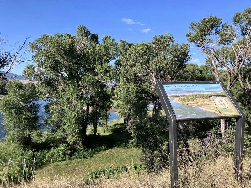
The Shields and Yellowstone river confluence may be observed through the trees.
Other nearby markers. At least 8 other markers are within 7 miles of this marker, measured as the crow flies: "to Cook and eate Dinner" (approx. 2½ miles away); Indians, Explorers & Cowboys (approx. 2.8 miles away); Fort Parker (approx. 2.8 miles away); Welcome to the Mission Ranch (approx. 2.8 miles away); Heading down the Yellowstone (approx. 4.9 miles away); KPRK Radio (approx. 5.4 miles away); 810 East Callender Street (approx. 6.1 miles away); 802 East Callender Street (approx. 6.1 miles away). Touch for a list and map of all markers in Livingston.
Credits. This page was last revised on August 24, 2025. It was originally submitted on August 24, 2025, by Barry Swackhamer of Brentwood, California. This page has been viewed 96 times since then and 38 times this year. Photos: 1, 2. submitted on August 24, 2025, by Barry Swackhamer of Brentwood, California.
