Cleveland in Upshur County, West Virginia — The American South (Appalachia)
Kesler's Raid
Capture of Upshur County Militia
Photographed by Don Morfe, August 2, 2012
1. Kesler's Raid Marker
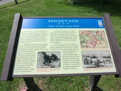
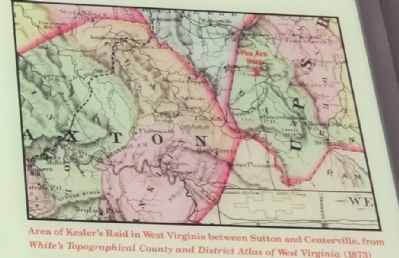
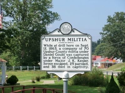
As Kesler made his way back to Pocahontas County from Sutton, he swept through Upshur County and, on September 12, captured Capt. Daniel Gould’s company of Upshur County militia at Centerville. Gould’s company was stationed at Centerville to protect the intersection of the Buckhannon and Little Kanawha Turnpike with the Hacker Valley Road. Allegedly Gould surrendered without firing a shot. The Confederates burned the nearby fortification as they marched away with their prisoners.
Of the seventy militiamen whom Kesler captured here, seven subsequently escaped, and twenty-five were paroled. For the remaining forty-three, however, the outcome was grim. They died in a variety of Confederate prisoner-of-war camps, including those at Belle Isle (Richmond), Virginia; Salisbury, North Carolina;
this page online
Kesler’s “successful scout” earned him a letter of commendation from Maj. Gen. Samuel Jones on September 19. Jones conveyed to Kesler “his high appreciation of the gallantry, skill, and enterprise displayed by him in this expedition. The courage and good conduct of the officers and men deserve and receive the highest commendation. If all our soldiers emulate their good example, we shall ever be able to meet our barbarous foe with the confidence of victory.”
Erected by West Virginia Civil War Trails.
Topics and series. This historical marker is listed in this topic list: War, US Civil. In addition, it is included in the West Virginia Civil War Trails series list. A significant historical month for this entry is September 1863.
Location. 38° 50.43′ N, 80° 20.322′ W. Marker is in Cleveland, West Virginia, in Upshur County. It is at the intersection of Ireland - Rock Cave Road (State Highway 20) and Flatwood Run Road (County Route 20/13) on Ireland - Rock Cave Road. Touch for map. Marker is in this post office area: Cleveland WV 26215, United States of America. Touch for directions.

Regionally, this marker is in
Photographed by Don Morfe, August 2, 2012
2. Kesler's Raid Marker
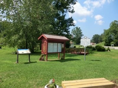
Other nearby markers. At least 8 other markers are within 8 miles of this marker, measured as the crow flies: Upshur Militia (here, next to this marker); God Is My Witness (here, next to this marker); Veterans Memorial (within shouting distance of this marker); French Creek (approx. 3.9 miles away); Bennett-Camden (approx. 6.7 miles away); Fort Pickens / Engagements of Co. A (approx. 6.7 miles away); Fort Pickens (approx. 6.8 miles away); Webster County / Upshur County (approx. 8.1 miles away). Touch for a list and map of all markers in Cleveland.
Photographed by Don Morfe, August 2, 2012
3. Kesler's Raid Marker
Photographed by Don Morfe, August 2, 2012
4. Nearby Marker
Credits. This page was last revised on September 4, 2025. It was originally submitted on August 24, 2012, by Don Morfe of Baltimore, Maryland. This page has been viewed 1,181 times since then and 46 times this year. Last updated on August 25, 2025, by Carl Gordon Moore Jr. of North East, Maryland. Photos: 1. submitted on August 24, 2012, by Don Morfe of Baltimore, Maryland. 2. submitted on September 2, 2012, by Don Morfe of Baltimore, Maryland. 3. submitted on September 10, 2012, by Don Morfe of Baltimore, Maryland. 4. submitted on August 24, 2012, by Don Morfe of Baltimore, Maryland. • Bernard Fisher was the editor who published this page.
