Maumelle in Pulaski County, Arkansas — The American South (West South Central)
Pyeatte-Mason Historical Cemetery
Established 1818
Photographed by Duane and Tracy Marsteller, June 22, 2025
1. Pyeatte-Mason Historical Cemetery Marker
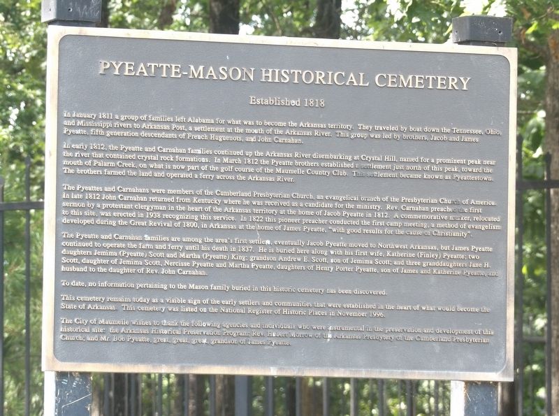
In early 1812, the Pyeatte and Carnahan families continued up the Arkansas River disembarking at Crystal Hill, named for a prominent peak near the river that contained crystal rock formations. In March 1812 the Pyeatte brothers established a settlement just north of this peak, toward the mouth of Palarm Creek, on what is now part of the golf course of the Maumelle Country Club. This settlement became known as Pyeattestown. The brothers farmed the land and operated a ferry across the Arkansas River.
The Pyeattes and Carnahans were members of the Cumberland Presbyterian Church, an evangelical branch of the Presbyterian Church of America. In late 1812 John Carnahan returned from Kentucky where he was received as a candidate for the ministry. Rev. Carnahan preached
this page online
The Pyeatte and Carnahan families are among the area's first settlers; eventually Jacob Pyeatte moved to Northwest Arkansas, but James Pyeatte continued to operate the farm and ferry until his death in 1837. He is buried here along with his first wife, Katherine (Finley) Pyeatte; two daughters Jemima (Pyeatte) Scott and Martha (Pyeatte) King; grandson Andrew E. Scott, son of Jemima Scott; and three granddaughters, Jane H. Scott, daughter of Jemima Scott, Nercisse Pyeatte and Martha Pyeatte, daughters of Henry Porter Pyeatte, son of James and Katherine Pyeatte, and husband to the daughter of Rev. John Carnahan.
To date, no information pertaining to the Mason family buried in this historic cemetery
Photographed by Duane and Tracy Marsteller, June 22, 2025
2. Pyeatte-Mason Historical Cemetery Marker
This cemetery remains today as a visible sign of the early settlers and communities that were established in the heart of what would become the State of Arkansas. This cemetery was listed on the National Register of Historic Places in November 1996.
The City of Maumelle wishes to thank the following agencies and individuals who were instrumental in the preservation and development of this historical site: the Arkansas Historical Preservation Program; Rev. Hubert Morrow of the Arkansas Presbytery of the Cumberland Presbyterian Church; and Mr. Bob Pyeatte, great, great, great, grandson of James Pyenne.
Erected by City of Maumelle, Arkansas.
Topics and series. This historical marker is listed in these topic lists: Cemeteries & Burial Sites • Religion & Religious Structures • Settlements & Settlers. In addition, it is included in the National Register of Historic Places (NRHP) series list. A significant historical month for this entry is January 1811.
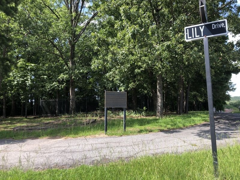
Location. 34° 51.103′ N, 92° 25.168′ W. Marker is in Maumelle, Arkansas, in Pulaski County. It is at the intersection of Lily Drive and Waterside Drive, on the right when traveling west on Lily Drive. Touch for map. Marker is in this post office area: Maumelle AR 72113, United States of America. Touch for directions.

Regionally, this marker is in the Little Rock Metropolitan Area and in the Quapaw Homeland. It is also in the American South and specifically in the Upper South. Globally, it is in North America, the Western Hemisphere, the Western World, and the Anglosphere. Historically, it finds itself in what was once the territory of the Mississippian Culture, the Louisiana Purchase, one of the Confederate States of America, and the Antebellum South.
Other nearby markers. At least 8 other markers are within 8 miles of this marker, measured as the crow flies: Looking Down the Arkansas River to the West (approx. 5.4 miles away); Looking Down the Arkansas River to the East (approx. 5.4 miles away); McClellan-Kerr Arkansas River Navigation System (approx. 5.4 miles away); Four Bridges (approx. 5.4 miles away); The Arkansas River Trail Story (approx. 5.4 miles away); The Farmers Home Cemetery (approx. 5.6 miles away); The Story of the Big Dam Bridge Monoliths (approx. 5.7 miles away); The Heights • A History (approx. 7.2 miles away).
Also see . . .
1. Pyeatte-Mason Cemetery. The cemetery contains ten marked graves. The earliest grave is dated to 1818. Most of the graves in the cemetery belong to members of the Pyeatte family. The most recent burials in the cemetery date to 1895 and 1907. (David Sesser, Henderson State University; in Encyclopedia of Arkansas) (Submitted on August 28, 2025, by Duane and Tracy Marsteller of Murfreesboro, Tennessee.)
2. Pyeatte-Mason Cemetery (PDF). National Register nomination for the burial ground, which is now surrounded by residential subdivisions. (Prepared by Kim Solomon, Arkansas Historic Preservation Program; via Arkansas Heritage)(Submitted on August 28, 2025, by Duane and Tracy Marsteller of Murfreesboro, Tennessee.)
Credits. This page was last revised on August 28, 2025. It was originally submitted on August 28, 2025, by Duane and Tracy Marsteller of Murfreesboro, Tennessee. This page has been viewed 87 times since then and 23 times this year. Photos: 1, 2. submitted on August 28, 2025, by Duane and Tracy Marsteller of Murfreesboro, Tennessee.
