Port Colborne in Niagara Region, Ontario — Central Canada (North America)
The Welland Canal
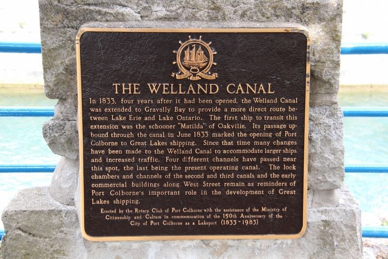
In 1833, four years after it had been opened, the Welland Canal was extended to Gravelly Bay to provide a more direct route between Lake Erie and Lake Ontario. The first ship to transit this extension was the schooner “Matilda” of Oakville. Its passage upbound through the canal in June 1833 marked the opening of Port Colborne to Great Lakes shipping. Since that time many changes have been made to the Welland Canal to accommodate larger ships and increased traffic. Four different channels have passed near this spot, the last being the present operating canal. The lock chambers and channels of the second and third canals and the early commercial buildings along West Street remain as reminders of Port Colborne's important role in the development of Great Lakes shipping.
Citizenship and Culture in commemoration of the 150th anniversary of the
City of Port Colborne as a lakeport (1833-1983)
Erected by Rotary Club of Port Colborne with the assistance of the Ministry of Citizenship and Culture.
Topics and series. This historical
this page online
Location. 42° 53.194′ N, 79° 14.987′ W. Marker is in Port Colborne, Ontario, in Niagara Region. It is at the intersection of West Street and Clarence Street, on the right when traveling north on West Street. Touch for map. Marker is at or near this postal address: 258 West St, Port Colborne ON L3K 4E4, Canada. Touch for directions.

Regionally, this marker is on the Golden Horseshoe and in Niagara Canada. It is also in Central Canada. Globally, it is in North America, on the Great Lakes, in the Western Hemisphere, in the Western World, and in the Anglosphere. Historically, it finds itself in what was once a British colony, the Viceroyalty of New France, the Haudenosaunee (Iroquois) Confederacy, and Rupert’s Land.
Other nearby markers. At least 8 other markers are within walking distance of this marker: Crossing The Canal / La Traversé Du Canal (about 90 meters away, measured in a direct line); Founding of Port Colborne

Photographed by Kevin Westell, July 21, 2025
2. The Welland Canal Marker
Photo faces north from Clarence Street, near West Street. West Street is on the left side. The marker (centre-left) is visible - a dark square outline against the blue metal rail fence.
Regarding The Welland Canal. During construction of the third Welland canal, a requirement was to permit ship traffic to continue in the second canal. This resulted in the need to construct a new channel beside the old one. The identical requirement resulted in the fourth canal's channel beside the third.

Photographed by Kevin Westell, July 21, 2025
3. The Welland Canal Marker
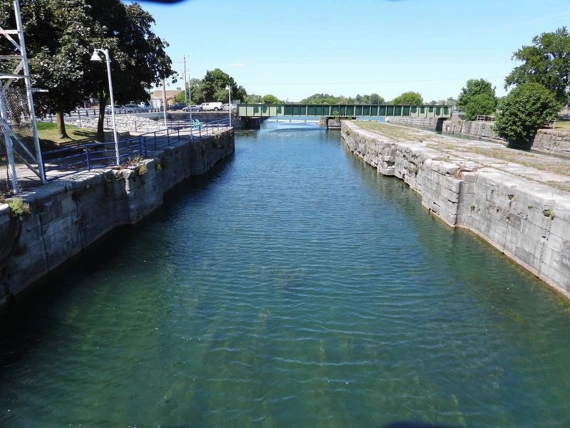
Photo faces south-east, from behind the marker stone. In the foreground is the unused channel of the second Welland canal. (Note the recesses in the stone wall for the lock doors, removed long ago.) Next is the channel for the third Welland canal (not much to see from this angle). Last is the Clarence Street vertical lift bridge over the fourth (current) Welland canal.
Photographed by Kevin Westell, July 21, 2025
4. The Second Welland Canal channel
Photo faces north from Clarence Street. The marker stone is on the left, beside the blue fence, under a lamp pole, on a projection between two lock gate wells.

Photographed by Kevin Westell, July 21, 2025
5. Third Welland Canal channel
Photo faces north from Clarence Street. On the left is the second Welland canal's channel; centre is the third canal's channel; distant right is water in the fourth canal. Note the recesses for lock doors, long since removed, in both the third and second canals' channels. Where the (unused) rail bridge sits, at one time there was a swing bridge there.

Photographed by Kevin Westell, July 21, 2025
6. Port Colborne's three Welland Canal channels
Photo faces north and north-east from West Street's promenade. From left to right, the 2nd, 3rd and 4th Welland canal channels. Pedestrians can visit the island parks between the 3rd and 4th canals - one park north of Clarence Street, and one park south - although these are not toddler-proof! (The narrower island between the 2nd and 3rd canal is fenced off.) The Clarence Street bridge is raising, to permit a ship's passage northbound into the canal.
Credits. This page was last revised on September 4, 2025. It was originally submitted on April 23, 2022, by Duane and Tracy Marsteller of Murfreesboro, Tennessee. This page has been viewed 318 times since then and 21 times this year. Last updated on August 28, 2025, by Kevin Westell of St. Catharines, Ontario. Photos: 1. submitted on April 23, 2022, by Duane and Tracy Marsteller of Murfreesboro, Tennessee. 2, 3, 4, 5, 6. submitted on July 25, 2025, by Kevin Westell of St. Catharines, Ontario. • Devry Becker Jones was the editor who published this page.
