Cambridge in Waterloo Region, Ontario — Central Canada (North America)
The Mill Race
Photographed by Tim Boyd, August 27, 2025
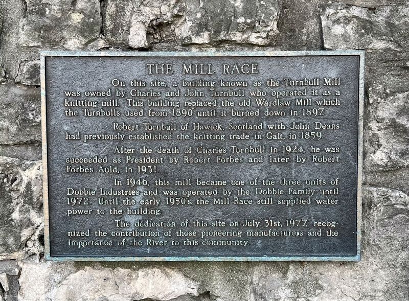
1. The Mill Race Marker
On this site, a building known as the Turnbull Mill was owned by Charles and John Turnbull who operated it as a knitting mill. This building replaced the old Wardlaw Mill which the Turnbulls used from 1890 until it burned down in 1897.
Robert Turnbull of Hawick, Scotland with John Deans had previously established the knitting trade in Galt, in 1859. After the death of Charles Turnbull in 1924, he was succeeded as President by Robert Forbes and later by Robert Forbes Auld, in 1931.
In 1946, this mill became one of the three units of Dobbie Industries and was operated by the Dobbie Family until 1972. Until the early 1950's, the Mill Race still supplied water power to the building.
The dedication of this site on July 31st, 1977, recognized the contribution of those pioneering manufacturers and the importance of the River to this community.
Topics. This historical marker is listed in these topic lists: Industry & Commerce • Waterways & Vessels. A significant historical year for this entry is 1859.
Location. 43° 21.787′ N, 80° 18.952′ W. Marker is in Cambridge, Ontario, in Waterloo Region. It is at the intersection
this page online

Regionally, this marker is in the Huron-Perth-Waterloo-Wellington Area and in Southwestern Ontario. It is also in Central Canada. Globally, it is in North America, the Western Hemisphere, the Western World, and the Anglosphere. Historically, it finds itself in what was once a British colony, the Viceroyalty of New France, the Haudenosaunee (Iroquois) Confederacy, and Rupert’s Land.
Other nearby markers. At least 8 other markers are within walking distance of this marker: Grand River/‘O:se Kenhionháta:tie/La Rivière Grand (within shouting distance of this marker); Parkhill Dam Drownings (about 120 meters away, measured in a direct line); Galt City Hall (approx. 0.4 kilometers away); The Honourable James Young 1835-1913 / L'Honorable James Young, 1835-1913 (approx. 0.4 kilometers away); Women's Royal Canadian Naval Service Monument (approx. half a kilometer away); Main Street Bridge
Photographed by Tim Boyd, August 27, 2025
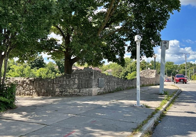
2. The Mill Race Marker
looking west from the corner of Water Street and Park Hill Road

Photographed by Tim Boyd, August 27, 2025
3. Site of the Turnbull Mill, 2025
Credits. This page was last revised on August 28, 2025. It was originally submitted on August 28, 2025, by Tim Boyd of Hamilton, Ontario. This page has been viewed 85 times since then and 20 times this year. Photos: 1, 2, 3. submitted on August 28, 2025, by Tim Boyd of Hamilton, Ontario. • Andrew Ruppenstein was the editor who published this page.
