
Corkscrew in Immokalee in Collier County, Florida — The American South (South Atlantic)
Fertilizer Spreader
| — | Immokalee Pioneer Museum | — |
Photographed by Brandon D Cross, July 30, 2025
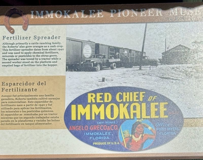
1. Fertilizer Spreader Marker

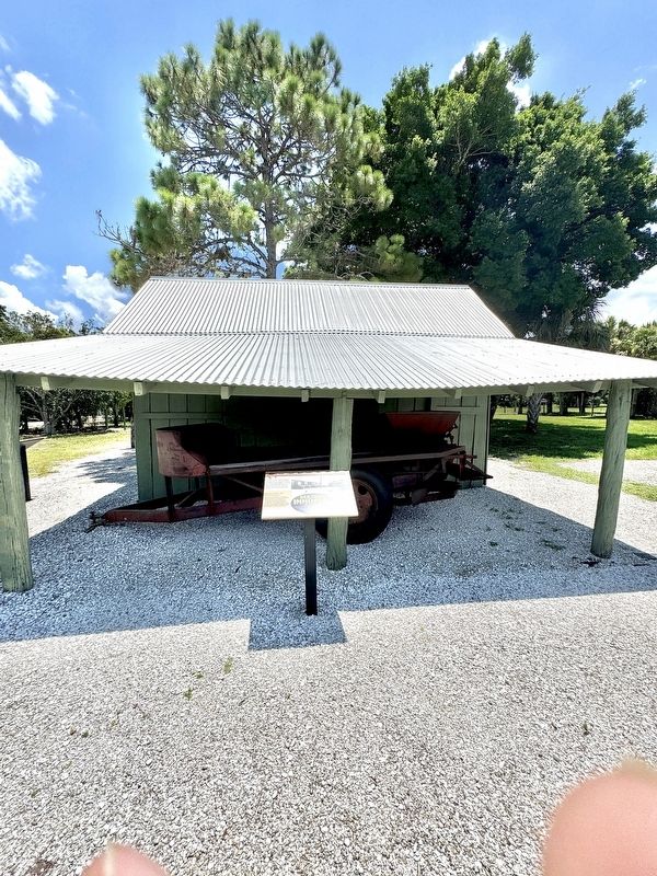
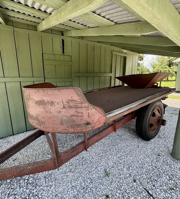
Although primarily a cattle ranching family, the Roberts' also grew oranges as a cash crop. This fertilizer spreader dates from about 1940 and was used to apply chemical fertilizers, minerals or pesticides to the citrus grove. The spreader was towed by a tractor while a second worker stood on the platform and emptied bags of fertilizer into the hopper.
Aunque fué principalmente una familia ganadera, Roberts también cultivó naranjas para comercializar. Este esparcidor de fertilizante nace a partir de 1940 y fué utilizado para aplicar los fertilizantes, los minerales o los pesticidas químicos. El esparcidor se remolcaba por un tractor mientras que un segundo trabajador estaba parado en la platforma y vaciaba las bolsas del fertilizante en tanque alimentador.
Erected by Immokalee Pioneer Museum.
Topics. This historical marker is listed in these topic lists: Agriculture • Industry & Commerce. A significant historical year for this entry is 1940.
Location. 26° 25.311′ N, 81° 25.904′ W. Marker is in Immokalee, Florida, in Collier County. It is in Corkscrew.
this page online

Regionally, this marker is on Florida’s Gulf Coast. It is also in the American South and on the Gulf Coast. Globally, it is in the North Atlantic Region, North America, a Gulf of Mexico state, the Western Hemisphere, the Western World, and the Anglosphere. Historically, it finds itself in what was once New Spain, the territory of the Mississippian Culture, one of the Confederate States of America, and the Antebellum South.
Other nearby markers. At least 8 other markers are within walking distance of this marker: Kitchen (here, next to this marker); Well (a few steps from this marker); Hide House (a few steps from this marker); Farm Equipment (a few steps from this marker); Sugarcane - Boiler (a few steps from this marker); Cane Mill (a few steps from this marker); Log Pen (a few steps from
Photographed by Brandon D Cross, July 30, 2025
2. Fertilizer Spreader Marker
Also see . . .
1. Hidden Gem: Immokalee Pioneer Museum at Roberts Ranch rich with history. (Submitted on August 28, 2025, by Brandon D Cross of Flagler Beach, Florida.)
2. Immokalee Pioneer Museum at Roberts Ranch. (Submitted on August 28, 2025, by Brandon D Cross of Flagler Beach, Florida.)
Photographed by Brandon D Cross, July 30, 2025
3. Fertilizer Spreader
Credits. This page was last revised on September 1, 2025. It was originally submitted on August 28, 2025, by Brandon D Cross of Flagler Beach, Florida. This page has been viewed 69 times since then and 13 times this year. Photos: 1, 2, 3. submitted on August 28, 2025, by Brandon D Cross of Flagler Beach, Florida. • Andrew Ruppenstein was the editor who published this page.
