
Fonthill in Niagara-on-the-Lake in Niagara Region, Ontario — Central Canada (North America)
Fort Drummond
⎯⎯⎯
Le Fort Drummond
Photographed by Dale K. Benington, June 11, 2012
1. Fort Drummond Marker

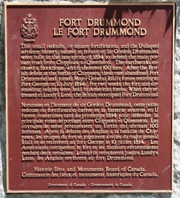
This small redoubt, or square fortification, and the U-shaped advance battery, named in honour of Sir Gordon Drummond, were built in the late spring of 1814 to defend the main portage road from Chippawa to Queenston. The earthworks enclosed a blockhouse which sheltered 100 men. After the British defeat at the battle of Chippawa, these men abandoned Fort Drummond and joined Major-General Riall's forces retiring to Fort George on 10 July 1814. For two weeks the fort and surrounding heights were held by American forces. When they retreated to Lundy's Lane, the British reoccupied Fort Drummond.
this page online
Erected by Historic Sites and Monuments Board of Canada.
Topics and series. This historical marker is listed in this topic list: War of 1812. In addition, it is included in the Canada, Historic Sites and Monuments Board series list. A significant historical date for this entry is July 10, 1814.
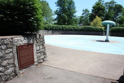
Location. 43° 9.555′ N, 79° 3.263′ W. Marker is in Niagara-on-the-Lake, Ontario, in Niagara Region. It is in Fonthill. It can be reached from Niagara River Parkway north of Portage Road. This historic marker is affixed`to a stone wall, at the northern entrance to a children's water/splash recreation area, that is located in Queenston Heights Park. The Brock Memorial Monument is just a short walk away from this historic marker, to the northeast. Touch for map. Marker is at or near this postal address: 14184 Niagara River Pkwy, Niagara-on-the-Lake ON L0S 1J0, Canada. Touch for directions.

Regionally, this marker is on Ontario’s Golden Horseshoe and in Niagara Canada. It is also in Central Canada. Globally, it
Photographed by Dale K. Benington, June 10, 2012
2. Fort Drummond Marker
View of the historic marker affixed to the stone wall, at the north entrance to a park water/splash recreation area.
Other nearby markers. At least 8 other markers are within walking distance of this marker: Teyoninhokarawen (John Norton) (1770-1827) (within shouting distance of this marker); Landscape Of Nations - Six Nations & Native Allies Commemorative Memorial (within shouting distance of this marker); The Battle of Queenston Heights (about 150 meters away, measured in a direct line); Brock's Monument - Queenston Heights Battlefield (about 150 meters away); Brock's Monument (about 150 meters away); Sir Isaac Brock (about 150 meters away); The Battle of Queenston Heights / la Bataille de Queenston (about 150 meters away); Sir Roger Hale Sheaffe (about 180 meters away). Touch for a list and map of all markers in Niagara-on-the-Lake.
More about this marker. The earthwork, that has the stone wall that the historic marker is affixed to, that surrounds the water/splash
Photographed by Dale K. Benington, June 10, 2012
3. Fort Drummond Marker
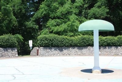
View looking north of the historic marker affixed to the stone wall, at the north entrance of the water/splash recreational area.
Also see . . . Fort Drummond (Queenston Heights). Wikipedia entry. (Submitted on August 5, 2020, by Larry Gertner of New York, New York.)
Photographed by Dale K. Benington, June 10, 2012
4. Fort Drummond Marker
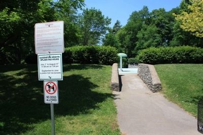
A view looking at the south entrance to the water/splash recreational area, with the north entrance in the distant background. The earthwork surrounding the recreational area is what remains of Fort Drummond.
Credits. This page was last revised on November 10, 2025. It was originally submitted on June 22, 2012, by Dale K. Benington of Toledo, Ohio. This page has been viewed 927 times since then and 46 times this year. Last updated on August 29, 2025, by Kevin Westell of St. Catharines, Ontario. Photos: 1. submitted on June 22, 2012, by Dale K. Benington of Toledo, Ohio. 2, 3, 4. submitted on June 23, 2012, by Dale K. Benington of Toledo, Ohio. • Devry Becker Jones was the editor who published this page.
