St. Davids in Niagara-on-the-Lake in Niagara Region, Ontario — Central Canada (North America)
Headquarters of DeRottenberg

Photographed by Dale K. Benington, June 10, 2012
1. Headquarters of DeRottenberg Marker
of
DeRottenberg
1812
Erected by Niagara Historical Society.
Topics. This historical marker is listed in this topic list: War of 1812. A significant historical year for this entry is 1812.
Location. 43° 9.514′ N, 79° 6.041′ W. Marker is in Niagara-on-the-Lake, Ontario, in Niagara Region. It is in St. Davids. It is at the intersection of York Road (County Route 81) and Paxton Lane, on the left when traveling east on York Road. This historic marker is located on the southwest corner of the grounds of the St. Davids Church. Touch for map. Marker is at or near this postal address: 1436 York Road, Niagara-on-the-Lake ON L0S 1P0, Canada. Touch for directions.

Regionally, this marker is on the Golden Horseshoe and in Niagara Canada. It is also in Central Canada. Globally, it is in North America, on the Great Lakes, in the Western Hemisphere, in the Western World, and in the Anglosphere. Historically, it finds itself in what was once a British colony, the Viceroyalty of New France, the Haudenosaunee (Iroquois) Confederacy, and Rupert’s Land.
Other nearby markers. At least 8 other markers are
this page online
More about this marker. This series of plain block markers was created by the Niagara Historical Society in the early 1900s. (Niagara in this context meant the town of Niagara, now called "The Old Town" of Niagara-on-the-Lake.)
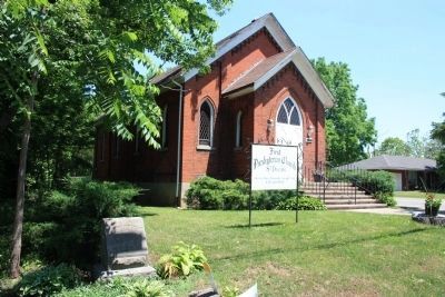
Photographed by Dale K. Benington, June 10, 2012
2. Headquarters of DeRottenberg Marker
View of St.Davids Church, with a view of the historic marker in the front left foreground of the picture.
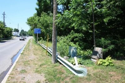
Photographed by Dale K. Benington, June 10, 2012
3. Headquarters of DeRottenberg Marker
View looking west along York Road of the historic marker.

Photographed by Dale K. Benington, June 10, 2012
4. Headquarters of DeRottenberg Marker
View looking east along York Road of the historic marker.
Credits. This page was last revised on November 10, 2025. It was originally submitted on July 2, 2012, by Dale K. Benington of Toledo, Ohio. This page has been viewed 630 times since then and 19 times this year. Last updated on August 29, 2025, by Kevin Westell of St. Catharines, Ontario. Photos: 1, 2, 3, 4. submitted on July 2, 2012, by Dale K. Benington of Toledo, Ohio. • Devry Becker Jones was the editor who published this page.
