Near Old Fort in McDowell County, North Carolina — The American South (South Atlantic)
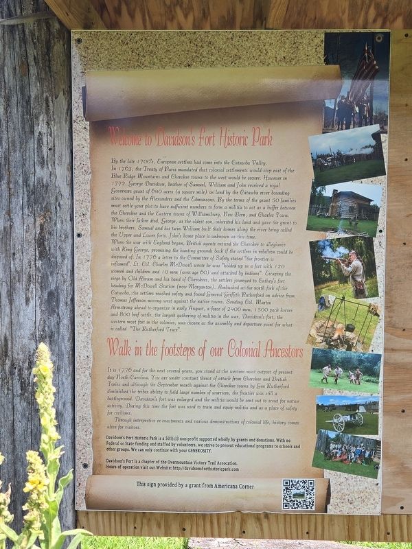
Welcome to Davidson's Fort Historic Park
Photographed by Mark Parker, August 29, 2025
1. Welcome to Davidson's Fort Historic Park Marker
By the late 1700's, European settlers had come into the Catawba Valley. In 1763, the Treaty of Paris mandated that colonial settlements would stop east of the Blue Ridge Mountains and Cherokee towns to the west would be secure. However in 1772, George Davidson, brother of Samuel, William and John received a royal Governors grant of 640 acres (a square mile) on land by the Catawba river bounding sites owned by the Alexanders and the Edmunsons. By the terms of the grant 50 families must settle your plot to have sufficient numbers to form a militia to act as a buffer between the Cherokee and the Eastern towns of Williamsburg, New Bern, and Charles Town When their father died, George, as the oldest son, inherited his land and gave the grant to his brothers. Samuel and his twin William built their homes along the river bring called the Upper and Lower forts. John's home place is unknown at this time.
When the war with England began, British agents enticed the Cherokee to allegiance with King George, promising the hunting grounds back if the settlers in rebellion could be disposed of. In 1776, a letter to the Committee of
this page online
Walk in the footsteps of our Colonial Ancestors
It is 1776 and for the next several years, you stand at the western most outpost of present day North Carolina. You are under constant threat of attack from Cherokee and British Tories and although the September march against the Cherokere town by Gen. Rutherford diminished the tribes
Photographed by Mark Parker, August 29, 2025
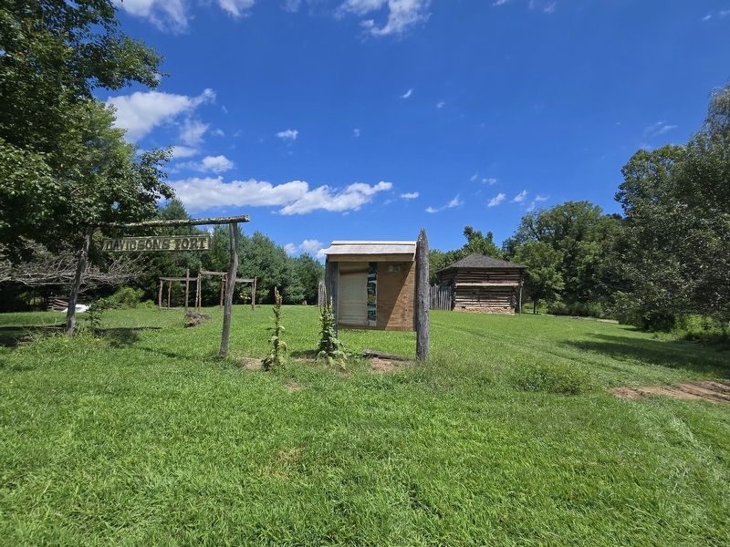
2. Welcome to Davidson's Fort Historic Park Marker next to the Davidson Fort sign
Replica fort is in the background
Through interpretive re-enactments and various demonstrations of colonial life, history comes alive for visitors.
Davidson's Fort Historic Park is a 501(c)3 non-profit supported wholly by grants and donations. With no Federal or State funding and staffed by volunteers, we strive to present educational programs to schools and other groups. We can only continue with your GENEROSITY.
Davidson's Fort is a chapter of the Overmountain Victory Trail Assocation. Hours of operation visit our Website: http://davidsonsforthistoricpark.com
Erected by Americana Corner.
Topics. This historical marker is listed in these topic lists: Forts and Castles • Settlements & Settlers • War, US Revolutionary • Wars, US Indian. A significant historical year for this entry is 1776.
Location. 35° 37.882′ N, 82° 10.217′ W. Marker is near Old Fort, North Carolina,
Photographed by Mark Parker, August 29, 2025
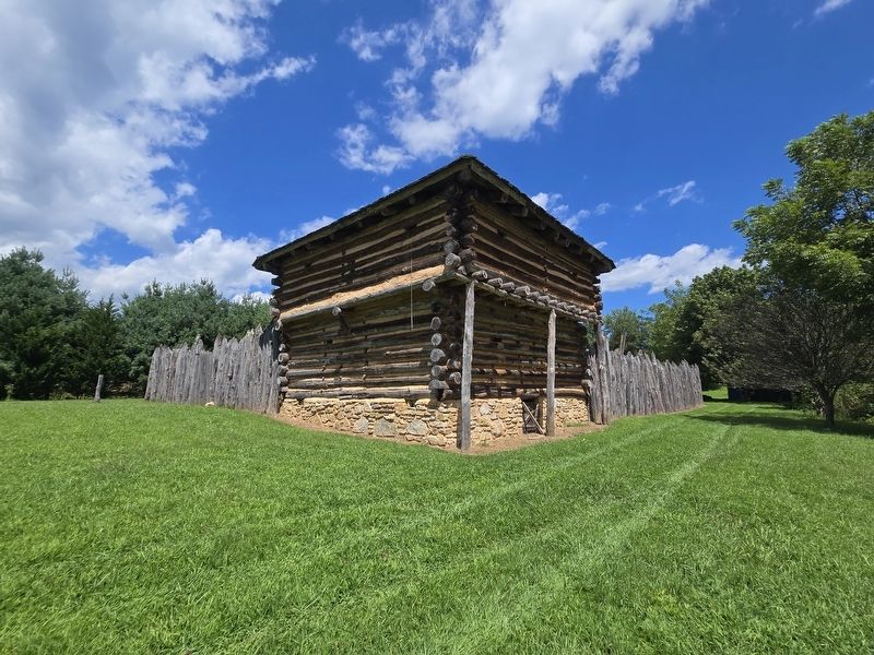
3. Davidson's Fort replica

Regionally, this marker is in the Mountains. It is also in the American South, specifically in the Upper South, in Appalachia, and specifically in Southern Appalachia. Globally, it is in North America, the Western Hemisphere, the Western World, and the Anglosphere. Historically, it finds itself in what was once the territory of the Mississippian Culture, one of the original Thirteen Colonies, one of the Confederate States of America, and the Antebellum South.
Other nearby markers. At least 8 other markers are within 3 miles of this marker, measured as the crow flies: Stepp Cabin (approx. 0.6 miles away); Old Fort Education Civil Rights Mural and Timeline (approx. 0.6 miles away); The Mountain Gateway Museum & Heritage Center (approx. 0.6 miles away); "What Happened To Our School?" (approx. 0.6 miles away); Morgan Cabin (approx. 0.6 miles away); Frontier Fort (approx. 0.6 miles away); The Old Indian Fort (approx. 0.6 miles away); Andrews Geyser (approx. 2.7 miles away). Touch for a list and map of all markers in Old Fort.
Regarding Welcome to Davidson's Fort Historic Park. Remnants of the original fort were destroyed in the 1916 Flood. Davidson's Fort is a reconstructed fort. Funding for the reconstruction and the surrounding park began in 2007.
Also see . . . Journey Back to 1776. (Submitted on August 29, 2025, by Mark Parker of Hickory, North Carolina.)
Credits. This page was last revised on September 1, 2025. It was originally submitted on August 29, 2025, by Mark Parker of Hickory, North Carolina. This page has been viewed 214 times since then and 81 times this year. Photos: 1, 2, 3. submitted on August 29, 2025, by Mark Parker of Hickory, North Carolina. • Bernard Fisher was the editor who published this page.
