Near Denmark in Manitowoc County, Wisconsin — The American Midwest (Great Lakes)
Wisconsin's Maritime Industries
Photographed by Keith L, September 12, 2009
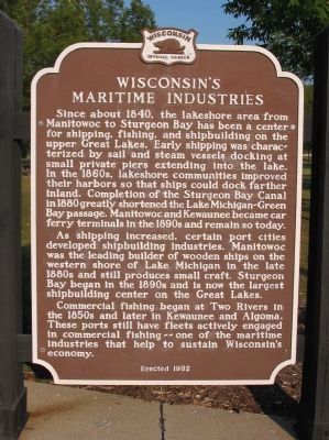
1. Wisconsin's Maritime Industries Marker
Since about 1840, the lakeshore area from Manitowoc to Sturgeon Bay has been a center for shipping, fishing, and shipbuilding on the upper Great Lakes. Early shipping was characterized by sail and steam vessels docking at small private piers extending into the lake. In the 1860s, lakeshore communities improved their harbors so that ships could dock farther inland. Completion of the Sturgeon Bay Canal in 1880 greatly shortened the Lake Michigan-Green Bay passage. Manitowoc and Kewaunee became car ferry terminals in the 1890s and remain so today.
As shipping increased, certain port cities developed shipbuilding industries. Manitowoc was the leading builder of wooden ships on the western shore of Lake Michigan in the late 1880s and still produces small craft. Sturgeon Bay began in the 1890s and is now the largest shipbuilding center on the Great Lakes.
Commercial fishing began at Two Rivers in the 1850s and later in Kewaunee and Algoma. These ports still have fleets actively engaged in commercial fishing--one of the maritime industries that help to sustain Wisconsin's economy.
Erected 1982 by the Wisconsin
this page online
Topics and series. This historical marker is listed in these topic lists: Industry & Commerce • Waterways & Vessels. In addition, it is included in the Wisconsin Historical Society series list. A significant historical year for this entry is 1840.
Location. Marker has been permanently removed. It was located near 44° 19.35′ N, 87° 48.921′ W. Marker was near Denmark, Wisconsin, in Manitowoc County. It could be reached from Interstate 43 at milepost 168, 4.1 miles north of County Highway Z, on the right when traveling north. Marker is at northbound Rest Area 52. Touch for map. Marker was in this post office area: Denmark WI 54208, United States of America.
We have been informed that this marker is no longer there and will not be replaced. This page is an archival view of what was.
Regionally, this marker was on Wisconsin’s Door Peninsula. It was also in the American Midwest and in the Corn Belt. Globally, it was in North America, on the Great Lakes, in the Western Hemisphere, in the Western World, and in the Anglosphere. Historically, it found itself in what was once the

Photographed by Keith L, September 12, 2009
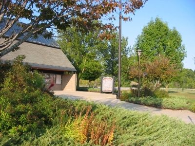
2. Wisconsin's Maritime Industries Marker
Other nearby markers. At least 8 other markers are within 16 miles of this location, measured as the crow flies: Wisconsin's Dairy Industry (approx. 0.3 miles away); Denmark (approx. 1.9 miles away); Rock Mill (approx. 2½ miles away); Rogation Shrines (approx. 9.1 miles away); Tisch Mills (approx. 9.6 miles away); Na-Ya-to-Shingh "Chief Mishicott" Potawatomi Leader (approx. 10.2 miles away); George Halada Farmstead (approx. 10.6 miles away); Bellevue Park (approx. 15.1 miles away).
More about this marker. Marker has been removed due to construction of new rest stop. Road to rest stop is closed. Unsure of status to be reinstalled.
Credits. This page was last revised on September 29, 2025. It was originally submitted on September 14, 2009, by Keith L of Wisconsin Rapids, Wisconsin. This page has been viewed 1,436 times since then and 43 times this year. Last updated on August 29, 2025, by Greta Mulder of Milwaukee, Wisconsin. Photos: 1, 2. submitted on September 14, 2009, by Keith L of Wisconsin Rapids, Wisconsin. • Devry Becker Jones was the editor who published this page.
