
Near Fort Erie in Niagara Region, Ontario — Central Canada (North America)
Conestoga Wagon Trek
Photographed by Dale K. Benington, June 11, 2012
1. Conestoga Wagon Trek Marker
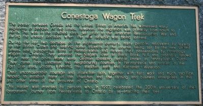
The border between Canada and the United States of America has witnessed many migrations of people. At two times, however, the migration was primarily from south to north. That was in the troubled days just prior to the American Revolutionary War and during the uneasy decades when the new republic was being formed.
During the last two decades of the eighteenth century, many people, motivated by loyalty to the British Crown and fearing some aspects of the course being set by the new United States, sold prosperous farms in Pennsylvania and moved their possessions by conestoga wagon to Ontario. They entered the Niagara River at Black Rock, N.Y. and probably landed at or near this point. Many were German speaking people known as Pennsylvania Dutch. They came from Lancaster and neighbouring counties in Pennsylvania and settled in the Fort Erie area, Jordan, Vineland, the Markham area and Kitchener - Waterloo.
Their unconquerable courage and inflexible faith, together with hard work and much sacrifice, helped to establish many of the churches and the farming and business enterprises in this and other areas of the province
this page online
This marker was erected by persons who, in 1997, celebrated the 200th anniversary of their foreparents' journey from Pennsylvania to Ontario by re-enacting their trek.
Erected by Niagara Parks Commission.
Topics. This historical marker is listed in these topic lists: Colonial Era • Settlements & Settlers. A significant historical year for this entry is 1997.
Location. 42° 58.93′ N, 79° 1.462′ W. Marker is near Fort Erie, Ontario, in Niagara Region. It is on Niagara Parkway just south of Netherby Road, on the left when traveling south. This historical marker is affixed to a large rock, along side a walking path that runs both in-between and parallel to the Niagara Parkway to the west and the Niagara River to the east. It is just a very short distance south of the Netherby Road intersection and north of the mouth of Black Creek. Touch for map. Marker is at or near this postal address: 4329 Niagara Parkway, Fort Erie ON L2E 6S6, Canada. Touch for directions.

Regionally, this marker is on Ontario’s Golden Horseshoe and in Niagara Canada. It is also in Central Canada. Globally, it is in North America,
Photographed by Dale K. Benington, June 11, 2012
2. Conestoga Wagon Trek Marker
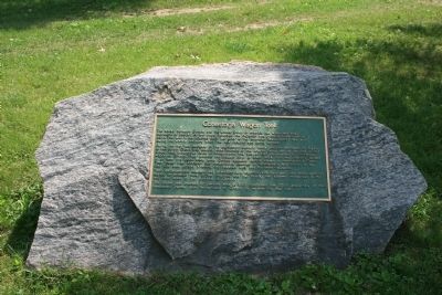
View of the historical marker affixed to a large rock.
Other nearby markers. At least 8 other markers are within 5 kilometers of this marker, measured as the crow flies: Location of the Ebenezer Settlement 1848 1858 (within shouting distance of this marker); Ebenezer Community (approx. 1.7 kilometers away); Strickler-Danner House circa 1805 (approx. 1.8 kilometers away); Disaster at Eagle Park (approx. 3.8 kilometers away in the U.S.); Willoughby Church Cemetery (approx. 3.8 kilometers away); a different marker also named Willoughby Church Cemetery (approx. 3.8 kilometers away); Gonder's Flats (approx. 4.2 kilometers away); Crossing of the River Brethren (approx. 4.9 kilometers away). Touch for a list and map of all markers in Fort Erie.
Also see . . .
1. Conestoga Wagons Trek From Lancaster. This is a link to information provided by Google News (Submitted on June 20, 2013, by Dale K. Benington of Toledo, Ohio.)
2. Speech for Boehm's Chapel Day, June 22, 1997.
Photographed by Dale K. Benington, June 11, 2012
3. Conestoga Wagon Trek Marker
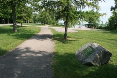
View of the historical marker, looking north along both the walking path and the Niagara Parkway, with a view of the Niagara River in the distant right/center background.
Photographed by Dale K. Benington, June 11, 2012
4. Conestoga Wagon Trek Marker
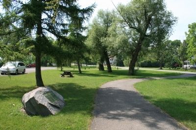
View of the historical marker, looking south along both the walking path and the Niagara Parkway.
Credits. This page was last revised on October 24, 2025. It was originally submitted on June 20, 2013, by Dale K. Benington of Toledo, Ohio. This page has been viewed 908 times since then and 26 times this year. Last updated on August 29, 2025, by Kevin Westell of St. Catharines, Ontario. Photos: 1, 2, 3, 4. submitted on June 20, 2013, by Dale K. Benington of Toledo, Ohio. • Devry Becker Jones was the editor who published this page.
