Near Richmond in Henrico County, Virginia — The American South (Mid-Atlantic)
The Potters of Four Mile Creek
Art and Industry in 19th Century Henrico

Photographed by Bernard Fisher, August 30, 2025
1. The Potters Of Four Mile Creek Marker
Norwich Mills/Randolph Pottery
During the first half of the nineteenth century, potters in the Four Mile Creek area of eastern Henrico County used the local clay deposits to produce a wealth of stoneware vessels whose artistry elevated them far above mere utilitarian objects. The products of these artisans, part of the James River school of pottery, are prized by collectors of American stoneware. The forms and decorations identify the potter and illustrate the influence each had on the other.
(caption) Mutual Assurance Society of Virginia 1816 sketch of insured buildings comprising the Randolph Pottery at the former Norwich Mills complex.
Norwich Mills was a large, eighteenth century mill complex along the banks of Four Mile Creek. In an 1806 Mutual Assurance Society of Virginia policy map, there were seven structures insured on the property. Around 1809, Richard Randolph purchased the property and converted the mill to a stoneware manufactory. Randolph would later rename the surrounding property "Kaolin", for the soft white clay found in the area. This clay was the ideal raw material for the manufacture of his
this page online
Samuel Frayser (ca. 1787-1849)
One of the first potters to work at the Randolph manufactory was Henrico County native Samuel Frayser, who later worked on his own and in partnership with Thomas Amoss. Images courtesy of the Museum of Early Southern Decorative Arts.
Thomas Amoss (1786-1822)
Baltimore native potter Thomas Amoss moved to Four Mile Creek and worked with Frayser from 1818 to 1821, when he and Frayser left to work independently. Images courtesy of the Colonial Williamsburg Foondation, Museum Purchase
Stephen Sweeney (1799-1862)
Possibly trained in Samuel Frayser's shop, Henrico native Stephen Sweeney bought land in the area, added to it over time and named it Claymount, where he set up his manufactory. In 1854, he bought the land where Randolph set up the original pottery in the area. Images courtesy of the Museum of Early Southern Decorative Arts.
Erected by County of Henrico.
Topics. This historical marker is listed in these topic lists: Arts, Letters, Music
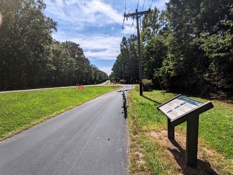
Photographed by Bernard Fisher, August 30, 2025
2. The Potters Of Four Mile Creek Marker
Location. 37° 25.35′ N, 77° 17.911′ W. Marker is near Richmond, Virginia, in Henrico County. It is at the intersection of New Market Road (Virginia Route 5) and Sweeney Landing Road, on the right when traveling east on New Market Road. Located along the Virginia Capital Trail. Touch for map. Marker is in this post office area: Henrico VA 23231, United States of America. Touch for directions.

Regionally, this marker is in the Piedmont and in Central Virginia. It is also in the American South, specifically in the Upper South, and on the Eastern Seaboard. Globally, it is in the North Atlantic Region, North America, the Western Hemisphere, the Western World, and the Anglosphere. Historically, it finds itself in what was once the territory of the Mississippian Culture, one of the original Thirteen Colonies, one of the Confederate States of America, and the Antebellum South.
Other nearby markers. At least 8 other markers are within 2 miles of this marker, measured as the crow flies: Pleasants v. Pleasants (approx. 0.2 miles away); First Battle of Deep Bottom (approx. 0.4 miles away); New Market Road (approx. 0.7 miles away); John Smith Explores the Chesapeake (approx. 1.1 miles away); Deep Bottom Landing (approx. 1.1 miles away); The War of 1812 / Richmond's War of 1812 Defensive Camps (approx. 1.2 miles away); New Market Heights (approx. 1.2 miles away); Battle of New Market Heights (approx. 1.2 miles away). Touch for a list and map of all markers in Richmond.
Other markers no longer nearby. Deep Bottom Park (was approx. 1.1 miles away but has been reported to have been replaced with another marker now near it); a different marker also named Deep Bottom Landing (was approx. 1.1 miles away but has been replaced with another marker now near it).
Credits. This page was last revised on September 13, 2025. It was originally submitted on August 30, 2025, by Bernard Fisher of Richmond, Virginia. This page has been viewed 1,053 times since then and 72 times this year. Photos: 1, 2. submitted on August 30, 2025, by Bernard Fisher of Richmond, Virginia.
