Northwest Colorado Springs in El Paso County, Colorado — The American Mountains (Southwest)
John Blair Bridge
Circa 1880
Photographed by Cosmos Mariner, August 25, 2025
1. John Blair Bridge Marker
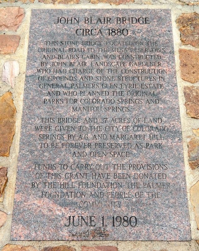
This stone bridge located on the original road to the mesa reservoirs and Blair’s cabin was constructed by John Blair, landscape gardener, who had charge of the construction of grounds and stone structures in General Palmer’s Glen Eyre Estate and who planned the original parks for Colorado Springs and Manitou Springs.
This bridge and 37 acres of land were given to the City of Colorado Springs by A.G. and Margaret Hill to be forever preserved as park and open space.
Funds to carry out the provisions of this grant have been donated by The Hill Foundation, The Palmer Foundation and people of the community.
Erected 1980.
Topics. This historical marker is listed in these topic lists: Architecture • Bridges & Viaducts • Charity & Public Work • Parks & Recreational Areas. A significant historical year for this entry is 1880.
Location. 38° 53.503′ N, 104° 52.501′ W. Marker is in Colorado Springs, Colorado, in El Paso County. It is in Northwest Colorado Springs. It is at the intersection of North 30th Street and Glen Eyrie, on the right when traveling north on North 30th Street. The marker is located
this page online

Regionally, this marker is in Colorado’s Front Range and in Pikes Peak Region. It is also in the American Mountain West. Globally, it is in North America, the Rocky Mountains, the Western Hemisphere, the Western World, and the Anglosphere. Historically, it finds itself in what was once the Comanchería.
Other nearby markers. At least 8 other markers are within one mile of this marker, measured as the crow flies: Welcome to Garden of the Gods Park (approx. 0.8 miles away); A Priceless Gift (approx. 0.9 miles away); The Garden of the Gods (approx. one mile away); O Beautiful For Spacious Skies… (approx. one mile away); Rock Ledge Ranch Historic Site (approx. one mile away); a different marker also named A Priceless Gift (approx. one mile away); Time Frozen In Stone (approx. one mile away); Garden of the Gods Park (approx. one mile away). Touch for a list and map of all markers in Colorado Springs.
Also see . . .
1. William Jackson Palmer (Wikipedia).
Photographed by Cosmos Mariner, August 25, 2025
2. John Blair Bridge Marker
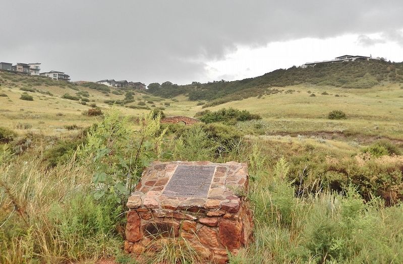
Looking east from North 30th Street. The John Blair Bridge is visible in the distant background.
Excerpt: In his early career, Palmer helped develop the expanding railroads of the United States in Pennsylvania. Heading west in 1867, Palmer helped build the Kansas Pacific Railway. He befriended a young English doctor, Dr. William Abraham Bell, who became his partner in most of his business ventures. The two men are best known as co-founders of the Denver and Rio Grande Railroad. The Rio Grande and its successors eventually operated the largest network of narrow-gauge railroads in the United States.(Submitted on August 30, 2025, by Cosmos Mariner of Cape Canaveral, Florida.)On July 31, 1871, Palmer and Bell founded Fountain Colony (later Colorado Springs), downstream of Colorado City, and it was laid out by the Colorado Springs Company that year. He also founded the town of Manitou (later Manitou Springs) as a resort town at the base of Pikes Peak. Palmer spent about $1,000,000 (equivalent to $35,841,034 in 2024) on the construction of roads and development of parks in Manitou Springs, Old Colorado City, Colorado Springs, and Manitou Park. Palmer donated land to establish the first city park, Acacia, and additional parks: Antlers Park, Monument Valley Park, North Cheyenne Cañon Park, Palmer Park, Pioneer
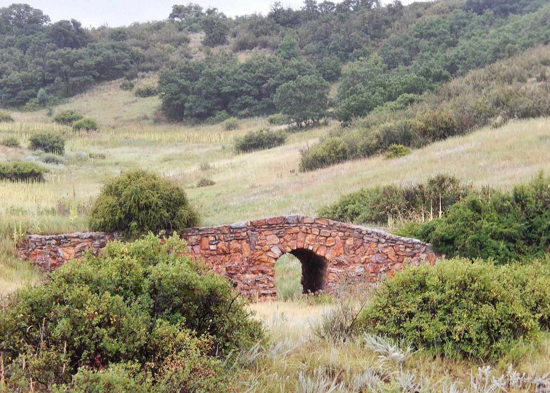
Square Park (South Park), Prospect Lake and Bear Creek Cañon Park. He donated a total of 1,270 acres of land, some of which was also used for scenic drives, tree-lined roadways and foot and bridle paths.Photographed by Cosmos Mariner, August 25, 20253. John Blair BridgeTelephoto view looking east from near the historical marker.
2. John Blair (The Cultural Landscape Foundation).
Excerpt: Born in Callander, Scotland, Blair apprenticed at Lanrick Castle in Doune before emigrating to St. Catherine’s, Ontario in 1851 to work as a landscape gardener. Eventually he moved to Chicago and began work for the Chicago Parks Department as Superintendent of Parks. He was instrumental in the creation of the West Side Park system. In 1871, he was introduced to railroad magnate and city founder General William Palmer. Palmer commissioned Blair to lay out much of the city, including parks, cemeteries, roads and trails, as well as Palmer’s own private estate, Glen Eyrie. Blair’s designs utilized rocks, trees, water, and rustic structural features to create naturalistic landscapes. As a master stone mason, he erected the first bridge built on public land in Colorado and designed a road through the Garden of the Gods between Manitou Springs and Glen Eyrie.(Submitted on August 30, 2025, by Cosmos Mariner of Cape Canaveral, Florida.)
Credits. This page was last revised on August 30, 2025. It was originally submitted on August 30, 2025, by Cosmos Mariner of Cape Canaveral, Florida. This page has been viewed 274 times since then and 140 times this year. Photos: 1, 2, 3. submitted on August 30, 2025, by Cosmos Mariner of Cape Canaveral, Florida.
