St. Catharines in Niagara Region, Ontario — Central Canada (North America)
Richard Pierpoint c.1744-c.1838
Photographed by Kevin Westell, September 4, 2025
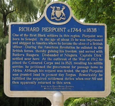
1. Richard Pierpoint c.1744-c.1838 - Marker

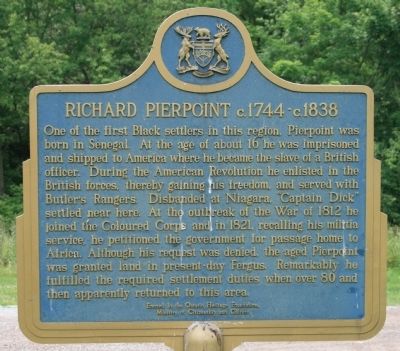
One of the first Black settlers in this region, Pierpoint was born in Senegal. At the age of about 16 he was imprisoned and shipped to America where he became the slave of a British officer. During the American Revolution he enlisted in the British forces, thereby gaining his freedom, and served with Butler's Rangers. Disbanded at Niagara, "Captain Dick" settled near here. At the outbreak of the War of 1812 he joined the Coloured Corps and in 1821, recalling his militia service, he petitioned the government for passage home to Africa. Although his request was denied, the aged Pierpoint was granted land in present-day Fergus. Remarkably he fulfilled the required settlement duties when over 80 and then apparently returned to this area.
this page online
Erected 1985 by Ontario Heritage Foundation, Ministry of Citizenship and Culture.
Topics and series. This historical marker is listed in these topic lists: African Americans • Science & Medicine • War of 1812 • War, US Revolutionary. In addition, it is included in the Canada, Ontario Heritage Trust series list. A significant historical year for this entry is 1744.
Location. 43° 9.664′ N, 79° 13.783′ W. Marker is in St. Catharines, Ontario, in Niagara Region. It is on Oakdale Avenue 0.1 kilometers north of Eastchester Ave, on the right when traveling south. This marker is 10 metres south of the road, just west of the parking for Richard Pierpoint Park (formerly Centennial Park), on a short concrete walking path from the road
Photographed by Kevin Westell, September 4, 2025
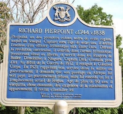
2. Richard Pierpoint c.1744-c.1838 - French on reverse

Regionally, this marker is on Ontario’s Golden Horseshoe and in Niagara Canada. It is also in Central Canada. Globally, it is in North America, on the Great Lakes, in the Western Hemisphere, in the Western World, and in the Anglosphere. Historically, it finds itself in what was once a British colony, the Viceroyalty of New France, the Haudenosaunee (Iroquois) Confederacy, and Rupert’s Land.
Other nearby markers. At least 8 other markers are within walking distance of this marker: St. Paul Street United Church (approx. 0.9 kilometers away); Harriet Tubman (approx. one kilometer away); Salem Chapel BME Church - Harriet Tubman Underground Railroad National Historic Site (approx. one kilometer away); The British Methodist Episcopal Church circa 1855 (approx. one kilometer away); Harriet Ross Tubman c. 1820-1913 (approx. one kilometer away); Harriet Tubman (c. 1822-1913) (approx. one kilometer away); Salem Chapel, British Methodist Episcopal Church (approx. one kilometer
Photographed by Kevin Westell, September 4, 2025
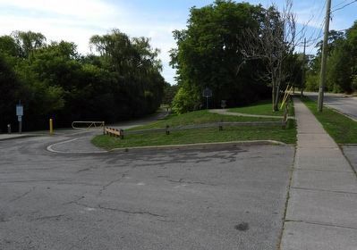
3. Richard Pierpoint c.1744-c.1838 - Marker in context
Marker is on its own short concrete walkway, close to the road and the parking lot (out-of-frame left).
Other markers no longer nearby. The First Welland Canal 1824-1833 (was approx. half a kilometer away but has been confirmed missing); BME Church (was approx. one kilometer away but has been replaced with another marker now near it).
Regarding Richard Pierpoint c.1744-c.1838. The creek that runs through the park used to be the first, then the second Welland Canal. But before that, it was known as Dick's Creek, named after Mr. Pierpoint, whose farm was upstream.
Also see . . .
1. Richard Pierpoint. This is a link to information provided by Wikipedia, the free encyclopedia. (Submitted on June 18, 2013, by Dale K. Benington of Toledo, Ohio.)
2. Richard Pierpoint: A very Canadian hero. This is a link to information provided by the Toronto Star Newspapers Ltd. (Submitted on June 18, 2013, by Dale K. Benington of Toledo, Ohio.)
Photographed by Kevin Westell, September 4, 2025
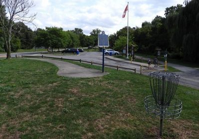
4. Richard Pierpoint c.1744-c.1838 - Marker in context
Marker is on its own short concrete walkway, close to the road and the parking lot; and close to a disc-golf "hole" (the "practice green").
Photographed by Dale K. Benington, June 11, 2012
5. Richard Pierpoint c.1744-c.1838 Marker
Close-up view of the side of the historical marker with the English Text.
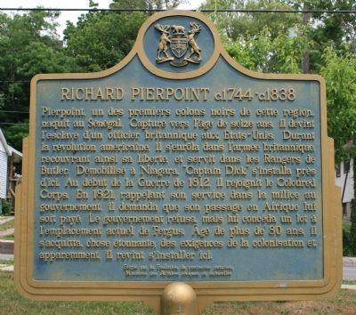
Photographed by Dale K. Benington, June 11, 2012
6. Richard Pierpoint c.1744-c.1838 Marker
Close-up view of the side of the historical marker with the French Text.
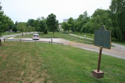
Photographed by Dale K. Benington, June 11, 2012
7. Richard Pierpoint c.1744-c.1838 Marker
View looking south along Oakdale Avenue, of the historical marker in the community park
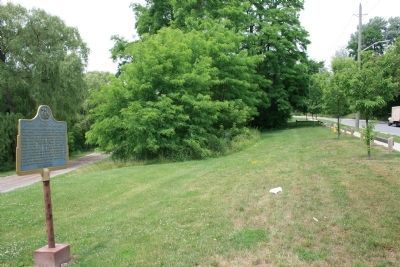
Photographed by Dale K. Benington, June 11, 2012
8. Richard Pierpoint c.1744-c.1838 Marker
View looking north along Oakdale Avenue, of the historical marker in the community park.
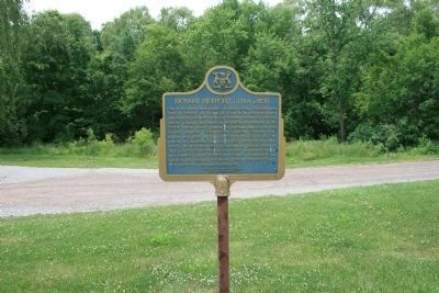
Photographed by Dale K. Benington, June 11, 2012
9. Richard Pierpoint c.1744-c.1838 Marker
View of the historical marker with the community park and park trail in the background.
Credits. This page was last revised on October 24, 2025. It was originally submitted on June 18, 2013, by Dale K. Benington of Toledo, Ohio. This page has been viewed 869 times since then and 45 times this year. Last updated on August 31, 2025, by Kevin Westell of St. Catharines, Ontario. Photos: 1. submitted on September 4, 2025, by Kevin Westell of St. Catharines, Ontario. 2, 3, 4. submitted on September 23, 2025, by Kevin Westell of St. Catharines, Ontario. 5, 6, 7, 8, 9. submitted on June 18, 2013, by Dale K. Benington of Toledo, Ohio. • Devry Becker Jones was the editor who published this page.
