North Loop in Minneapolis in Hennepin County, Minnesota — The American Midwest (Upper Plains)
Streetcars, Groceries & Booze
Built: 1885, 1889, 1908
| — | Historic North Loop | — |

Photographed by McGhiever, May 12, 2024
1. Streetcars, Groceries & Booze Marker
This building's first three stories were constructed for the streetcar system in 1885, with plans to modernize and upgrade from horse-drawn cars to a cable system. But after adding steam generators here in 1889 to power the cables, the city went instead with electric streetcars and this building sat vacant.
It became a distribution center for wholesale groceries with two more stories added on in 1908. Cold storage units were added in 1938, making fresh fruits and vegetables available year-round.
And things got dicey here, at times, during and after Prohibition. A storage company named Colonial Warehouses, Inc. was the target of raids and hold-ups here because of the large quantities of alcohol it stored. Or, as the company called them during Prohibition, "body rub" and "hair tonic."
Erected by North Loop Neighborhood Association.
Topics. This historical marker is listed in these topic lists: Industry & Commerce • Law Enforcement • Railroads & Streetcars. A significant historical year for this entry is 1885.
Location. 44° 59.123′ N, 93° 16.292′ W. Marker is in Minneapolis, Minnesota, in Hennepin County.
this page online

Regionally, this marker is in the Twin Cities Metropolitan Area. It is also in the American Midwest, in the Corn Belt, and in the Great River Road Region. Globally, it is in North America, the Western Hemisphere, the Western World, and the Anglosphere. Historically, it finds itself in what was once Rupert’s Land, the territory of the Mississippian Culture, and the Louisiana Purchase.
Other nearby markers. At least 8 other markers are within walking distance of this marker: Carriages to Cars (within shouting distance of this marker); Windmills, Wagons and More (about 600 feet away, measured in a direct line); Carriages, Crackers & Color TVs (about 600 feet away); Buggy Assembly Plant (about 700 feet away); Lutefisk Processing Plant (about 700 feet away); Pasta Factory (approx. 0.2 miles away); Gothic Storage Facility (approx.
Photographed by McGhiever, May 12, 2024
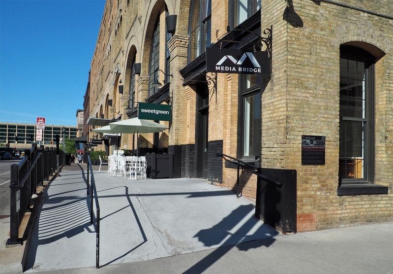
2. Streetcars, Groceries & Booze Marker (right) on the building's N. 2nd Street façade
Also see . . . Loop Back: Colonial Warehouse (QR code on marker). (Submitted on August 31, 2025, by McGhiever of Minneapolis, Minnesota.)
Credits. This page was last revised on August 31, 2025. It was originally submitted on August 31, 2025, by McGhiever of Minneapolis, Minnesota. This page has been viewed 77 times since then and 19 times this year. Photos: 1, 2. submitted on August 31, 2025, by McGhiever of Minneapolis, Minnesota.
