Garrison in McLean County, North Dakota — The American Midwest (Upper Plains)
Fort Stevenson State Park
Lewis and Clark in North Dakota

Photographed by Barry Swackhamer, July 23, 2025
1. Fort Stevenson State Park Marker
With "the assistance of the wind, the current and our oars," the expedition covered 86 miles of its homeward journey on the cool and blustery day. At the mouth of the Little Missouri, the party stopped to hunt, but were able only to wound an elk. Several Indians were seen on nearby hills. Clark wrote that "nothing very remarkable took place," but noted thankfully that the "Misquetors" were "not so troublesome" when the camped at Snake Creek.
(Same text as the "Garrison Dam Overlook" marker)
Erected by North Dakota Parks & Recreation, US Army Corps of Engineers.
Topics and series. This historical marker is listed in these topic lists: Animals • Exploration • Waterways & Vessels. In addition, it is included in the Lewis & Clark Expedition series list. A significant historical date for this entry is August 13, 1806.
Location. 47° 35.254′ N, 101° 25.263′ W. Marker is in Garrison, North Dakota, in McLean County. It can be reached from 41st Avenue NW near Scooter Drive. The marker is located in Fort Stevenson State Park in a grassy field bordered by Lake Sakakawea, near the south end of 41st
this page online

Regionally, this marker is in the Mandan, Hidatsa, and Arikara Nation, in the Standing Rock Sioux Tribe, in the Drift Prairie, and on the Missouri Plateau. It is also in the American Lewis & Clark Corridor, on the prairies, and on the Northern Plains. Globally, it is in North America, the Western Hemisphere, the Western World, and the Anglosphere. Historically, it finds itself in what was once Rupert’s Land and also the Louisiana Purchase.
Other nearby markers. At least 8 other markers are within 6 miles of this marker, measured as the crow flies: Garrison Dam (a few steps from this marker); Lake Sakakawea (a few steps from this marker); A Blank Canvas (within shouting distance of this marker); De Trobriand (within shouting distance of this marker); Buffalo (within shouting distance of this marker); Intake Structure (approx. 5.7 miles away); Powerhouse (approx. 5.8 miles away); a different marker also named Garrison Dam (approx. 5.8 miles away). Touch for a list and map

Photographed by Barry Swackhamer, July 23, 2025
2. Fort Stevenson State Park Marker

Photographed by Barry Swackhamer, July 23, 2025
3. Fort Stevenson State Park Marker
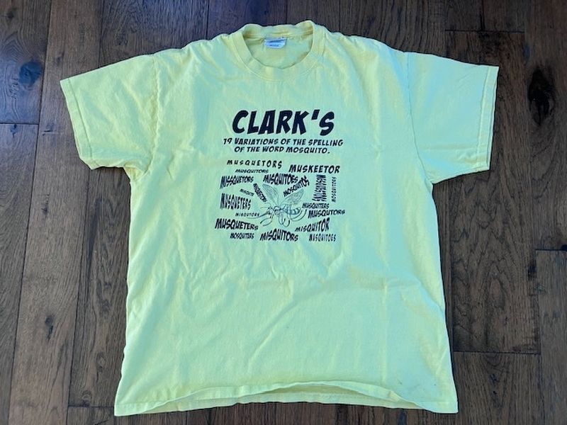
Photographed by Barry Swackhamer
4. Clark's 19 Variation of the Spelling of the Word Mosquito
T-shirt available at the Lewis & Clark Interpretive Center at Great Falls, Montana.
Credits. This page was last revised on September 4, 2025. It was originally submitted on September 4, 2025, by Barry Swackhamer of Brentwood, California. This page has been viewed 95 times since then and 27 times this year. Photos: 1, 2, 3, 4. submitted on September 4, 2025, by Barry Swackhamer of Brentwood, California.
