Utica in Licking County, Ohio — The American Midwest (Great Lakes)
The Water Wheel
Photographed by Craig Doda, August 31, 2025
1. The Water Wheel Marker
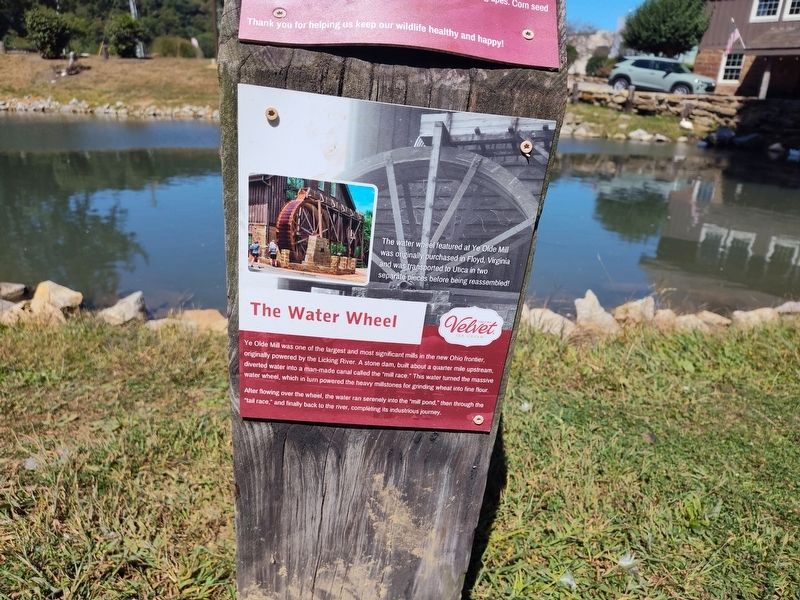
Ye Olde Mill was one of the largest and most significant mills in the new Ohio frontier, originally powered by the Licking River. A stone dam, built about a quarter mile upstream, diverted water into a man-made canal called the "mill race." This water turned the massive water wheel, which in turn powered the heavy millstones for grinding wheat into fine flour.
After flowing over the wheel, the water ran serenely into the "mill pond," then through the "tail race," and finally back to the river, completing its industrious journey.
The water wheel featured at Ye Olde Mill was originally purchased in Floyd, Virginia and was transported to Utica in two separate pieces before being reassembled!
Topics. This historical marker is listed in these topic lists: Architecture • Industry & Commerce • Waterways & Vessels.
Location. 40° 12.864′ N, 82° 26.511′ W. Marker is in Utica, Ohio, in Licking County. It is at the intersection of Mount Vernon Road (Ohio Route 13) and Ginger Hill Road, on the right when traveling north on Mount Vernon Road. Touch for map. Marker is
this page online

Regionally, this marker is in the Columbus Metropolitan Area. It is also in the American Midwest, in the Corn Belt, in Appalachia, and specifically in Northern Appalachia. Globally, it is in North America, the Western Hemisphere, the Western World, and the Anglosphere. Historically, it finds itself in what was once the Haudenosaunee (Iroquois) Confederacy, the territory of the Mississippian Culture, and the Northwest Territory.
Other nearby markers. At least 8 other markers are within walking distance of this marker: "Ye Olde Mill" (within shouting distance of this marker); Ye Olde Mill, Utica, Ohio (within shouting distance of this marker); Ye Olde Mill - Utica, Ohio (within shouting distance of this marker); a different marker also named Water Wheel (within shouting distance of this marker); a different marker also named The Water Wheel (within shouting distance of this marker); Underground Railroad (within shouting distance of this marker); Buckeye Tree Grove (within shouting distance of this marker); Ritchey's Lunches & Fountain Service
Photographed by Craig Doda, August 31, 2025
2. The Water Wheel Marker
Photographed by Craig Doda, August 31, 2025
3. The Water Wheel Marker
Credits. This page was last revised on September 29, 2025. It was originally submitted on September 5, 2025, by Craig Doda of Napoleon, Ohio. This page has been viewed 77 times since then and 30 times this year. Photos: 1, 2, 3. submitted on September 5, 2025, by Craig Doda of Napoleon, Ohio. • Devry Becker Jones was the editor who published this page.
