
Niagara Falls in Niagara Region, Ontario — Central Canada (North America)
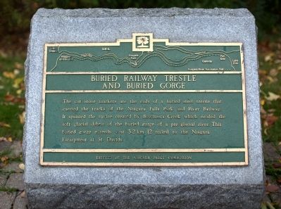
Buried Railway Trestle and Buried Gorge
Photographed by J. J. Prats, October 15, 2014
1. Buried Railway Trestle and Buried Gorge Marker
Erected by the Niagara Parks Commission.
Topics. This historical marker is listed in these topic lists: Entertainment • Natural Features • Railroads & Streetcars. A significant historical year for this entry is 1893.
Location. 43° 7.43′ N, 79° 4.65′ W. Marker is in Niagara Falls, Ontario, in Niagara Region. It is on Niagara Parkway just north of Whirlpool Road, on the right when traveling north. It is on the Niagara River Recreation Trail that parallels the parkway. Touch for map. Marker is in this post office area: Niagara Falls ON L2E 6V5, Canada. Touch for directions.

Regionally, this marker is on Ontario’s Golden Horseshoe and in Niagara Canada. It is also in Central Canada. Globally, it is in North America, on the Great Lakes, in the Western
this page online
Other nearby markers. At least 8 other markers are within walking distance of this marker: Niagara Falls Park and River Railway (about 180 meters away, measured in a direct line); Niagara River Recreation Trail (approx. 0.3 kilometers away); Thompson Point (approx. 0.7 kilometers away); Whirlpool Rapids Gorge (approx. 0.9 kilometers away); Niagara Spanish Aero Car (approx. one kilometer away); The Niagara Spanish Aerocar / Le Téléférique Espanol Du Niagara / El Transbordador Español De Niágar (approx. one kilometer away); Eddy Basin (approx. 1.1 kilometers away in the U.S.); Challenging the Whirlpool Rapids (approx. 1.1 kilometers away in the U.S.). Touch for a list and map of all markers in Niagara Falls.
More about this marker. Historical marker is located half-way between two cut-stone markers that indicate the ends of the trestle.
Related markers. Click here for a list of markers that are related to
Photographed by J. J. Prats, October 15, 2014
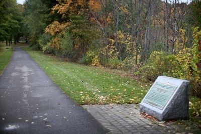
2. Historical Marker and Trestle Marker
The cut stone that indicates the north end of the trestle can be seen on the far left next to the trail, just before the trees.
Also see . . . Niagara Falls Then and Now, Buildings lost, Buildings found. Scroll down to see another photograph of the trestle. “This ravine below the bridge was slowly filled in with tailings from the construction of the Canadian Niagara Power Co. electric generating station pits located just above Niagara Falls. The ravine was filled by 1903, at which point the bridge was completely buried in the fill. In the photo, stone is already seen dumped at the bottom left. To the right this ravine was filled in, now the Niagara Parkway runs there, as well as part of the golf course. To the left the ravine is still open, dropping quickly and directly to the cul-de-sac of the Niagara River’s famous Whirlpool.” (Submitted on December 10, 2014.)
Photographed by J. J. Prats, October 15, 2014
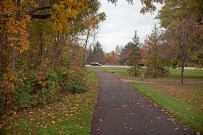
3. Cut Stone Marker Marking South End of Trestle
It can be seen in the distance on the right of the trail. The ground between the two stones was leveled with fill.
Credits. This page was last revised on October 14, 2025. It was originally submitted on December 10, 2014, by J. J. Prats of Powell, Ohio. This page has been viewed 864 times since then and 46 times this year. Last updated on September 5, 2025, by Kevin Westell of St. Catharines, Ontario. Photos: 1, 2, 3. submitted on December 10, 2014, by J. J. Prats of Powell, Ohio. • Devry Becker Jones was the editor who published this page.
