Niagara Falls in Niagara Region, Ontario — Central Canada (North America)
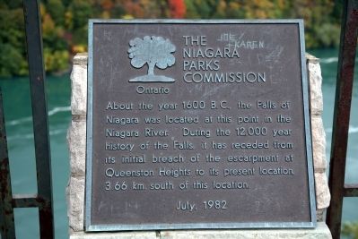
About the year 1600 B.C. ...
Photographed by J. J. Prats, October 15, 2014
1. About the year 1600 B.C. Marker
Erected 1982 by The Niagara Parks Commission.
Topics. This historical marker is listed in this topic list: Natural Features. A significant historical year for this entry is 1600 BCE.
Location. 43° 6.396′ N, 79° 3.629′ W. Marker is in Niagara Falls, Ontario, in Niagara Region. It is at the intersection of River Road and Queen Street, on the right when traveling north on River Road. It is at the foot of Queen Street, overlooking the gorge. Touch for map. Marker is at or near this postal address: 4605 River Road, Niagara Falls ON L2E 3G1, Canada. Touch for directions.

Regionally, this marker is on the Golden Horseshoe and in Niagara Canada. It is also in Central Canada. Globally, it is in North America, on the Great Lakes, in the Western Hemisphere, in the Western World, and in the Anglosphere. Historically, it finds itself in what was once
this page online
Other nearby markers. At least 8 other markers are within walking distance of this marker: The Original Hill's Barrel (within shouting distance of this marker); Bampfield Hall 1872 (about 210 meters away, measured in a direct line); Rosberg Family Park (about 210 meters away); 140th Anniversary of Christ Church Anglican Church (about 210 meters away); Olympic Torch Run Legacy Trail (about 210 meters away); Binational Heritage Peace Garden Trail (about 210 meters away); Samuel Zimmerman 1815 - 1857 (approx. 0.2 kilometers away); Rededication of Centennial Square and Dedication of the Peace Park (approx. 0.3 kilometers away). Touch for a list and map of all markers in Niagara Falls.
Also see . . . Niagara Falls Geology Facts and Figures. “Cavitation is a special type of erosion that happens at waterfalls because only at the base of waterfalls is there enough speed to produce enough bubbles close enough to rock to affect it. This is the fastest type of erosion. As the water goes over the falls, it speeds
Photographed by J. J. Prats, October 15, 2014
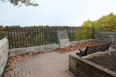
2. About the year 1600 B.C. Marker
Photographed by J. J. Prats, October 15, 2014
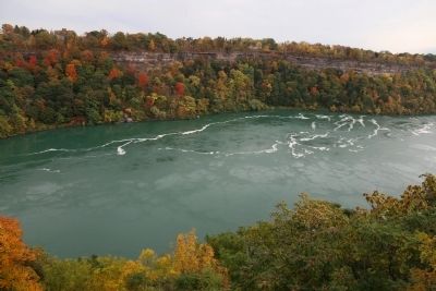
3. The View from the Marker
Credits. This page was last revised on October 12, 2025. It was originally submitted on December 14, 2014, by J. J. Prats of Powell, Ohio. This page has been viewed 722 times since then and 26 times this year. Last updated on September 5, 2025, by Kevin Westell of St. Catharines, Ontario. Photos: 1, 2, 3. submitted on December 14, 2014, by J. J. Prats of Powell, Ohio. • Andrew Ruppenstein was the editor who published this page.
