Elba in Coffee County, Alabama — The American South (East South Central)
Evergreen Cemetery
Elba, Alabama
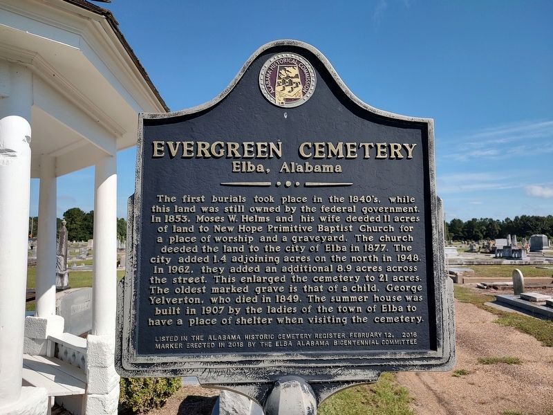
Photographed by Jimmy Emerson, August 31, 2025
1. Evergreen Cemetery Marker
Erected 2018 by Alabama Historical Commission and Elba Alabama Bicentennial Committee.
Topics. This historical marker is listed in this topic list: Cemeteries & Burial Sites. A significant historical date for this entry is February 12, 2016.
Location. 31° 25.968′ N, 86° 4.542′ W. Marker is in Elba, Alabama, in Coffee County. It is on Clayton Ave (State Highway 189) north of Johnson Street. Touch for map.
this page online

Regionally, this marker is in the American South, specifically in the Deep South, and in the Wiregrass. Globally, it is in North America, a Gulf of Mexico state, the Western Hemisphere, the Western World, and the Anglosphere. Historically, it finds itself in what was once the territory of the Mississippian Culture, one of the Confederate States of America, and the Antebellum South.
Other nearby markers. At least 8 other markers are within 6 miles of this marker, measured as the crow flies: Mulberry Heights School (approx. ¾ mile away); City of Elba (approx. 1.4 miles away); First United Methodist Church (approx. 1.4 miles away); Elba Lodge #170 AF & AM (approx. 1.4 miles away); Historic Court Square (approx. 1.4 miles away); Folsom Birthplace (approx. 1½ miles away); Folsom Estate (approx. 1½ miles away); Site of Curtis School (approx. 5.4 miles away). Touch for a list and map of all markers in Elba.
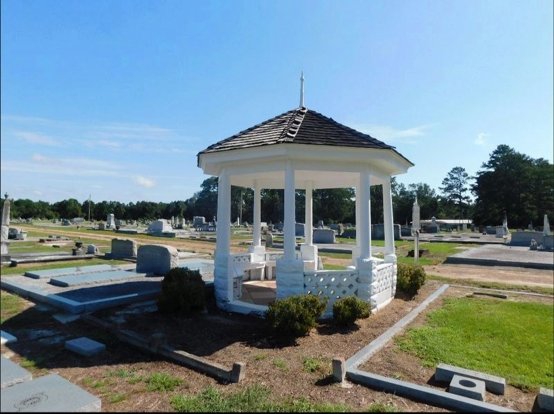
Photographed by Jimmy Emerson
2. Evergreen Cemetery Marker
Credits. This page was last revised on September 14, 2025. It was originally submitted on September 10, 2025, by Jimmy Emerson of Dalton, Georgia. This page has been viewed 264 times since then and 147 times this year. Photos: 1. submitted on September 10, 2025, by Jimmy Emerson of Dalton, Georgia. 2. submitted on September 11, 2025, by Jimmy Emerson of Dalton, Georgia. • James Hulse was the editor who published this page.
