
Near Brent in Nipissing District, Ontario — Central Canada (North America)
Brent Crater
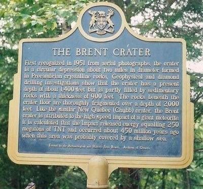
Photographed by Kevin Westell, circa 2002/08
1. Brent Crater - Marker in 2002
Erected by Archaeological and Historic Sites Board, Archives of Ontario.
Topics and series. This historical marker is listed in this topic list: Natural Features. In addition, it is included in the Canada, Ontario Heritage Trust series list. A significant historical year for this entry is 1951.
Location. 46° 3.998′ N, 78° 27.487′ W. Marker is near Brent, Ontario, in Nipissing District. It is on Brent Road, on the left when traveling south. The marker is in the north part of Algonquin Provincial Park, on the Brent Road,
this page online

Regionally, this marker is in Northeastern Ontario and specifically in Northern Ontario. It is also in Central Canada. Globally, it is in North America, the Great North Woods, the Western Hemisphere, the Western World, and the Anglosphere. Historically, it finds itself in what was once a British colony, the Viceroyalty of New France, the Haudenosaunee (Iroquois) Confederacy, and Rupert’s Land.
Other nearby markers. At least 2 other markers are within 26 kilometers of this marker, measured as the crow flies: Brent Crater: The Discovery (a few steps from this marker); Rapids of the Upper Ottawa (approx. 24.6 kilometers away).
More about this marker. A day-use pass for Algonquin Park is required to use the Brent Crater hiking trail and its viewing tower.
Also see . . .
1. Brent Crater, by Charles O'Dale (A geological summary). (Submitted on September 11, 2025, by Kevin Westell of St. Catharines, Ontario.)
2. Brent Crater Trail, by the Friends of
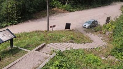
Photographed by Kevin Westell, August 28, 2017
2. Brent Crater Hiking Trail - Parking Lot
Photo faces north from the stairs to the viewing tower for the Brent Crater hiking trail. The marker (right, in line with car) is beside the parking lot.

Photographed by Kevin Westell, August 28, 2017
3. Brent Crater Viewing Tower
Photo faces south, from Brent Road. The marker is out-of-frame left.
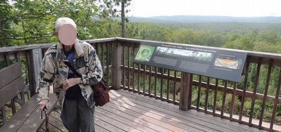
Photographed by Kevin Westell, August 28, 2017
4. Brent Crater
Photo faces west from the viewing tower. On the horizon is the rim of the crater.
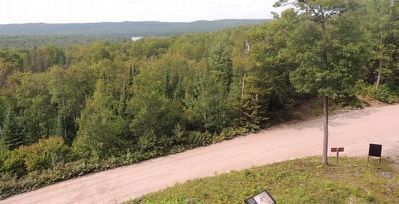
Photographed by Kevin Westell, August 28, 2017
5. Brent Crater
Photo faces north and north-west from the Brent Crater hiking trail's viewing tower. The tiny triangle of water (left of centre) is a lake within the north part of the crater. On the horizon is the crater's rim; farthest on the left, then getting closer on the right.
Photographed by Kevin Westell, August 28, 2017
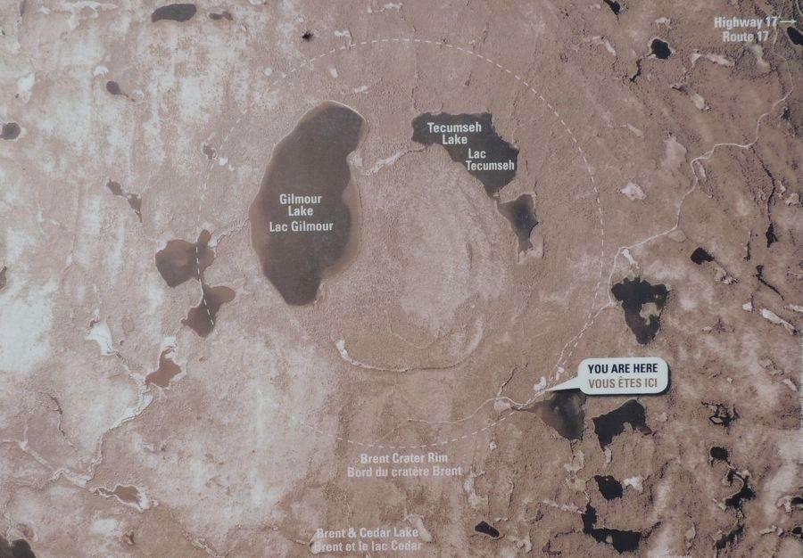
6. Brent Crater Overview Photo and Map
This map is part of the panel half-way up the stairs.
Credits. This page was last revised on September 11, 2025. It was originally submitted on September 11, 2025, by Kevin Westell of St. Catharines, Ontario. This page has been viewed 72 times since then and 15 times this year. Photos: 1, 2, 3, 4, 5, 6. submitted on September 11, 2025, by Kevin Westell of St. Catharines, Ontario. • Andrew Ruppenstein was the editor who published this page.
