Wilmington in New Hanover County, North Carolina — The American South (South Atlantic)
Battle of Forks Road
USCT Fight to Capture Wilmington
Photographed by Mike McKeown, September 11, 2025
1. Battle of Forks Road Marker
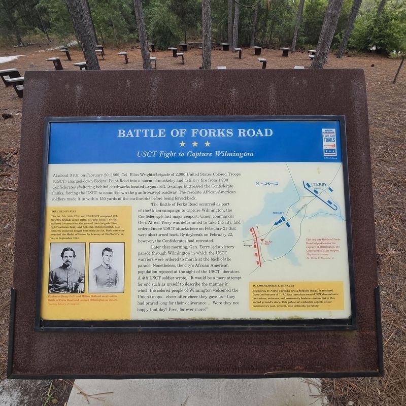
At about 3 P.M. on February 20, 1865, Col. Elias Wright's brigade of 2,000 United States Colored Troops (USCT) charged down Federal Point Road into a storm of musketry and artillery fire from 1,200 Confederates sheltering behind earthworks located to your left. Swamps buttressed the Confederate flanks, forcing the USCT to assault down the gunfire-swept roadway. The resolute African American soldiers made it to within 150 yards of the earthworks before being forced back.
The Battle of Forks Road occurred as part of the Union campaign to capture Wilmington, the Confederacy's last major seaport. Union commander Gen. Alfred Terry was determined to take the city, and ordered more USCT attacks here on February 21 that were also turned back. By daybreak on February 22, however, the Confederates had retreated.
Later that morning, Gen. Terry led a victory parade through Wilmington in which the USCT warriors were ordered to march at the back of the parade. Nonetheless, the city's African American population rejoiced at the sight of the USCT liberators. A 4th USCT soldier wrote, "It would be a mere attempt for one such as
this page online
(sidebar)
Touched By Fire
The 1st, 5th, 10th, 27th, and 37th USCT composed Col. Wright's brigade at the Battle of Forks Road. The 5th suffered 39 casualties, the most of their brigade. First Sgt. Powhatan Beaty and Sgt. Maj. Milton Holland, both formerly enslaved, fought here with the 5th. Both men were awarded the Medal of Honor for bravery at Chaffin's Farm, Va., in September 1864.
(Captions)
Powhatan Beaty (left) and Milton Holland survived the Battle of Forks Road and entered Wilmington as victors. Courtesy Library of Congress
The two-day Battle of Forks Road helped lead to the capture of Wilmington, the Confederacy's last seaport. Map source courtesy Dr. Chris E. Fonvielle, Jr.
(sidebar)
To Commemorate The USCT
Boundless, by North Carolina artist Stephen Hayes, is rendered from the features of 11 African American men—USCT descendants, reenactors, veterans, and community leaders—connected
Photographed by Mike McKeown, September 11, 2025
2. Battle of Forks Road Marker
Erected 2025 by North Carolina Civil War Trails.
Topics and series. This historical marker is listed in these topic lists: African Americans • War, US Civil. In addition, it is included in the North Carolina Civil War Trails series list. A significant historical date for this entry is February 20, 1865.
Location. 34° 11.089′ N, 77° 54.897′ W. Marker is in Wilmington, North Carolina, in New Hanover County. It can be reached from Museum Drive east of South 17th Street, on the left when traveling east. This marker is located northeast of the visitor parking lot of the Cameron Art Museum. Touch for map. Marker is at or near this postal address: 3201 S 17th St, Wilmington NC 28412, United States of America. Touch for directions.

Regionally, this marker is in the Coastal Plain and on the Cape Fear Coast. It is also in the American South, specifically in the Upper South, in the Tidewater, and on the Eastern Seaboard. Globally, it is in the North Atlantic Region, North America, the Western Hemisphere, the Western

Photographed by Mike McKeown, September 11, 2025
3. Battle of Forks Road Marker
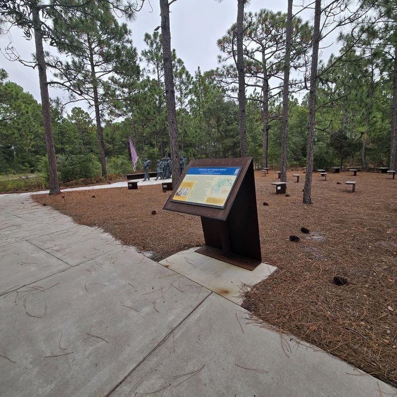
Sculpture near marker
Other nearby markers. At least 8 other markers are within 3 miles of this marker, measured as the crow flies: Fall of Wilmington (approx. 0.6 miles away); 1st Wilmington WWII POW Camp (approx. 1.2 miles away); North Carolina Shipbuilding Co. (approx. 1.2 miles away); Legion Stadium (approx. 1.8 miles away); Chadwick-Teague House (approx. 2 miles away); Marshall Cottage (approx. 2 miles away); McNeal-Applewhite House (approx. 2.1 miles away); Dye-Honeycutt House (approx. 2.1 miles away). Touch for a list and map of all markers in Wilmington.
Another marker is no longer nearby. Last Stand At Wilmington (was a few steps from this marker but has been replaced with another marker now near it).
Related marker. Click here for another marker that is related to this marker. Old CWT Marker At This Location titled "Last Stand At Wilmington".
Also see . . .
1. Discover the Boundless Legacy of the USC Troops Wilmingtonbeaches.com. (Submitted on September 11, 2025, by Mike McKeown of Baltimore, Maryland.)
2. Elias Wright (Wikipedia). (Submitted on September 11, 2025, by Mike McKeown of Baltimore, Maryland.)
Credits. This page was last revised on October 22, 2025. It was originally submitted on September 11, 2025, by Mike McKeown of Baltimore, Maryland. This page has been viewed 144 times since then and 80 times this year. Photos: 1, 2, 3. submitted on September 11, 2025, by Mike McKeown of Baltimore, Maryland. • Bernard Fisher was the editor who published this page.
