
Dudley near Goldsboro in Wayne County, North Carolina — The American South (South Atlantic)
Battle of Goldsboro Bridge
End of Foster’s Raid
| — | Foster’s Raid | — |
Photographed by J. J. Prats, February 27, 2010
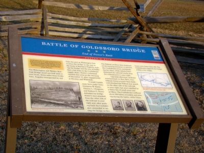
1. Battle of Goldsboro Bridge Marker
The Wilmington and Weldon Railroad Bridge stood one-half mile to your front, three miles from Goldsboro. Supplies transported by rail from the port at Wilmington had to cross the bridge on the way to the Army of Northern Virginia, making the bridge and the city of Goldsboro vital links in the Confederate supply chain. Foster’s command reached this area on the morning of December 17, after engagements at Kinston and Whitehall.
A small Confederate force under Generals Gustavus W. Smith, Thomas L. Clingman, and Nathan G. Evans defended the bridge. Foster’s men attacked from the other side of the railroad to your right and, after pushing back the Confederates, succeeded in setting
this page online
Late that afternoon, as Foster marched back to New Bern, Confederate forces crossed these fields and attacked the Federal rear guard on the other side of the railroad to your right, but were repulsed by a heavy fire of small arms and artillery. The Confederates suffered about 150 killed, wounded, and missing during the battle, while Union losses were fewer than 100. The Confederates repaired the bridge within a few weeks.
Erected by North Carolina Civil War Trails.
Topics and series. This historical marker is listed in this topic list: War, US Civil. In addition, it is included in the North Carolina Civil War Trails series list. A significant historical date for this entry is December 17, 1862.
Location. This marker has been replaced by another marker nearby. It was located near 35° 20.378′ N, 78° 1.717′ W. Marker was near Goldsboro, North Carolina, in Wayne County. It was in Dudley. It was on Old Mt Olive Highway 0.2 miles
Photographed by J. J. Prats, February 27, 2010
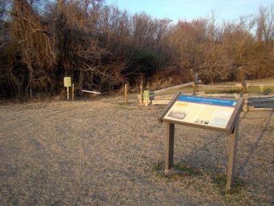
2. Battle of Goldsboro Bridge Marker

Regionally, this marker was in North Carolina’s Coastal Plain and in the Piedmont. It was also in the American South and specifically in the Upper South. Globally, it was in North America, the Western Hemisphere, the Western World, and the Anglosphere. Historically, it found itself in what was once the territory of the Mississippian Culture, one of the original Thirteen Colonies, one of the Confederate States of America, and the Antebellum South.
Other nearby markers. At least 8 other markers are within walking distance of this location: Battle Of Goldsborough Bridge (here, next to this marker); Battle of Goldsborough Bridge (about 300 feet away, measured in a direct line); River Road and Pontoon Bridges (about 400 feet away); Confederate and Union Earthworks (about 700 feet away); Confederate Counterattack (about 700 feet away); Confederate Earthworks (about 800 feet away); Attack of the 17th Massachusetts (approx.
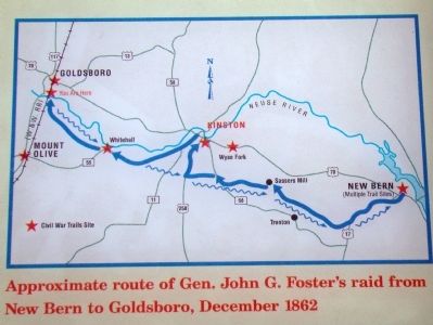
3. Detail from the Marker
“Approximate route of General John G. Foster’s raid from New Bern to Goldsboro, December 1862.”
More about this marker. This is Stop No. 1 of the four stops on the battlefield walking tour.
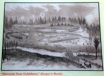
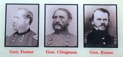
Marker has a Harper’s Weekly illustration of the battle on the lower left; portraits of Generals Foster, Clingman and Evans in the lower center; and two maps on the right side, one of General Foster’s route from New Bern and the other of the engagement here.
Marker is at the Goldsborough Bridge Battlefield, in the parking area. The Goldsborough Bridge Battlefield is owned by Wayne County and developed and operated by the volunteer group the Goldsborough Bridge Battlefield Association. Follow the first link below for more information.
The Google satellite view available on the “click for map” link above in the Location Section (then click on the Satellite button in the upper right) provides a detailed view of the battlefield and the current railroad bridge.
Related marker. Click here for another marker that is related to this marker. New CWT Marker At This Location also titled "Battle of Goldsborough Bridge".
Also see . . . Goldsborough Bridge Battlefield.
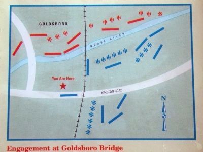
4. Detail from the Marker
“Engagement at Goldsboro Bridge”
5. Detail from the Marker
“ ‘Skirmish Near Golsbroro,’ Harper’s Weekly”
6. Detail from the Marker
Portraits of Generals John G. Foster (Union), Thomas L. Clingman and Nathan G. Evans (Confederate).
Photographed by J. J. Prats, February 27, 2010
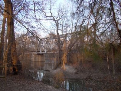
7. Today’s Railroad Bridge over the Neuse River
View is from the south bank. This railroad line today belongs to CSX Transportation. From 1900 to 1967 it was part of the Atlantic Coast Line Railroad.
Credits. This page was last revised on September 14, 2025. It was originally submitted on March 7, 2010, by J. J. Prats of Powell, Ohio. This page has been viewed 3,293 times since then and 63 times this year. Last updated on September 11, 2025, by Mike McKeown of Baltimore, Maryland. Photos: 1, 2, 3, 4, 5, 6, 7. submitted on March 7, 2010, by J. J. Prats of Powell, Ohio. • Bernard Fisher was the editor who published this page.
