Niagara-on-the-Lake in Niagara Region, Ontario — Central Canada (North America)
Niagara District Airport
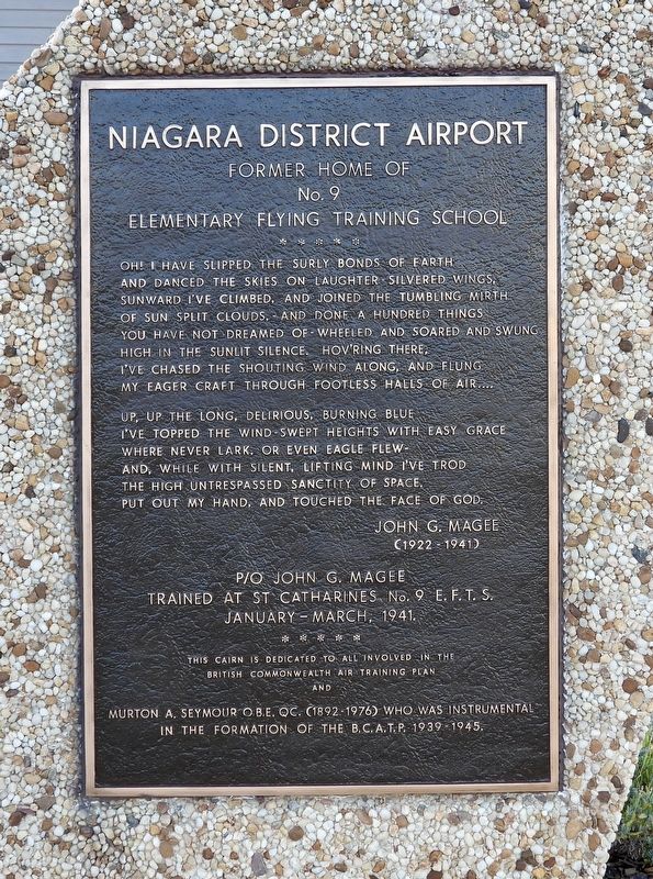
Former Home of No. 9 Elementary Flying Training School
Photographed by Kevin Westell, September 11, 2025
1. Niagara District Airport - Marker
Up, up the long, delirious, burning blue I've topped the wind-swept heights with easy grace where never lark, or even eagle flew- and, while with silent, lifting mind I've trod the high untrespassed sanctity of space. Put out my hand, and touched the face of God.
P/O John G. Magee trained at St Catharines No. 9 E. F. T. S. January-March, 1941.
This cairn is dedicated to all involved in the British Commonwealth Air Training Plan and
Murton A. Seymour OBE, QC. (1892-1976) who was instrumental in the formation of the B.C.A.T.P. 1939-1945.
Topics. This memorial is listed in these topic lists: Air & Space • War, World II • Wars, Non-US. A significant historical year for this entry is 1939.
Location. 43° 11.381′ N,
this page online

Regionally, this memorial is on the Golden Horseshoe and in Niagara Canada. It is also in Central Canada. Globally, it is in North America, on the Great Lakes, in the Western Hemisphere, in the Western World, and in the Anglosphere. Historically, it finds itself in what was once a British colony, the Viceroyalty of New France, the Haudenosaunee (Iroquois) Confederacy, and Rupert’s Land.
Other nearby markers. At least 8 other markers are within 5 kilometers of this marker, measured as the crow flies: Madame Marie Sklodowska-Curie (1867-1934) (approx. 3 kilometers away); At Or Near This Spot In The Year 1795 (approx. 3.2 kilometers away); Private Alexander Watson (approx. 4 kilometers away); 10th (St. Catharines) Field Battery R. C. A. 1939-1945 / 10th Field Battery (approx. 4.1 kilometers away); Rev. Anthony Burns

Photographed by Kevin Westell, September 11, 2025
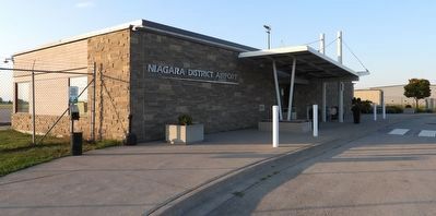
2. Niagara District Airport - Terminal Building
The marker faces the road along the south side of the terminal.
Regarding Niagara District Airport. During WW2, air crew training started at Toronto's exhibition grounds (C.N.E grounds) and lands east of it, including the west end of Toronto Island. Some of the C.N.E.'s agricultural buildings (horse palace, cattle pavilion etc) were used as barracks. Afterward, each person's training would continue at different schools at bases around the country, based on their role - pilot, but also navigator, bombardier, radio operator, gunner...
Also see . . . BCATP - British Commonwealth Air Training Plan, article by The Canadian Encyclopedia. (Submitted on September 11, 2025, by Kevin Westell of St. Catharines, Ontario.)
Photographed by Kevin Westell, September 11, 2025
3. Niagara District Airport - Terminal Building
The marker (far right) is at the east end, in front of that little tree.
Photographed by Kevin Westell, September 11, 2025
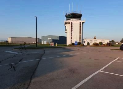
4. Niagara District Airport - control tower
Photo faces east across the front of the terminal building (out-of-frame left). The tower is 5 storeys high, plenty to see over the short buildings for the various air-related businesses. This air traffic control room has 5 sides. There are 3 parking spots for buses in front of the terminal building.
Photographed by Kevin Westell, September 11, 2025
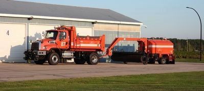
5. Maintenance Truck with MB tow-behind runway sweeper brush
Autumn leaves are coming! The sheds must hold a family of clean-up tools for different seasons.
Credits. This page was last revised on September 12, 2025. It was originally submitted on September 11, 2025, by Kevin Westell of St. Catharines, Ontario. This page has been viewed 51 times since then and 13 times this year. Photos: 1, 2, 3, 4, 5. submitted on September 11, 2025, by Kevin Westell of St. Catharines, Ontario. • Andrew Ruppenstein was the editor who published this page.
