
Camptonville in Yuba County, California — The American West (Pacific Coastal)
Henness Pass Road – Freeman’s Crossing
| — | California Trail | — |
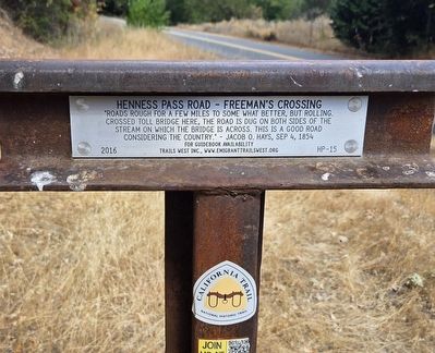
Photographed by Cory Waters, September 11, 2025
1. Henness Pass Road – Freeman’s Crossing Marker
Erected 2016 by Trails West Inc. (Marker Number HP-15.)
Topics and series. This historical marker is listed in these topic lists: Roads & Vehicles • Settlements & Settlers. In addition, it is included in the California Trail, and the Henness Pass series lists. A significant historical date for this entry is September 4, 1854.
Location. 39° 23.35′ N, 121° 5.214′ W. Marker is in Camptonville, California, in Yuba County. It is on Moonshine Road 0.4 miles south of Golden Chain Highway (California Route 49), on the right when traveling south. It is just before the intersección with Old Toll Road. Touch for map. Marker is at or near this postal address: 14110 Moonshine Rd, Camptonville CA 95922, United States of America. Touch for directions.

Regionally, this marker is in California’s Sacramento Metro, in the Sacramento Valley, and specifically in the Central Valley. Globally, it is
this page online
Other nearby markers. At least 8 other markers are within 3 miles of this marker, measured as the crow flies: Marysville to Virginia City in 32 Hours (approx. 0.6 miles away); Oregon Creek Covered Bridge (approx. 0.6 miles away); North San Juan United Methodist Church (approx. 1.6 miles away); North San Juan Fire Department (approx. 1.6 miles away); Wells Fargo & Company / North San Juan (approx. 1.6 miles away); Old North San Juan School (approx. 1.8 miles away); Bullards Bar Dam and Reservoir (approx. 2½ miles away); Henness Pass Road - Oak Tree Ranch (approx. 2.7 miles away). Touch for a list and map of all markers in Camptonville.
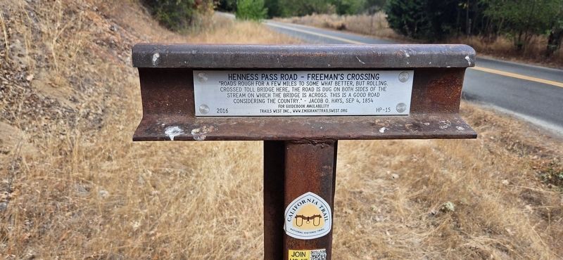
Photographed by Cory Waters, September 11, 2025
2. Henness Pass Road – Freeman’s Crossing Marker
Credits. This page was last revised on November 9, 2025. It was originally submitted on September 12, 2025, by J. J. Prats of Powell, Ohio. This page has been viewed 132 times since then and 35 times this year. Photos: 1, 2. submitted on September 12, 2025, by J. J. Prats of Powell, Ohio.
