Near Wilmington in New Hanover County, North Carolina — The American South (South Atlantic)
Last Stand At Wilmington
The Forks Road Engagement
| — | Confederate Lifeline | — |
Photographed by Bernard Fisher, March 11, 2010
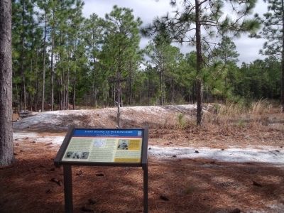
1. Last Stand At Wilmington CWT Marker
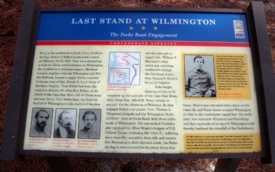
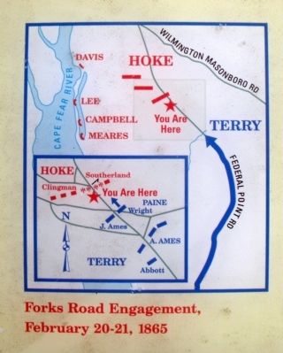
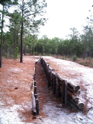
Here, in the earthworks in front of you, Confederate Gen. Robert F. Hoke’s troops made a stand on February 20-21, 1865. They were attempting to halt the Union army’s advance on Wilmington, the Confederacy’s principal seaport. Blockade runners, together with the Wilmington and Weldon Railroad, formed a supply lifeline essential to the survival of Gen. Robert E. Lee’s Army of Northern Virginia. That lifeline had been disrupted on January 15, when Fort Fisher, at the mouth of the Cape Fear River, fell to Union army and navy forces. Four weeks later, the Federals headed for Wilmington to take control of the river and the railroads to supply Gen. William T. Sherman’s army, which was marching northward through the Carolinas to join Gen. Ulysses S. Grant’s forces in Virginia.
Hoke fought delaying actions as he withdrew up the east side of the Cape Fear River, with Union Gen. Alfred H. Terry’s troops in pursuit. On the afternoon of February 20, they engaged Hoke’s rear guard—Gen. Thomas L. Clingman’s brigade and the Wilmington Horse Artillery—here at Forks Road, then three miles south of Wilmington. The entrenched Confederates
this page online
(sidebar)
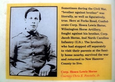
Sometimes during the Civil War, “brother against brother” was literally, as well as figuratively, true. Here at Forks Road, Confederate Corp. Hosea Lewis Horne, Wilmington Horse Artillery, fought against brother, Corp. Jacob Horne, 2nd North Carolina Infantry (U.S.). The brothers, who had stopped off separately top visit their parents at the family home nearby, survived the war and returned to New Hanover County to live.
(sidebar)
In 2002, thanks to a generous donation from the Cameron family, this site became home to the Cameron Art Museum, with the stipulation that the Civil War fortifications be preserved. In keeping with its mission to educate the public, the Cameron Art Museum is committed to maintaining and preserving this historic site for future generations.
(captions)
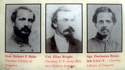
Gen. Robert F. Hoke" Courtesy Library of Congress
Col. Elias Wright Courtesy U.S. Army Military History Institute
Sgt. Powhatan Beaty, 5th U.S.C.T. - Courtesy Library of Congress
Corp. Hosea Lewis Horne Courtesy Chris E. Fonvielle, Jr.
Erected by North
March 11, 2010
2. Fork Roads Engagement
Topics and series. This historical marker is listed in this topic list: War, US Civil. In addition, it is included in the North Carolina Civil War Trails series list. A significant historical date for this entry is February 20, 1865.
Location. This marker has been replaced by another marker nearby. It was located near 34° 11.091′ N, 77° 54.892′ W. Marker was near Wilmington, North Carolina, in New Hanover County. It could be reached from the intersection of South 17th Street and Independence Boulevard. This marker is located northeast of the visitor parking lot of the Cameron Art Museum. Touch for map. Marker was at or near this postal address: 3201 South 17th Street, Wilmington NC 28412, United States of America. Touch for directions.

Regionally, this marker was in the Coastal Plain and on the Cape Fear Coast. It was also in the American South, specifically in the Upper South, in the Tidewater, and on the Eastern Seaboard. Globally, it was in the North Atlantic Region, North America, the Western Hemisphere, the Western World, and the Anglosphere. Historically, it found itself in what was once the territory
March 11, 2010
3. Participants in the battle
Other nearby markers. At least 8 other markers are within 3 miles of this location, measured as the crow flies: Battle of Forks Road (a few steps from this marker); Fall of Wilmington (approx. 0.6 miles away); 1st Wilmington WWII POW Camp (approx. 1.2 miles away); North Carolina Shipbuilding Co. (approx. 1.2 miles away); Legion Stadium (approx. 1.8 miles away); Chadwick-Teague House (approx. 2 miles away); Marshall Cottage (approx. 2 miles away); McNeal-Applewhite House (approx. 2.1 miles away). Touch for a list and map of all markers in Wilmington.
Related marker. Click here for another marker that is related to this marker. New CWT Marker At This Location titled "Battle of Forks Road".
Also see . . .
1. “The Stonewall of Forks Road”. Cape Fear Historical Institute entry:
General Robert F. Hoke and the Battle of Forks Road, February 20-21, 1865. (Submitted on March 18, 2010.)
2. Fort Fisher. North Carolina Historic Sites entry (Submitted on March 15, 2010.)
3. Civil War Trails.
March 11, 2010
4. Corp. Hosea Lewis Horne
Photographed by Bernard Fisher, March 11, 2010
5. Last Stand At Wilmington Marker
Photographed by Bernard Fisher, March 11, 2010
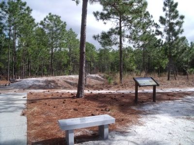
6. Last Stand At Wilmington Marker
Photographed by Bernard Fisher, March 11, 2010
7. Earthworks
March 11, 2010
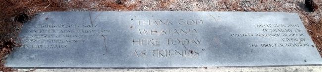
8. "Thank God we stand here today as friends"
Lt. Commander James Parker, US Navy, to Colonel William Lamb, Confederate commander of Fort Fisher, at 1903 reunion of Civil war veterans.
Meditation path in memory of William Benjamin Berry III
given by the Belk Foundation
Credits. This page was last revised on September 17, 2025. It was originally submitted on March 15, 2010, by Bernard Fisher of Richmond, Virginia. This page has been viewed 3,371 times since then and 73 times this year. Last updated on September 12, 2025, by Mike McKeown of Baltimore, Maryland. Photos: 1, 2, 3, 4, 5, 6, 7. submitted on March 15, 2010, by Bernard Fisher of Richmond, Virginia. 8. submitted on March 15, 2010.
