Thorold in Niagara Region, Ontario — Central Canada (North America)
Construction of the Welland Canals
⎯⎯⎯
La Construction des Canaux Welland

Photographed by Tim Boyd, November 7, 2024
1. Construction of the Welland Canals/ La Construction des Canaux Welland Marker

The Welland Canals have long provided an important navigation link between Lake Ontario and Lake Erie, which helped foster the growth of trade, industry, and cities around the Great Lakes. Between 1824 and 1932, four successively larger canals were built along different routes using the latest technologies. The construction of the Fourth Canal (the Welland Ship Canal) was recognized at the time as one of Canada's major civil engineering projects. Thousands of labourers toiled in difficult and dangerous conditions to build these canals, initially without the aid of health and safety regulations, and an unknown number died.
Ces canaux permettent un lien de navigation important entre les lacs Ontario et Érié, favorisant l'essor du commerce, de l'industrie et du développement urbain aux abords des Grands Lacs. De 1824 à 1932, quatre canaux de dimensions de plus en plus larges sont construits suivant divers tracés et d'après les dernières technologies. Lá construction du quatrième canal (le canal maritime Welland) fut alors considérée
this page online
Erected by Historic Sites and Monuments Board of Canada.
Topics and series. This historical marker is listed in these topic lists: Industry & Commerce • Waterways & Vessels. In addition, it is included in the Canada, Historic Sites and Monuments Board, and the The Welland Canals series lists. A significant historical year for this entry is 1824.
Location. 43° 7.315′ N, 79° 11.704′ W. Marker is in Thorold, Ontario, in Niagara Region. It is on Chapel Street South near Service Road West, on the right when traveling north. Touch for map. Marker is at or near this postal address: 50 Chapel St S, Thorold ON L2V 2C6, Canada. Touch for directions.

Regionally, this marker is on the Golden Horseshoe and in Niagara Canada. It is also in Central Canada. Globally, it is in North America, on the Great Lakes, in the Western Hemisphere, in the Western World, and in the Anglosphere. Historically, it
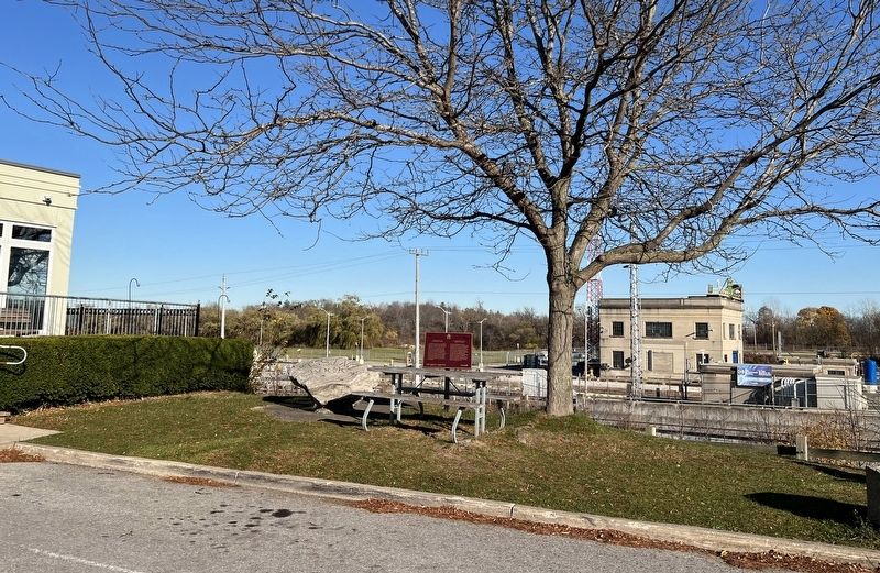
Photographed by Tim Boyd, November 7, 2024
2. Construction of the Welland Canals/ La Construction des Canaux Welland Marker
Other nearby markers. At least 8 other markers are within walking distance of this marker: The Ontario Paper Company Ltd. (within shouting distance of this marker); Stewart House c. 1860 (within shouting distance of this marker); Lynch House 1908 (about 120 meters away, measured in a direct line); Flannery House 1859 (about 120 meters away); Carter-Holland House 1875 (about 120 meters away); Kennedy-Ward House c. 1854 (about 180 meters away); Millar House c. 1876 (about 180 meters away); Fraser-McMann House 1876 (about 210 meters away). Touch for a list and map of all markers in Thorold.
Regarding Construction of the Welland Canals / La Construction des Canaux Welland. At least 138 workers died during the construction of the 4th (current) Welland canal.
Also see . . . The Evolution of the Welland Canal (The Canadian Encyclopedia).
The early settlement of Canada, without roads or trails, depended on rivers and lakes as convenient and efficient means of travel. However, the(Submitted on November 10, 2024, by Tim Boyd of Hamilton, Ontario.)St. Lawrence and Niagara Falls presented formidable obstacles to travel from the east coast by water to the interior. Before the construction of the Welland Canal, the only route between Lake Ontario and Lake Erie was the laborious and hazardous portage from Queenston to the Chippawa Creek. The canal opened a lifeline of trade and commerce to inland North America. Communities along its length owe their urban form and industrial development to the canal. 3. Construction of the 4th Welland Canal, 1924Source: St. Catharines Museum (public domain)

4. Route of the First Welland Canal, 1828
Source: Brock University (public domain)
Credits. This page was last revised on September 29, 2025. It was originally submitted on November 10, 2024, by Tim Boyd of Hamilton, Ontario. This page has been viewed 253 times since then and 33 times this year. Last updated on September 14, 2025, by Kevin Westell of St. Catharines, Ontario. Photos: 1, 2, 3, 4. submitted on November 10, 2024, by Tim Boyd of Hamilton, Ontario. • Devry Becker Jones was the editor who published this page.
