Lyons in Wayne County, New York — The American Northeast (Mid-Atlantic)
Enlarged Erie Canal Lock 54 “Lock Berlin”
| — | Empire State Trail | — |
Photographed by Susan A. Dalaba, August 22, 2025
1. Enlarged Erie Canal Lock 54 “Lock Berlin” Marker
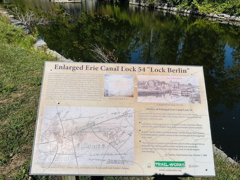
Lock Berlin was first settled in 1805 by Solomon Ford with his purchase of one hundred acres of land, mainly south of the soon to be proposed canal. In 1812 James Showers, John and McQuilter Parish, and John Acker further settled the area with their purchases of one hundred acres each. David Ford erected the first frame house in 1817, and David, William and Benjamin Ford opened the first store in 1824, prior to which time the trading was all done at Marengo. The Erie Canal passed through the southern edge of the village, at Clinton’s Ditch Lock 65, a lock with a seven foot descent being situated nearly equidistant between Clyde and Lyons. William Griswold was for a long time a grocer on the canal. When the canal was enlarged about five years previous to the outbreak of the Civil War, it was re-routed to the southern edge and Lock 54 was built, leaving the village several hundred rods away.
Contracted 1849 more than half completed in 1852; in use 1857, berme chamber 1873; lengthened 1888. Lock 54 had a lift of 7.7 feet and had both a miter grate and timber gate.
• Lock Berlin,
this page online
• Richard Garrity, author Canal Boatman, said the section from Lyons to Lock Berlin was his favorite section on the canal because of the long bend in the canal.
• “The last lock we visited was Lock Berlin Lock 54 of the enlarged Erie on Peters Road. The difference by the two locks was remarkable. Comparing Lock 65 to a one-story house, Lock 54 was the Empire State Building.”
Mr. Barben, Canal Society Tour, October 7, 1969
Topics. This historical marker is listed in these topic lists: Industry & Commerce • Waterways & Vessels. A significant historical year for this entry is 1812.
Location. 43° 4.587′ N, 76° 56.924′ W. Marker is in Lyons, New York, in Wayne County. It is on Peters Road (New York State Route 31) west of Gansz Road, on the right when traveling west. Located on the Empire State Trail. Touch for map. Marker is at or near this postal address: 9086 Peters Road, Lyons NY 14489, United States of America. Touch for directions.

Regionally, this marker is in Upstate New York, specifically
Photographed by Susan A. Dalaba, August 22, 2025
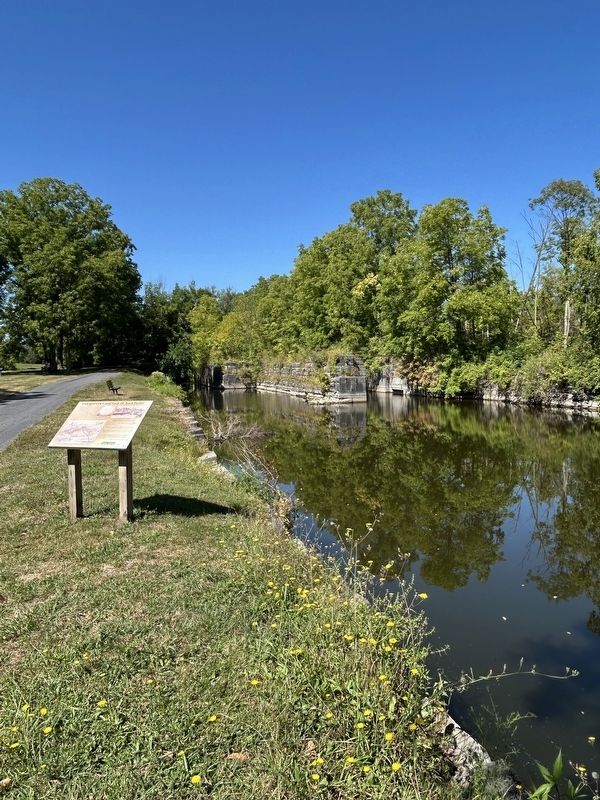
2. Enlarged Erie Canal Lock 54 “Lock Berlin” Marker
Other nearby markers. At least 8 other markers are within 3 miles of this marker, measured as the crow flies: The Erie Canal (within shouting distance of this marker); Canal Fight (about 500 feet away, measured in a direct line); Mildred Taylor (approx. 2.1 miles away); Gratefully Dedicated (approx. 2.3 miles away); Taylor Memorial Park (approx. 2.3 miles away); Trolley Station (approx. 2.3 miles away); It is 1880 and You are Riding on a Packet Boat (approx. 2.3 miles away); Pomeroy Anvil (approx. 2.3 miles away). Touch for a list and map of all markers in Lyons.
Also see . . . Erie Canal (Wikipedia). (Submitted on September 20, 2025, by Michael Herrick of Southbury, Connecticut.)
Photographed by Susan A. Dalaba, August 22, 2025
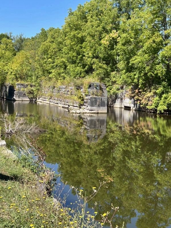
3. Enlarged Erie Canal Lock 54 “Lock Berlin”
Credits. This page was last revised on September 20, 2025. It was originally submitted on September 14, 2025, by Susan A. Dalaba of Cortland, New York. This page has been viewed 73 times since then and 26 times this year. Photos: 1, 2, 3. submitted on September 14, 2025, by Susan A. Dalaba of Cortland, New York. • Michael Herrick was the editor who published this page.
