
Near North Las Vegas in Clark County, Nevada — The American Mountains (Southwest)
The Old Spanish Trail
Photographed by Craig Baker, September 11, 2025
1. The Old Spanish Trail Marker
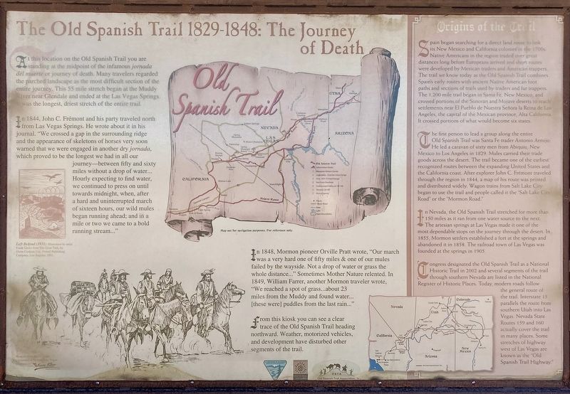
At this location on the Old Spanish Trail you are standing at the midpoint of the infamous jornada del muerte or journey of death. Many travelers regarded the parched landscape as the most difficult section of the entire journey. This 55 mile stretch began at the Muddy River near Glendale and ended at the Las Vegas Springs. It was the longest, driest stretch of the entire trail.
In 1844, John C. Frémont and his party traveled north from Las Vegas Springs. He wrote about it in his journal. "We crossed a gap in the surrounding ridge and the appearance of skeletons of horses very soon warned that we were engaged in another dry jornada, which proved to be the longest we had in all our journey — between fifty and sixty miles without a drop of water... Hourly expecting to find water, we continued to press on until towards midnight, when, after a hard and uninterrupted march of sixteen hours, our wild mules began running ahead; and in a mile or two we came to a bold running stream..."
In 1848, Mormon pioneer Orville Pratt wrote, "Our march was a very hard one of fifty miles & one of our mules failed by the wayside. Not
this page online
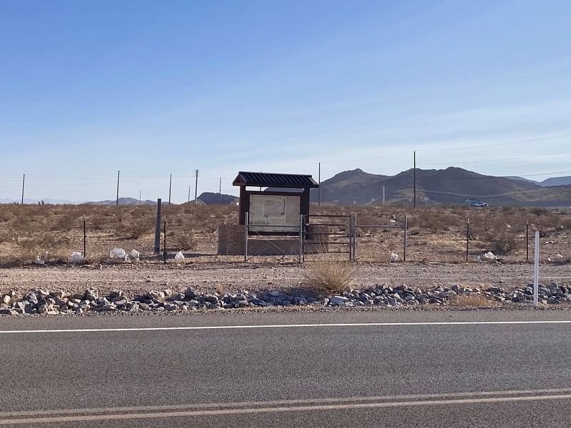
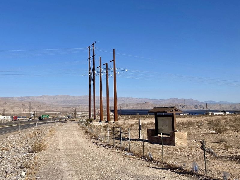
From this kiosk you can see a clear trace of the Old Spanish Trail heading northward. Weather, motorized vehicles, and development have disturbed other segments of the trail.
Origins of the Trail
Spain began searching for a direct land route to link its New Mexico and California colonies in the 1700s. Native Americans in the region traded over great distances long before Europeans arrived and short routes were developed by Mexican traders and American trappers. The trail we know today as the Old Spanish Trail combines Spain's early routes with ancient Native American foot paths and sections of trails used by traders and fur trappers. The 1,200 mile trail began in Santa Fe, New Mexico, and crossed portions of the Sonoran and Mojave deserts to reach settlements near El Pueblo de Nuestra Señora la Reina de Los Angeles, the capital of the Mexican province, Alta California. It crossed
Photographed by Craig Baker, September 11, 2025
2. The Old Spanish Trail Marker
The first person to lead a group along the entire Old Spanish Trail was Santa Fe trader Antonio Armijo. He led a caravan of sixty men from Abiquiu, New Mexico to Los Angeles in 1829. Mules carried their trade goods across the desert. The trail became one of the earliest recognized routes between the expanding United States and the California coast. After explorer John C. Frémont traveled through the region in 1844, a map of his route was printed and distributed widely. Wagon trains from Salt Lake City began to use the trail and people called it the "Salt Lake City Road" or the "Mormon Road."
In Nevada, the Old Spanish Trail stretched for more than 150 miles as it ran from one water source to the next. The artesian springs at Las Vegas made it one of the most dependable stops on the journey through the desert. In 1855, Mormon settlers established a fort at the springs and abandoned it in 1858. The railroad town of Las Vegas was founded at the springs in 1905.
Congress designated the Old Spanish Trail as a National Historic Trail in 2002 and several segments of the trail through southern Nevada are
Photographed by Craig Baker, September 11, 2025
3. The Old Spanish Trail Marker
Erected by Bureau of Land Management, Nevada Department of Cultural Affairs, and Old Spanish Trail Association.
Topics. This historical marker is listed in these topic lists: Roads & Vehicles • Settlements & Settlers. A significant historical year for this entry is 1844.
Location. 36° 22.929′ N, 114° 53.587′ W. Marker is near North Las Vegas, Nevada, in Clark County. It can be reached from the intersection of U.S. 93 and Interstate 15. Touch for map. Marker is at or near this postal address: 13395 Hwy 91, Las Vegas NV 89165, United States of America. Touch for directions.

Regionally, this marker is in the Mojave Desert and in Greater Las Vegas. It is also in the American Southwest and in the Mountain West. Globally, it is in North America, the Western Hemisphere, the Western World, and the Anglosphere.
Photographed by Craig Baker, September 11, 2025
4. Old Spanish Trail Marker
Other nearby markers. At least 8 other markers are within 15 miles of this marker, measured as the crow flies: Lockheed Martin F-16C Block 32 (approx. 12.6 miles away); F-15 Eagle (approx. 14 miles away); F-86 Sabrejet (approx. 14 miles away); F-111A (approx. 14.1 miles away); F-105G Thunderchief (approx. 14.1 miles away); F-100D Super Sabre (approx. 14.1 miles away); F-4C Phantom (approx. 14.2 miles away); F-117A (approx. 14.2 miles away).
More about this marker. The kiosk is behind a gate with a chain but no padlock.
Credits. This page was last revised on September 19, 2025. It was originally submitted on September 15, 2025, by Craig Baker of Sylmar, California. This page has been viewed 142 times since then and 61 times this year. Photos: 1, 2, 3, 4. submitted on September 15, 2025, by Craig Baker of Sylmar, California.
Editor’s want-list for this marker. Photo of the trace of the Old Spanish Trail heading northward from the kiosk. • Can you help?
