St. Catharines in Niagara Region, Ontario — Central Canada (North America)
The Norton Cabin c. 1817
Photographed by Kevin Westell, September 14, 2025
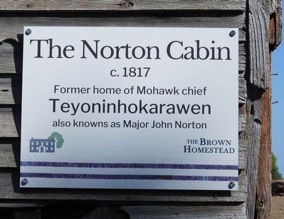
1. The Norton Cabin c. 1817 - Marker
The Norton Cabin
c. 1817
Former home of Mohawk chief
Teyoninhokarawen
also knowns as Major John Norton
The Brown Homestead
Topics. This historical marker is listed in these topic lists: Indigenous Peoples and Communities • Notable Buildings. A significant historical year for this entry is 1817.
Location. 43° 6.557′ N, 79° 17.196′ W. Marker is in St. Catharines, Ontario, in Niagara Region. It is at the intersection of Pelham Road and Scout Camp Road on Pelham Road. Touch for map. Marker is at or near this postal address: 1317 Pelham Road, St Catharines ON L2R 6P7, Canada. Touch for directions.

Regionally, this marker is on Ontario’s Golden Horseshoe and in Niagara Canada. It is also in Central Canada. Globally, it is in North America, on the Great Lakes, in the Western Hemisphere, in the Western World, and in the Anglosphere. Historically, it finds itself in what was once a British colony, the Viceroyalty of New France, the Haudenosaunee (Iroquois) Confederacy, and Rupert’s Land.
Other nearby markers. At least 8 other markers are within 3 kilometers of this marker, measured as the
this page online
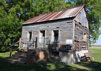
Regarding The Norton Cabin c. 1817. John Norton was a military leader during the War of 1812. This house was constructed around 1817, near Caledonia. To prevent its demolition, it was moved here in 1997.
Photographed by Kevin Westell, September 14, 2025
2. The Norton Cabin
Photographed by Kevin Westell, September 14, 2025
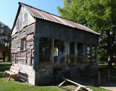
3. The Norton Cabin
We get to watch the restoration at it proceeds.
Photographed by Kevin Westell, September 14, 2025
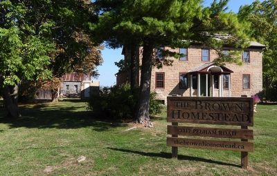
4. The Brown Homestead
The Norton House (distant left) can be seen from the road, behind all the other buildings on the site.
Credits. This page was last revised on September 19, 2025. It was originally submitted on September 15, 2025, by Kevin Westell of St. Catharines, Ontario. This page has been viewed 65 times since then and 24 times this year. Photos: 1, 2, 3, 4. submitted on September 15, 2025, by Kevin Westell of St. Catharines, Ontario. • Andrew Ruppenstein was the editor who published this page.
