Welland in Niagara Region, Ontario — Central Canada (North America)
The Bridges of the Fourth Canal
The Canal Structures
Photographed by Tim Boyd, November 18, 2024
1. The Bridges of the Fourth Canal Marker
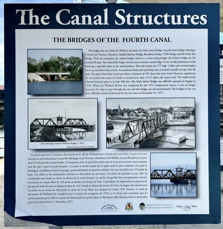
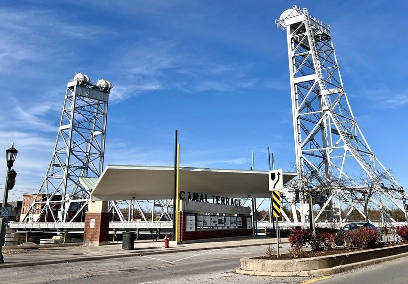
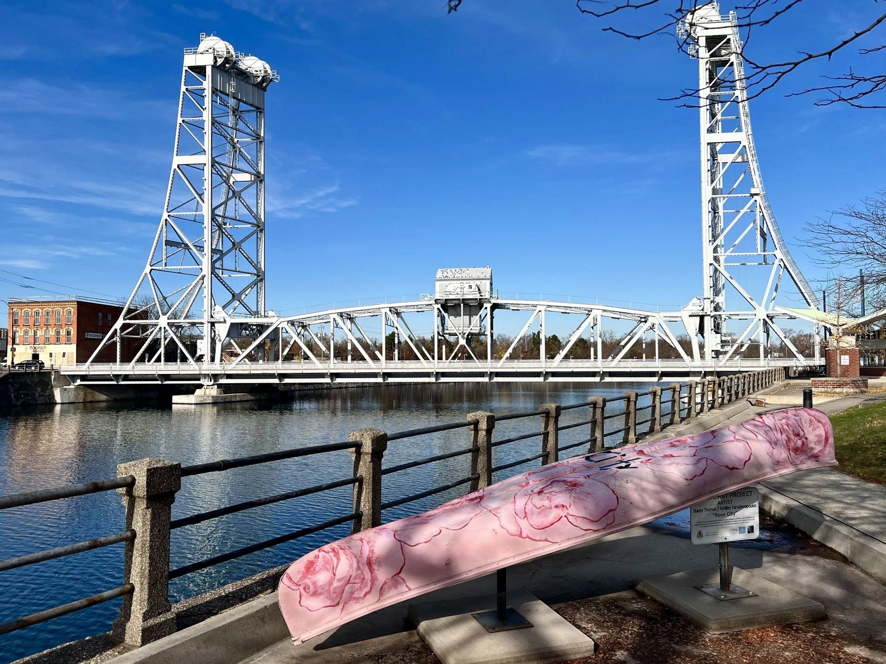
Inscription. The bridges that are within the Welland city limits are: Main Street Bridge; Lincoln Street Bridge; Michigan Central and Toronto, Hamilton, Buffalo Railway Bridge; Broadway Bridge; CNR Bridge and the Forks Rd. Bridge. With one exception, the railway bridge, which is a center swing bridge, all of these bridges are the vertical lift type. The vertical lift bridge was the most common canal bridge. It was visually prominent in the landscape, especially when in the raised position. The twin towers are 175' high. Cables and counterweights move up and down these towers. A machinery house and operating room is located centrally on top of the lift span. The span, when fully raised, provided a clearance of 120' above the water level. However, regulations do not permit the masts of vessels to exceed more than 116.5' above the water level. The width of the channel between piers is at least 200 feet. The Main Street Bridge was officially opened on August 6, 1930. When the Welland ByPass was completed for the 1973 navigational season, it was no longer necessary for ships to pass through the city and this bridge was decommissioned.
Click or scan to see this page online
The bridges in the city were officially raised and lowered for the last time on December 15, 1972.
Les ponts qui sont à l'intérieur des limites de la ville de Welland sont: le pont de la rue Main, le pont de la rue Lincoln, le pont ferroviaire Central de Michigan et de Toronto, Hamilton et de Buffalo, le pont Broadway, le pont du CN et le pont de la route Forks. A l'exception d'un, le pont ferroviaire, qui est un pont tournant, tous ces ponts sont du type «pont à travée levante». Le pont à travée levante fut le pont-canal le plus commun. On peut le distinguer visuellement dans le paysage, particulièrement en position relevée. Les tours jumelles ont 175 pieds de haut. Les câbles et les contrepoids montent et descendent de ces tours. Un carter de machine et une salle de commande sont situés au centre au-dessus de la travée levante. La travée, lorsqu'elle était complètement relevée, fournissait un espace libre de 120 pieds au-dessus du niveau de l'eau. Cependant, les règlements ne permettent pas que les mâts de navires dépassent plus de 116.5 pieds au-dessus du niveau de l'eau. La largeur du chenal entre les jetées est au moins de 200
Photographed by Tim Boyd, November 18, 2024
2. The Bridges of the Fourth Canal Marker
pieds. Le pont de la rue Main fut inauguré le 6 août 1930. Ensuite, le canal de dérivation de Welland fut complété pour la saison de navigation de 1973, et il n'était plus nécessaire que les navires passent par la ville et ce pont fut démantelé. Les ponts dans la ville furent officiellement levés et descendus pour la dernière fois le 15 décembre 1972.
Topics and series. This historical marker is listed in these topic lists: Bridges & Viaducts • Waterways & Vessels. In addition, it is included in the The Welland Canals series list. A significant historical date for this entry is December 15, 1972.
Location. 42° 59.478′ N, 79° 15.054′ W. Marker is in Welland, Ontario, in Niagara Region. It is at the intersection of King Street and East Main Street, on the right when traveling south on King Street. Touch for map. Marker is at or near this postal address: 30 King Street, Welland ON L3B 3H9, Canada. Touch for directions.
Regionally, this marker is on Ontario’s Golden Horseshoe and in Niagara Canada. It is also in Central Canada. Globally, it is in North America, on the Great Lakes, in the Western Hemisphere, in the Western World,
Photographed by Tim Boyd, October 18, 2024
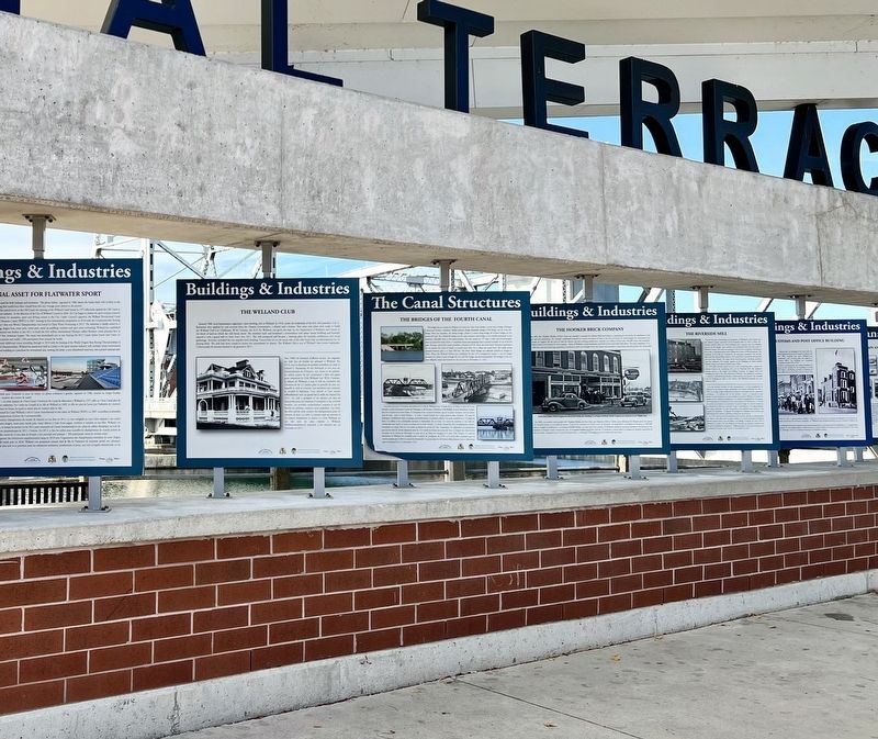
3. Canal Terrace Marker Bank
and in the Anglosphere. Historically, it finds itself in what was once a British colony, the Viceroyalty of New France, the Haudenosaunee (Iroquois) Confederacy, and Rupert’s Land.
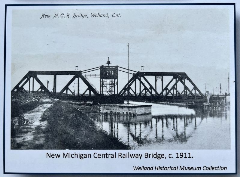
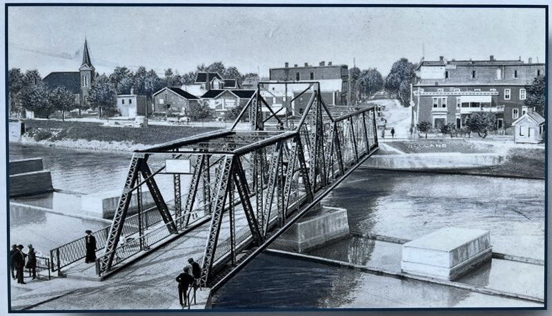
courtesy Welland Historical Museum Collection, circa 1911
4. The Bridges of the Fourth Canal marker photo detail
Michigan Central Railway Bridge, 1911
5. The Bridges of the Fourth Canal marker photo detail
Photographed by Tim Boyd, November 18, 2024
6. The Main Street Bridge, Welland, 2024
Credits. This page was last revised on September 23, 2025. It was originally submitted on November 19, 2024, by Tim Boyd of Hamilton, Ontario. This page has been viewed 167 times since then and 29 times this year. Last updated on September 16, 2025, by Kevin Westell of St. Catharines, Ontario. Photos:1, 2, 3, 4, 5, 6. submitted on November 19, 2024, by Tim Boyd of Hamilton, Ontario. • Devry Becker Jones was the editor who published this page.