Port Colborne in Niagara Region, Ontario — Central Canada (North America)
Founding of Port Colborne
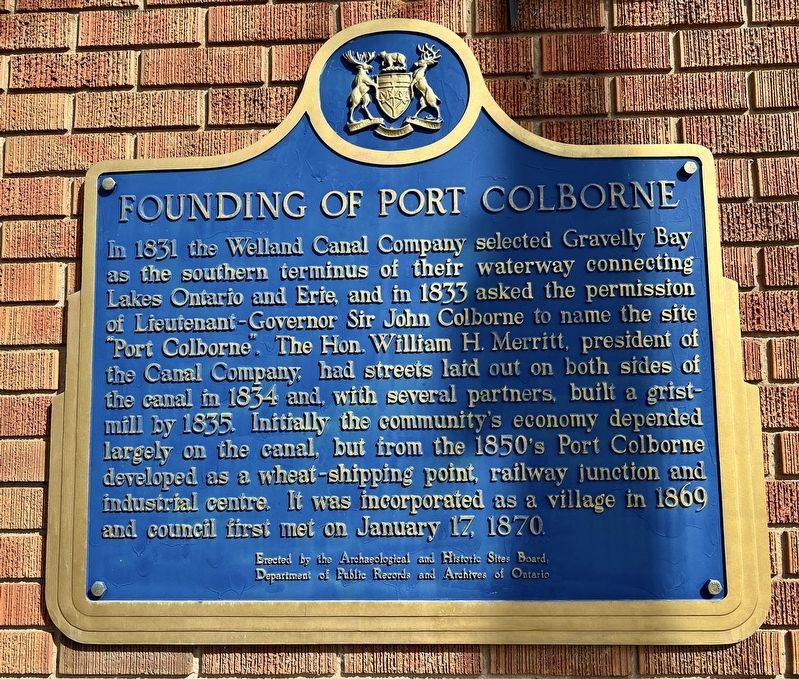
Photographed by Tim Boyd, March 14, 2025
1. Founding of Port Colborne Marker
Erected by Archeological and Historic Sites Board of Ontario.
Topics and series. This historical marker is listed in these topic lists: Industry & Commerce • Settlements & Settlers • Waterways & Vessels. In addition, it is included in the Canada, Ontario Heritage Trust, and the The Welland Canals series lists. A significant historical year for this entry is 1831.
Location. 42° 53.187′ N, 79° 15.076′ W. Marker is in Port Colborne, Ontario, in Niagara
this page online

Regionally, this marker is on the Golden Horseshoe and in Niagara Canada. It is also in Central Canada. Globally, it is in North America, on the Great Lakes, in the Western Hemisphere, in the Western World, and in the Anglosphere. Historically, it finds itself in what was once a British colony, the Viceroyalty of New France, the Haudenosaunee (Iroquois) Confederacy, and Rupert’s Land.
Other nearby markers. At least 8 other markers are within walking distance of this marker: Port Colborne and the Niagara St. Catharines and Toronto Railway (NS&T) (within shouting distance of this marker); Warriors Day Commemoration (about 120 meters away, measured in a direct line); The Welland Canal (about 120 meters away); King George Memorial Park War Memorial (about 120 meters away); Hand operated winch from 2nd Welland Canal Lock Gate (about 120 meters away); Anchor from the Raleigh

Photographed by Tim Boyd, March 14, 2025
2. Founding of Port Colborne Marker
Also see . . . Port Colborne (Wikipedia).
Originally called Gravelly Bay, after the shallow, bedrock-floored bay upon which it sits, today's City of Port Colborne traces its roots back to the United Empire Loyalist settlements that grew up in the area following the American Revolution. Growth became focused around the southern terminus of the Welland Canal after it reached Lake Erie in 1833. As the population rose, Welland County was formed in 1845 from Lincoln County and Port Colborne was incorporated as a village in 1870, became a town in 1918, merged with the neighbouring Village of Humberstone in 1952, and was re-incorporated as a city in 1966.(Submitted on March 16, 2025, by Tim Boyd of Hamilton, Ontario.)

1837
3. Map of Port Colborne and the Termination of the Welland Canal, 1837
Brock University

Photographed by Tim Boyd, March 14, 2025
4. The Welland Canal at Port Colborne, 2025
Credits. This page was last revised on September 18, 2025. It was originally submitted on March 16, 2025, by Tim Boyd of Hamilton, Ontario. This page has been viewed 311 times since then and 98 times this year. Last updated on September 16, 2025, by Kevin Westell of St. Catharines, Ontario. Photos: 1, 2, 3, 4. submitted on March 16, 2025, by Tim Boyd of Hamilton, Ontario. • Devry Becker Jones was the editor who published this page.
