Port Colborne in Niagara Region, Ontario — Central Canada (North America)
Welland Canals
Niagara's vital waterway spanning three centuries
⎯⎯⎯
Les Canaux Welland
Au service de la marine marchande depuis 1833

Photographed by Tim Boyd, March 14, 2025
1. Welland Canals/ Les Canaux Welland Marker

In 1824 businessman William Hamilton Merritt formed the Welland Canal Company, so named because of his plan to dig a "ditch" that would carry water from the Welland River to his mills in St. Catharines. With the Erie Canal opening in 1825, the idea evolved into a deeper channel that would allow vessels to circumvent Niagara Falls. Water from the Welland River never was used to supply the canal… but the name has survived to this day.
The Welland Canal has been constantly evolving. As it has grown over the years, it has been referred to as the first, second, third and fourth Welland Canal.
The first Welland Canal, which opened in 1829 and was extended to Port Colborne in 1833, was only eight feet deep. As ships grew larger and demands were greater, the Welland Canal remained in an almost constant state of reconstruction for the next century to keep up with technology.
Work started on the second Welland Canal in 1842 and was not entirely completed until 1855. The third Welland Canal took from 1874 until 1887 to complete. Construction began on the fourth or Welland Ship Canal in 1913, halted during World War I, resumed in 1918, and was finally complete in 1932. The Welland By-Pass was constructed between 1967 and 1973, providing an unimpeded direct route for ships from Port Robinson to Port Colborne. The Welland Ship Canal continues to serve the shipping industry to this day.
this page online
Le canal Welland est en constante évolution. Comme il s'est développé à travers les années, il y eut le premier, le deuxième, le troisième et le quatrième Canal Welland.
Le premier canal, ouvert en 1829, avait seulement 3 pieds de profondeur. Il fut prolongé jusqu'à Port Colborne en 1833. Comme les bateaux devenaient plus grands et les demandes augmentaient, le Canal Welland fut constamment en état de reconstruction et de réaménagement durant un siècle afin de se maintenir au niveau de la technologie.
Les travaux commencèrent sur le deuxième canal en 1842 et se terminèrent en 1855. Les travaux sur le troisième canal durèrent de 1874 à 1877. La construction du quatrième canal commença en 1913, s'arrêta durant la première guerre mondiale, reprit en 1918 et se termina en 1932. La déviation du Canal Welland fut construite entre 1967 et 1973 donnant aux navires un passage direct et sans entrave de Port Robinson à Port Colborne. Le Canal Welland continue à servir l'industrie de la navigation jusqu'à nos jours.
Erected by City of Port Colborne.
Topics and series.
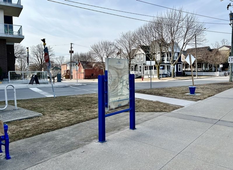
Photographed by Tim Boyd, March 14, 2025
2. Welland Canals/ Les Canaux Welland Marker
Location. 42° 52.977′ N, 79° 14.98′ W. Marker is in Port Colborne, Ontario, in Niagara Region. It is at the intersection of West Street and Victoria Street, on the right when traveling north on West Street. Touch for map. Marker is at or near this postal address: 118 West Street, Port Colborne ON L3K 4E6, Canada. Touch for directions.

Regionally, this marker is on the Golden Horseshoe and in Niagara Canada. It is also in Central Canada. Globally, it is in North America, on the Great Lakes, in the Western Hemisphere, in the Western World, and in the Anglosphere. Historically, it finds itself in what was once a British colony, the Viceroyalty of New France, the Haudenosaunee (Iroquois) Confederacy, and Rupert’s Land.
Other nearby markers. At least 8 other markers are within walking distance of this marker: West Street (here, next to this marker); Canal Commerce and Industry / Le Canal: Commerce et Industrie
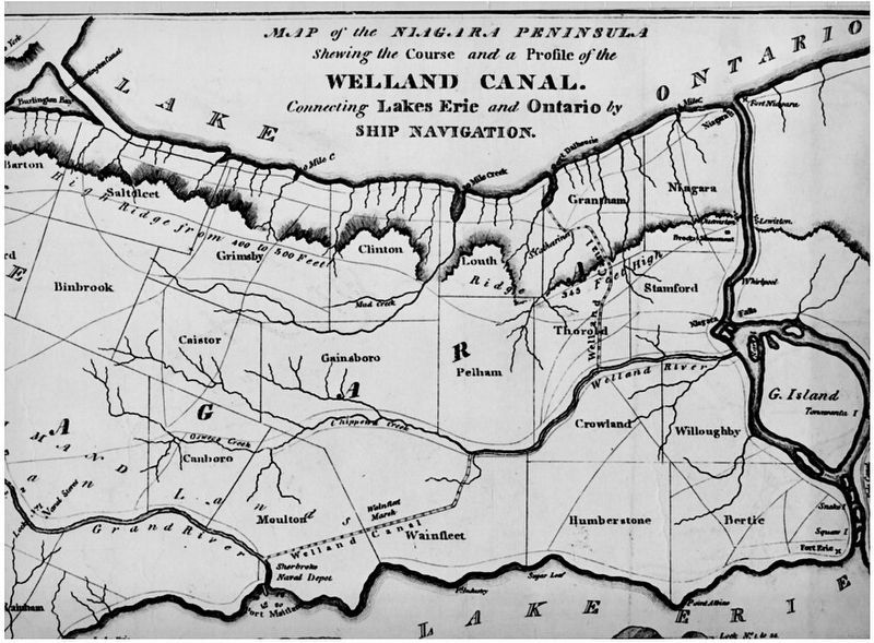
3. Map of the first Welland Canal, before it’s extension to Port Colborne in 1828
Source: Brock University

1931
4. Map of the 4th Welland Canal
Source: St. Catharines Museum (public domain)
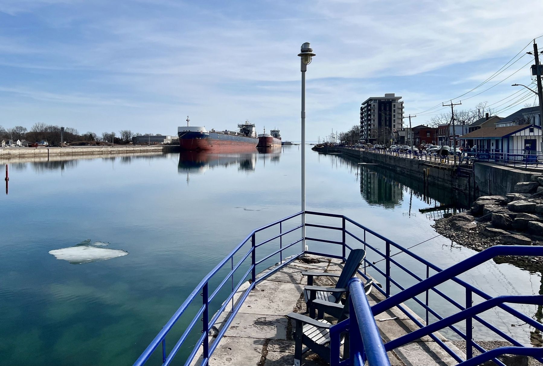
Photographed by Tim Boyd, March 14, 2025
5. The Welland Canal at Port, Colborne, 2025
Credits. This page was last revised on September 18, 2025. It was originally submitted on March 17, 2025, by Tim Boyd of Hamilton, Ontario. This page has been viewed 204 times since then and 46 times this year. Last updated on September 16, 2025, by Kevin Westell of St. Catharines, Ontario. Photos: 1, 2, 3, 4, 5. submitted on March 17, 2025, by Tim Boyd of Hamilton, Ontario. • Devry Becker Jones was the editor who published this page.
