
Niagara Falls in Niagara Region, Ontario — Central Canada (North America)
Lyon's Creek Cemetery
Photographed by Kevin Westell, September 17, 2025
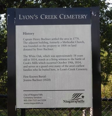
1. Lyon's Creek Cemetery - Marker
Captain Henry Buchner settled the area in 1778. The adjacent building, formerly a Methodist Church, was founded on the property in 1808 on land donated by Peter Buchner.
The White Oak, which was approximately 58 years old in 1814, stands as a living witness to the battle of Cook's Mills which occurred October 19th, 1814, and serves as a guard over many of the area's earliest families who lie buried here, in Lyon's Creek Cemetery.
First Known Burial: Joanna Buchner (1820)
City of Niagara Falls Cemetery Services 905-356-7521 ext 52241 www.niagarafalls.ca
Niagara Falls Canada
Erected by City of Niagara Falls.
Topics. This historical marker is listed in these topic lists: Cemeteries & Burial Sites • War of 1812. A significant historical year for this entry is 1778.
Location. 43° 0.215′ N, 79° 7.638′ W. Marker is in Niagara Falls, Ontario, in Niagara Region. It is at the intersection of Lyons Creek Road and Schliser Road, on the right when traveling east on Lyons Creek Road. Touch for map. Marker is at or near this postal address: 7906 Lyons Creek Road, Niagara Falls ON L3B 5N4,
this page online

Regionally, this marker is on Ontario’s Golden Horseshoe and in Niagara Canada. It is also in Central Canada. Globally, it is in North America, on the Great Lakes, in the Western Hemisphere, in the Western World, and in the Anglosphere. Historically, it finds itself in what was once a British colony, the Viceroyalty of New France, the Haudenosaunee (Iroquois) Confederacy, and Rupert’s Land.
Other nearby markers. At least 8 other markers are within 5 kilometers of this marker, measured as the crow flies: White Oak at Lyon's Creek Cemetery (here, next to this marker); a different marker also named Lyon's Creek Cemetery (within shouting distance of this marker); Battle of Cook's Mills / La Bataille de Cook's Mills (approx. 3.9 kilometers away); Battle of Cook's Mills - Oct. 19th 1814 (approx. 4.8 kilometers away); Battle of Cook's Mills - Niagara Campaign 1814 (approx. 4.8 kilometers away); 50 Visages Militaires [50 faces of War - French marker] (approx. 4.8 kilometers away); 50 Faces Of War (approx. 4.8 kilometers away); Willoughby Church Cemetery (approx. 4.9 kilometers away). Touch for a list and map
Photographed by Kevin Westell, September 17, 2025
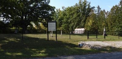
2. Lyon's Creek Cemetery
A tall hedge (right) separates the cemetery from its former church (out-of-frame right).
Also see . . . Lyon's Creek Church, web page from HistoricPlaces.ca. (Submitted on September 18, 2025, by Kevin Westell of St. Catharines, Ontario.)
Photographed by Kevin Westell, September 17, 2025
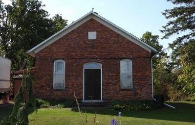
3. Lyon's Creek Church 1861 (just west of cemetery)
The original church on this site was built around 1806. This was a Methodist, later a United church. It is now a private residence.
Credits. This page was last revised on September 18, 2025. It was originally submitted on September 18, 2025, by Kevin Westell of St. Catharines, Ontario. This page has been viewed 74 times since then and 22 times this year. Photos: 1, 2, 3. submitted on September 18, 2025, by Kevin Westell of St. Catharines, Ontario. • Andrew Ruppenstein was the editor who published this page.
