
Barstow in San Bernardino County, California — The American West (Pacific Coastal)
The Old Spanish Trail
Santa Fe to Los Angeles
| — | 1829 - 1848 | — |
Photographed by Craig Baker, September 9, 2025
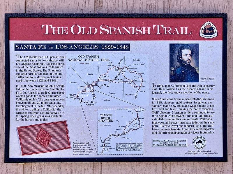
1. Old Spanish Trail Marker
The 1,200-mile long Old Spanish Trail connected Santa Fe, New Mexico, with Los Angeles, California. It is considered one of the most arduous trade routes in the United States. The Spaniards explored parts of the trail in the late 1700s and New Mexico pack trains used it between 1829 and 1848.
In 1829, New Mexican Antonio Armijo led the first mule caravan from Santa Fe to Los Angeles to trade Churro sheep woolen goods for horses and famed California mules. The caravans moved between 15 and 20 miles each day, traveling west in the fall. After spending the winter trading in California, the caravans returned east to Santa Fe in the spring when grass was available for the horses and mules.
In 1844, John C. Fremont used the trail to journey east. He recorded it as the "Spanish Trail" in his journal, the first known mention of the name.
When Americans began moving into the Southwest in 1848, pioneers, gold seekers, freighters, and soldiers made new trails and wagon roads to use for travel and trade, making the entire "Spanish Trail" obsolete. Mormon settlers continued to use the
this page online
In 2002, the U.S. Congress designated the entire route as the Old Spanish National Historic Trail.
To learn more about the Mojave River Chapter of the Old Spanish Trail Association, stop inside the Mojave River Valley Museum.
For more information visit
oldspanishtrail.org
www.nps.gov/olsp
Erected by Old Spanish Trail Association.
Topics. This historical marker is listed in these topic lists: Exploration • Roads & Vehicles • Settlements & Settlers. A significant historical year for this entry is 1829.
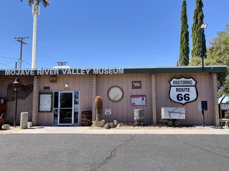
Location. 34° 53.277′ N, 117° 1.424′ W. Marker is in Barstow, California, in San Bernardino County. It is at the intersection of Virginia Way and Barstow Road, on the left when traveling west on Virginia Way. Located at the Mojave River Valley Museum. Touch for map. Marker is at or near this postal
Photographed by Craig Baker, September 9, 2025
2. Old Spanish Trail Marker

Regionally, this marker is in Greater Los Angeles, in the Mojave Desert, in the Peninsular Ranges, and specifically in the Transverse Ranges. It is also in the American Southwest. Globally, it is in North America, on the Ring of Fire, in the Pacific Rim, in the Western Hemisphere, in the Western World, and in the Anglosphere. Historically, it finds itself in what was once New Spain and also Mexico’s Alta California.
Other nearby markers. At least 8 other markers are within walking distance of this marker: Log Cabin (within shouting distance of this marker); Mojave Riverbed Trail (within shouting distance of this marker); The California Gold Rush (approx. ¾ mile away); Father Garces (approx. ¾ mile away); John Charles Fremont (approx. ¾ mile away); Jedediah Smith (approx. ¾ mile away); Kit Carson (approx. ¾ mile away); General Steven Watts Kearny (approx. ¾ mile away). Touch for a list and map of all markers in Barstow.
More about this marker. Click on any photo to see it full-size.
Also see . . .
1. Old Spanish Trail Association.

Photographed by Craig Baker, September 9, 2025
3. Museum Building Dedication - 1963
2. Old Spanish National Historic Trail - National Park Service. (Submitted on September 19, 2025.)
Photographed by Craig Baker, September 9, 2025
4. Point of Historical Interest
Credits. This page was last revised on September 26, 2025. It was originally submitted on September 19, 2025, by Craig Baker of Sylmar, California. This page has been viewed 127 times since then and 37 times this year. Photos: 1, 2, 3, 4. submitted on September 19, 2025, by Craig Baker of Sylmar, California.
