
Ketchikan in Ketchikan Gateway Borough, Alaska — Northwest (North America)
An Underwater Discovery
Photographed by Thomas Smith, August 13, 2025
1. An Underwater Discovery Marker
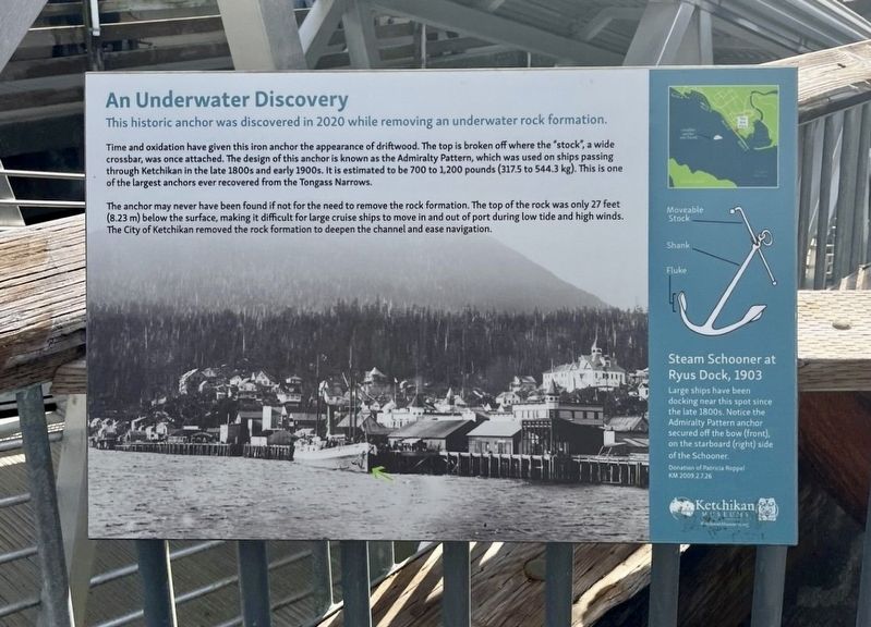
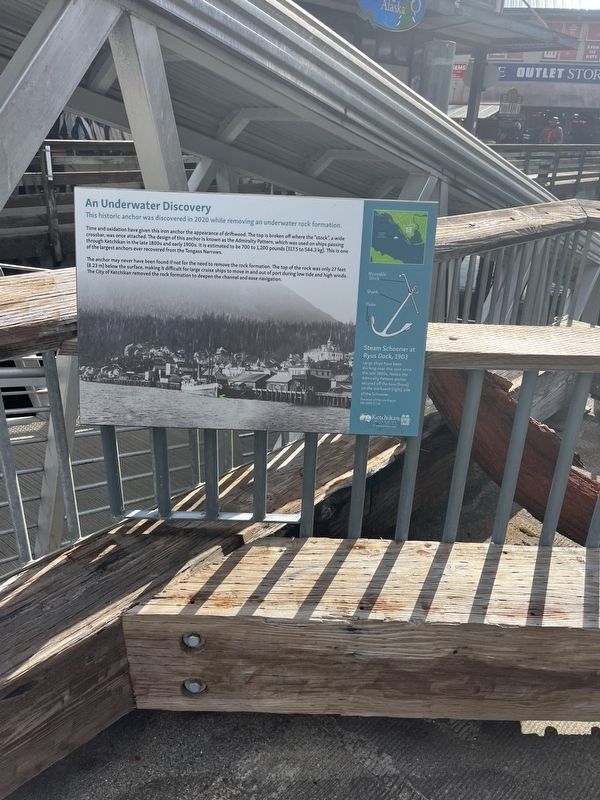
This historic anchor was discovered in 2020 while removing an underwater rock formation.
Time and oxidation have given this iron anchor the appearance of driftwood. The top is broken off where the "stock", a wide crossbar, was once attached. The design of this anchor is known as the Admiralty Pattern, which was used on ships passing through Ketchikan in the late 1800s and early 1900s. It is estimated to be 700 to 1,200 pounds (3175 to 544.3 kg). This is one of the largest anchors ever recovered from the Tongass Narrows.
The anchor may never have been found if not for the need to remove the rock formation. The top of the rock was only 27 feet (8.23 m) below the surface, making it difficult for large cruise ships to move in and out of port during low tide and high winds. The City of Ketchikan removed the rock formation to deepen the channel and ease navigation.
Steam Schooner at Ryus Dock, 1903
Large ships have been docking near this spot since the late 1800s. Notice the Admiralty Pattern anchor secure off the bow (front), on the starboard (right) side of the Schooner.
Erected by Ketchikan Museums.
this page online
Topics. This historical marker is listed in this topic list: Waterways & Vessels. A significant historical year for this entry is 1800.
Location. 55° 20.4′ N, 131° 38.672′ W. Marker is in Ketchikan, Alaska, in Ketchikan Gateway Borough. It is on Spruce Mill Way 0.1 miles west of Main Street, on the left when traveling west. Close to Christmas in Alaska. Touch for map. Marker is in this post office area: Ketchikan AK 99901SPRUCE, United States of America. Touch for directions.

Regionally, this marker is in Southeast Alaska, in Tlingit and Haida & Tsimshian Region. It is also on the American Pacific Coast. Globally, it is in North America, the Inside Passage, the Pacific Rim, the Western Hemisphere, the Western World, and the Anglosphere. Historically, it finds itself in what was once the Russian Empire.
Other nearby markers. At least 8 other markers are within walking distance of this marker: Ketchikan Spruce Mills from the air, 1954 (a few steps from this marker); Three steamers on the Ketchikan waterfront, 1911 (within shouting distance of this marker); Spirit & Sparks (about 500 feet away, measured in a direct line);
Photographed by Thomas Smith, August 13, 2025
2. An Underwater Discovery Marker
Credits. This page was last revised on September 21, 2025. It was originally submitted on September 19, 2025, by Thomas Smith of Waterloo, Ill. This page has been viewed 97 times since then and 49 times this year. Photos: 1, 2. submitted on September 19, 2025, by Thomas Smith of Waterloo, Ill. • Andrew Ruppenstein was the editor who published this page.
