Kittery in York County, Maine — The American Northeast (New England)
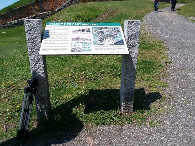
Welcome To Fort McClary

Photographed by Craig Doda, June 3, 2019
1. Welcome To Fort McClary Marker
The Pepperrell's were "Tories” or loyalists to the Crown, and when the Revolution came local "rebels” took over their property, including the fort, which was occupied by the New Hampshire Militia until 1779. In 1808 Massachusetts gave land to the Federal government to build a new fort named Fort McClary in honor of Major Andrew McClary, a New Hampshire native who was served at the Battle of Bunker Hill in 1775.
That fort consisted of two batteries of cannons; a semi circular wall protected a "Lower Battery” below the present blockhouse site, while an "Upper Battery” with accompanying, barracks, quarters, a cookhouse, and
this page online
In 1844 the hexagonal blockhouse replaced the Upper Battery. The upper floors were used as Officer's quarters, and two brick rifleman's houses were built on either side. In 1846 the Federal government deactivated the fort.
In the midst of the Civil War, Confederate raiders captured and destroyed a ship in Portland Harbor raising the fear of attacks on the Maine coast. A granite bastion and powder magazine and a guardhouse and hospital were added to the fort at that time. Five years after the Civil War ended, work was suspended and the outer wall was never completed. Soon afterward, this style of fort was considered obsolete so Fort McClary was remained unfinished.
The buildings here today represent several different periods of construction as the fort was upgraded and modified to meet the area's defensive needs. The site was manned during five wars - The Revolutionary War, War of 1812, Civil War, Spanish-American War, and World War I. Like most other Maine forts, it saw little conflict. Be sure to enjoy the hiking area to your left and the picnic area
Photographed by Craig Doda, June 3, 2019
2. Welcome To Fort McClary Marker
(sidebar)
Private Hannibal Hamlin
Shortly before the 1864 election, the Coast Guard unit in which Maine's Hannibal Hamlin served was called to active duty at Fort McClary. Hamlin reported for duty and served at the fort even though he was at that time Vice President of the United States.
Erected by Maine Department Of Agriculture, Conservation and Forestry, Division of Parks and Public Land.
Topics. This historical marker is listed in these topic lists: Forts and Castles • War of 1812 • War, US Civil • War, US Revolutionary. A significant historical year for this entry is 1689.
Location. 43° 4.917′ N, 70° 42.533′ W. Marker is in Kittery, Maine, in York County. It can be reached from Pepperrell Road (Maine Route 103) 0 miles west of Crockett Neck Road, on the left when traveling west. Touch for map. Marker is in this post office area: Kittery Point ME 03905, United States of America. Touch for directions.

Regionally, this marker is in the American Northeast, in New England, and on the Eastern
Photographed by Craig Doda, June 3, 2019
3. Welcome To Fort McClary Marker
Other nearby markers. At least 8 other markers are within walking distance of this marker: Fort McClary (within shouting distance of this marker); Resisting Naval Firepower (within shouting distance of this marker); Mines Building (approx. 0.7 miles away in New Hampshire); Portcullis (approx. ¾ mile away in New Hampshire); Fort William and Mary Commemoration Marker (approx. ¾ mile away in New Hampshire); Walbach Tower (approx. 0.8 miles away in New Hampshire); a different marker also named Walbach Tower (approx. 0.8 miles away in New Hampshire); Frost Cemetery (approx. 0.8 miles away in New Hampshire). Touch for a list and map of all markers in Kittery.
Also see . . . Fort McClary State Historic Site. Department of Agriculture, Conservation and Forestry (Submitted on December 6, 2020.)

Photographed by Michael Cleary, September 11, 2025
4. Fort McClary battlement with embrasures, blockhouse, and buildings, seen from entrance road
The battlement with embrasures extends toward Pepperrell Road. It is seen here from the gravel entrance road leading from Pepperrell Road. The blockhouse is atop the hill, partially blocked in this view by the brick magazine. The walls of the remaining brick rifleman's house are seen to the left. The plaques at the foot of the hill ("Welcome to Fort McClary" and "Fort McClary At Kittery Point, Maine") are just out of sight around the far end of the large granite retaining wall seen in this photo.

Photographed by Michael Cleary, September 11, 2025
5. View of the "Welcome To Fort McClary" Marker in situ
This view of the marker includes the blockhouse in the center, the magazine and rifleman's house to the right of the blockhouse. The cannons in front of the "Resisting Naval Firepower" marker can be seen off to the left. The fort's Caponier is out of sight at the far end of the defensive mound, beyond the cannons.
Photographed by Michael Cleary, September 11, 2025
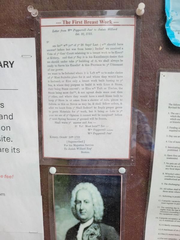
6. The First Breast Work - 1721 Letter of William Pepperrell Jr to Josiah Willard
This is Pepperrell's response to Willard's letter, in which Willard had told him the Massachusetts Bay Colony's legislature had decided to erect a breast work here. The photo below is of a painting of Pepperrell, a major figure in the town of Kittery and in the history of the colony. This letter is posted on the park's announcements board; that board can be seen in another photo here of the battlement with embrasures, at the water's end of the large granite defensive wall.

Photographed by Michael Cleary, September 11, 2025
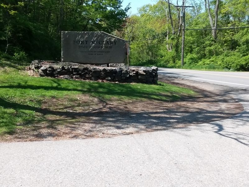
7. Fort McClary Entrance

Photographed by Michael Cleary, September 11, 2025
8. Entrance to Caponier at Fort McClary
Photographed by Michael Cleary, September 11, 2025
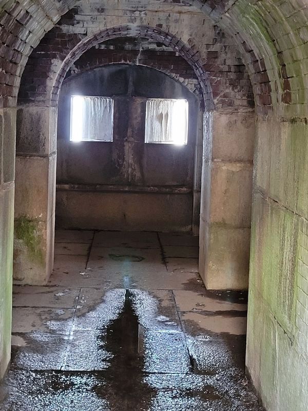
9. Two Embrasures in a Caponier
Credits. This page was last revised on September 24, 2025. It was originally submitted on December 5, 2020, by Craig Doda of Napoleon, Ohio. This page has been viewed 631 times since then and 76 times this year. Last updated on September 20, 2025, by Michael Cleary of Salem, Massachusetts. Photos: 1, 2, 3. submitted on December 5, 2020, by Craig Doda of Napoleon, Ohio. 4, 5, 6. submitted on September 13, 2025, by Michael Cleary of Salem, Massachusetts. 7, 8, 9. submitted on September 20, 2025, by Michael Cleary of Salem, Massachusetts. • Michael Herrick was the editor who published this page.
