North Las Vegas in Clark County, Nevada — The American Mountains (Southwest)
Trench K
The Big Dig
| — | 1962-1963 | — |
Photographed by Craig Baker, September 17, 2025
1. Trench K Marker
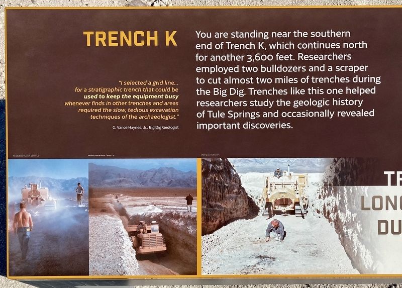
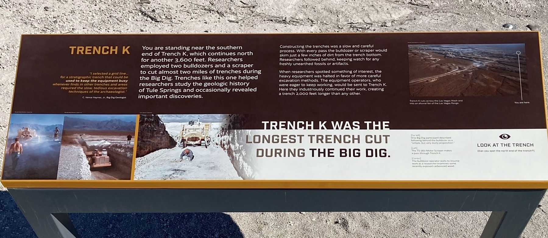
You are standing near the southern end of Trench K, which continues north for another 3,600 feet. Researchers employed two bulldozers and a scraper to cut almost two miles of trenches during the Big Dig. Trenches like this one helped researchers study the geologic history of Tule Springs and occasionally revealed important discoveries.
"I selected a grid line... for a stratigraphic trench that could be used to keep the equipment busy whenever finds in other trenches and areas required the slow, tedious excavation techniques of the archaeologist."
C. Vance Haynes, Jr.
Big Dig Geologist.
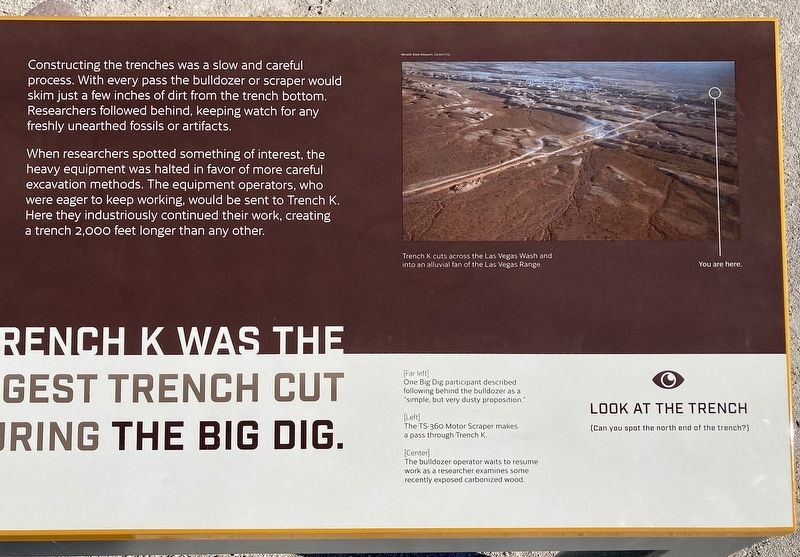
Constructing the trenches was a slow and careful process. With every pass the bulldozer or scraper would skim just a few inches of dirt from the trench bottom. Researchers followed behind, keeping watch for any freshly unearthed fossils or artifacts.
When researchers spotted something of interest, the heavy equipment was halted in favor of more
this page online
Trench K cuts across the Las Vegas Wash and into an alluvial fan of the Las Vegas Range.
Trench K was the longest trench cut during the Big Dig.
Erected 2024 by Ice Age Fossils State Park.
Topics. This historical marker is listed in this topic list: Anthropology & Archaeology.
Location. 36° 19.08′ N, 115° 11.837′ W. Marker is in North Las Vegas, Nevada, in Clark County. It can be reached from North Decatur Boulevard 0.3 miles north of Horse Drive, on the right when traveling north. Located in Ice Age Fossils State Park. Hike ½-mile from the visitor center to the marker. Touch for map. Marker is at or near this postal address: 8660 N Decatur Blvd, North Las Vegas NV 89085, United States of America. Touch for directions.

Regionally,
Photographed by Craig Baker, September 17, 2025
2. Trench K Marker
Other nearby markers. At least 8 other markers are within 10 miles of this marker, measured as the crow flies: Tule Springs (approx. 4 miles away); John Mull's And The Road Kill Grill (approx. 6.3 miles away); Kyle (Kiel) Ranch (approx. 8.6 miles away); Christensen House "The Castle" (approx. 9½ miles away); Moody House (approx. 9½ miles away); Twin Lakes Lodge (approx. 9½ miles away); Padre Francisco Garcés (approx. 9½ miles away); Jackson Street Commercial District (approx. 9½ miles away).
More about this marker. Ice Age Fossils State Park is open Wednesday - Sunday 8:00am - 4:30pm. Entrance fee $3.00. Avoid hiking the Big Dig Trail on a hot day -- There is
Photographed by Craig Baker
3. Trench K Marker
Also see . . . Ice Age Fossils State Park. The park opened in 2024. (Submitted on September 20, 2025.)
Photographed by Craig Baker, September 17, 2025
4. Trench K and Marker
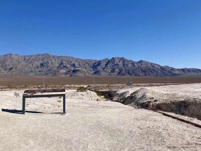
The trail continues down into the trench.

Photographed by Craig Baker, September 17, 2025
5. Trail to the Marker

Photographed by Craig Baker, September 17, 2025
6. Ice Age Fossils State Park
Credits. This page was last revised on September 20, 2025. It was originally submitted on September 20, 2025, by Craig Baker of Sylmar, California. This page has been viewed 93 times since then and 34 times this year. Photos: 1, 2, 3, 4, 5, 6. submitted on September 20, 2025, by Craig Baker of Sylmar, California.
Editor’s want-list for this marker. Photos of the other markers along this 2-mile trail, on their own marker pages, if they include human history. • Can you help?
