
Near Garrison in McLean County, North Dakota — The American Midwest (Upper Plains)
Encampments
Indian Hills
Photographed by Barry Swackhamer
1. Encampments Marker
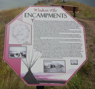
Captions: (upper left) Typical Earthlodge Layout.; (bottom) Typical Earthlodge.
Such Earthlodge "summer" villages were actually occupied during the greater part of the year. For the three of four months during the coldest weather,
this page online
These habitations showed a good deal of individual variation between the tribes and some minor changes as time passed. The Mandan left open plazas about 150 feet across with ceremonial lodges on the north side. The Arikara had ceremonial lodges in the center of the village and open areas around it for dancing. The Hidatsa did not have separate ceremonial lodges until they adopted it from the Mandan.
There was a tendency to choose village sites that could be readily defended, such as the people occupying Nightwalker's Butte. Some required a protective wall on all sides. Euro-American visitors in the early Nineteenth Century often commented on the poor condition of such palisades, noting they were often used for firewood.
Several of the surrounding hills and ridges have stone circles located on them. The first of these features are generally believed to have appeared at least 2,000 years ago. Perhaps the most common origin of stone circles
Photographed by Barry Swackhamer
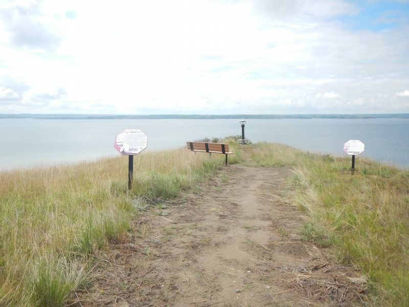
2. Encampments Marker, on the left
Erected by Indian Hill Resort.
Topics. This historical marker is listed in these topic lists: Indigenous Peoples and Communities • Settlements & Settlers.
Location. 47° 35.888′ N, 102° 5.877′ W. Marker is near Garrison, North Dakota, in McLean County. It can be reached from 73rd Avenue NorthWest @ 14th Street NorthWest. Touch for map. Marker is at or near this postal address: 14th Street NorthWest, Garrison ND 58540, United States of America. Touch for directions.

Regionally, this marker is in North Dakota’s Mandan, Hidatsa, and Arikara Nation, in the Standing Rock Sioux Tribe, in the Drift Prairie, and on the Missouri Plateau. It is also in the American Lewis & Clark Corridor, on the prairies, and on the Northern Plains. Globally, it is in North America, the Western Hemisphere, the Western World, and the Anglosphere. Historically, it finds itself in what was once Rupert’s Land and also the Louisiana Purchase.
Other nearby markers. At least 8 other markers are within walking distance of this marker: Contemporary Towns (here, next to this marker); Four Bears Bridge (about 400 feet away, measured in a direct line); Lewis & Clark (about 400 feet away); Sakakawea (about 500 feet away); Lake Sakakawea (about 500 feet away); Nightwalker's Butte (approx. 0.2 miles away); a different marker also named Nightwalker's Butte (approx. 0.2 miles away); Geology (approx. 0.2 miles away). Touch for a list and map of all markers in Garrison.
More about this marker. The marker is located on the Nux Baa Ga (meansing “All the People” in Arikara) Trail.
Also see . . . Mandan Earth Lodges. Pictures of an earthlodge construction sequence. (Submitted on September 22, 2025, by Barry Swackhamer of Brentwood, California.)
Credits. This page was last revised on September 22, 2025. It was originally submitted on September 22, 2025, by Barry Swackhamer of Brentwood, California. This page has been viewed 46 times since then and 21 times this year. Photos: 1, 2. submitted on September 22, 2025, by Barry Swackhamer of Brentwood, California.
