Union in Union County, South Carolina — The American South (South Atlantic)
A Lasting Mark
Photographed by Benjamin Rubin, September 21, 2025
1. A Lasting Mark Marker
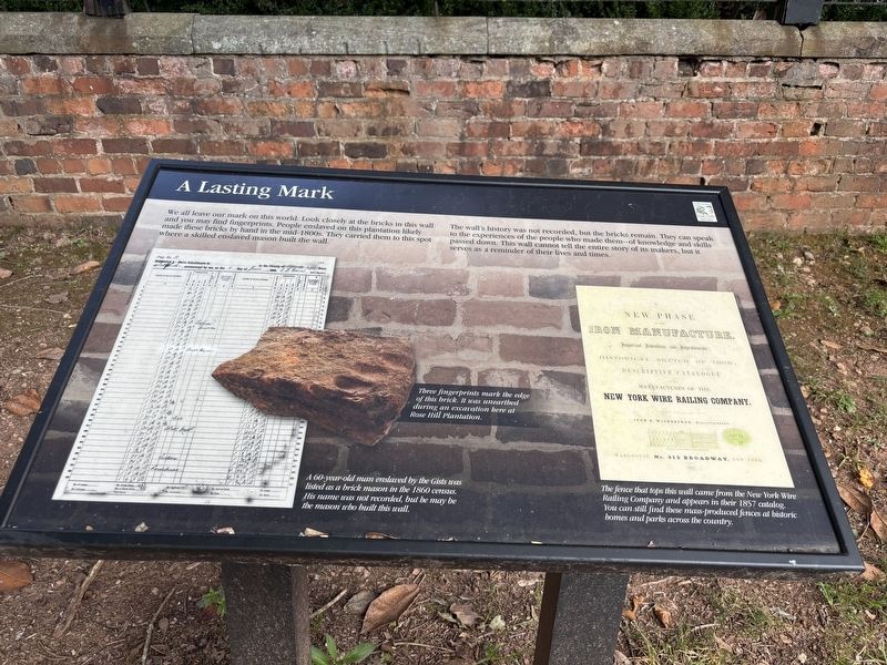
We all leave our mark on this world. Look closely at the bricks in this wall and you may find fingerprints. People enslaved on this plantation likely made these bricks by hand in the mid-1800s. They carried them to this spot where a skilled enslaved mason built the wall.
The wall's history was not recorded, but the bricks remain. They can speak to the experiences of the people who made them—of knowledge and skills passed down. This wall cannot tell the entire story of its makers, but it serves as a reminder of their lives and times.
(captions)
Three fingerprints mark the edge of this brick. It was unearthed during an excavation here at Rose Hill Plantation.
A 60-vear-old man enslaved by the Gists was listed as a brick mason in the 1860 census. His name was not recorded, but he may be the mason who built this wall.
The fence that tops this wall came from the New York Wire Railing Company and appears in their 1857 catalog. You can still find these mass-produced fences at historic homes and parks across the country.
Erected by South Carolina State Park Service.
Topics. This historical marker is listed
this page online
Location. 34° 36.358′ N, 81° 39.834′ W. Marker is in Union, South Carolina, in Union County. It can be reached from Sardis Road 0.3 miles north of Galilee CH Road, on the right when traveling north. Touch for map. Marker is at or near this postal address: 2677 Sardis Rd, Union SC 29379, United States of America. Touch for directions.

Regionally, this marker is in Upstate and in the Olde English District. It is also in the American South, specifically in the Deep South, in Appalachia, and specifically in Southern Appalachia. Globally, it is in North America, the Western Hemisphere, the Western World, and the Anglosphere. Historically, it finds itself in what was once the original Cherokee Nation, the territory of the Mississippian Culture, one of the original Thirteen Colonies, one of the Confederate States of America, and the Antebellum South.
Other nearby markers. At least 8 other markers are within 7 miles of this marker, measured as the crow flies: Field to Forest (about 500 feet away, measured in a direct line); Rose Hill Mansion (about 600 feet away); Gist Cemetery (approx. 0.9 miles away); Otterson's Fort (approx. 4½ miles away); Padgett’s Creek Baptist Church (approx. 4.7 miles away); Fair Forest Plantation / Emslie Nicholson House (approx. 5.4 miles away); Fairforest Meeting (approx. 5.9 miles away); Cross Keys House (approx. 6½ miles away). Touch for a list and map of all markers in Union.
Another marker is no longer nearby. The Old Quaker Cemetary (was approx. 2.3 miles away but has been confirmed missing).
Credits. This page was last revised on September 23, 2025. It was originally submitted on September 23, 2025, by Benjamin Rubin of Columbia, South Carolina. This page has been viewed 75 times since then and 25 times this year. Photo 1. submitted on September 23, 2025, by Benjamin Rubin of Columbia, South Carolina. • Bernard Fisher was the editor who published this page.
